Retrograding low may spin up to 20 cm spring snow in Newfoundland
An incoming weather system is set to bring significant snowfall to parts of Newfoundland
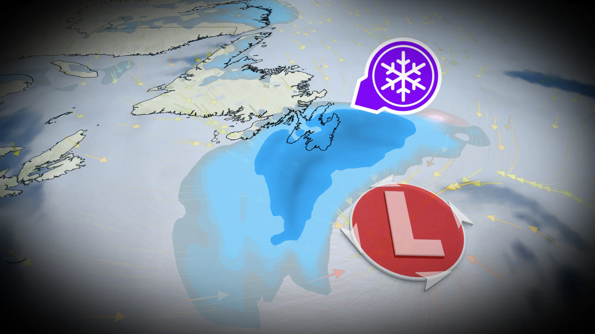
A stalled atmospheric pattern will keep active weather pushing through Newfoundland this week. A storm system over the Atlantic will retrograde westward, reaching the Avalon Peninsula by Friday afternoon.
Eastern Newfoundland, including St. John’s, is expected to see widespread wet snow, with accumulations of 10-25 cm. Strong winds will result in blowing snow and reduced visibility, creating challenging travel conditions.
DON'T MISS: Who gets the best of summer? The drivers behind Canada’s forecast
Stay prepared for travel delays and deteriorating conditions.
Atlantic storm to bring heavy snow to Avalon Peninsula Friday into Saturday
A storm system over the Atlantic is set to retrograde westward, impacting the Avalon Peninsula by Friday afternoon.

Heavy snow is expected through Friday evening, with flurries lingering along northern coasts into Saturday morning. Snowfall totals will range from 5-15+ cm, with localized amounts up to 25 cm possible.
DON'T MISS: A typical April’s weather across Canada is one wild ride
Travel conditions in the St. John's area may become hazardous later on Friday due to accumulating snow and reduced visibility.

Snowfall Highlights for 2026 (as of April 23):
Total snowfall in St. John’s so far: 406 cm
With 20+ cm in the forecast, 2026 could surpass the snowiest year since 2003 (428 cm)
Typical snowfall from January to April in St. John’s: 264 cm

This year has already nearly doubled the average snowfall for the first four months of the year.