
September storms continue to thunder across Manitoba, northwestern Ontario
Manitoba and northwestern Ontario continue to be Canada's active weather hotspot heading into the midweek as another stormy day shapes up.
Strong, mid-September storms have been plaguing the eastern Prairies and northwestern Ontario since Sunday, with a round of tornado warnings issued in southern Manitoba on Sunday evening and another in southern Saskatchewan on Monday.
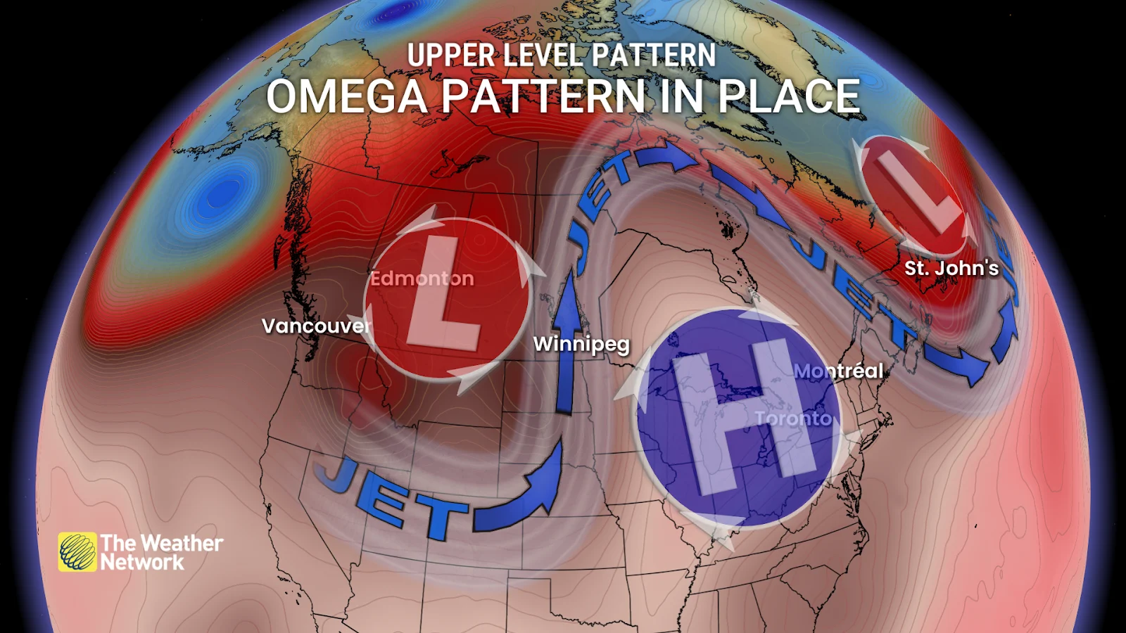
This active weather pattern is thanks to a slow-moving Omega blocking pattern that has settled over the country. An Omega pattern is an upper-level region of high pressure with low-pressure centres on either side, forming an Omega-like shape in the jet stream. The low over the Prairies on the western side of the high pressure is blocked from moving eastward, slowly dragging the stormy weather up from the south and around the ridge.
Visit our Complete Guide to Fall 2025 for an in depth look at the Fall Forecast, tips to plan for it and much more!
While Tuesday will be the final day of stormy weather for the Prairies and northwestern Ontario, the thunderous storm track will continue to shift eastward into northeastern Ontario and northern Quebec on Wednesday.
Tuesday already started off with a boom for some communities as early-morning storms rolled through the Hudson Bay region. To the south, we saw some showers fall over Manitoba's Interlake region.
Severe storm threat pushes into northwestern Ontario Tuesday
Non-severe storms are forecast across much of Manitoba and northwestern Ontario on Tuesday, but we could see some storms become severe by the early evening as a cold front passes through the region.
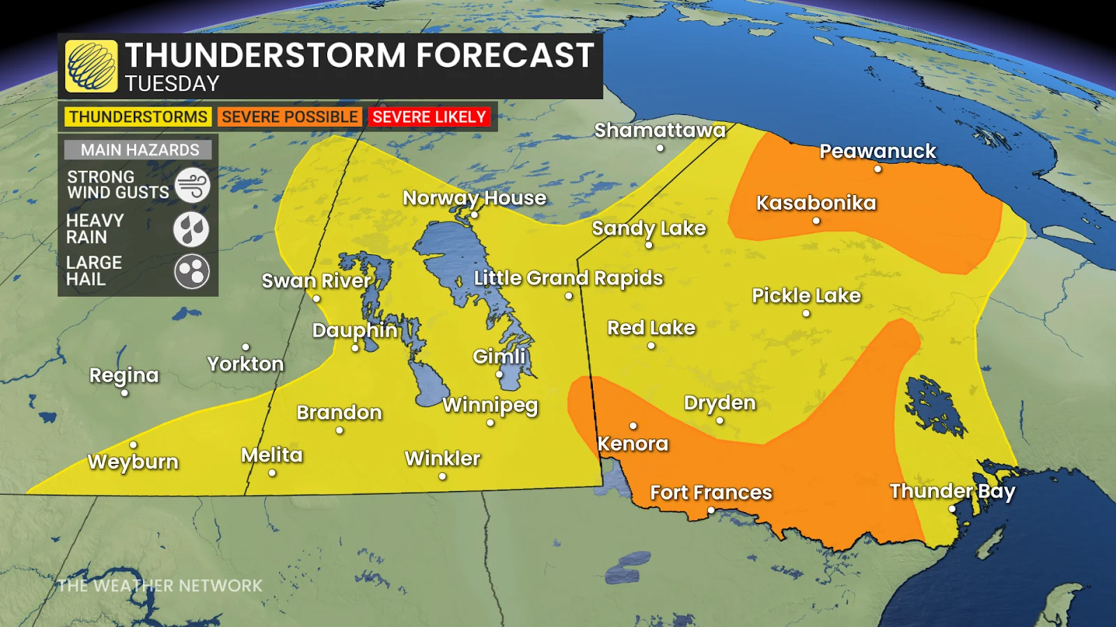
The chance for severe weather should stay west of Thunder Bay, along the Minnesota border, as well as just west of Lake Nipigon.
We'll also see a risk of severe thunderstorms along the southern Hudson Bay shores, reaching Kasabonika.
SEE ALSO: La Niña watch continues amid major Pacific temperature divide
The biggest threats to look out for with these storms will be strong wind gusts that could damage tree branches, as well as large hail.
The line of storms will continue to trek eastward through the evening, reaching Thunder Bay and Lake Superior's north shores overnight.

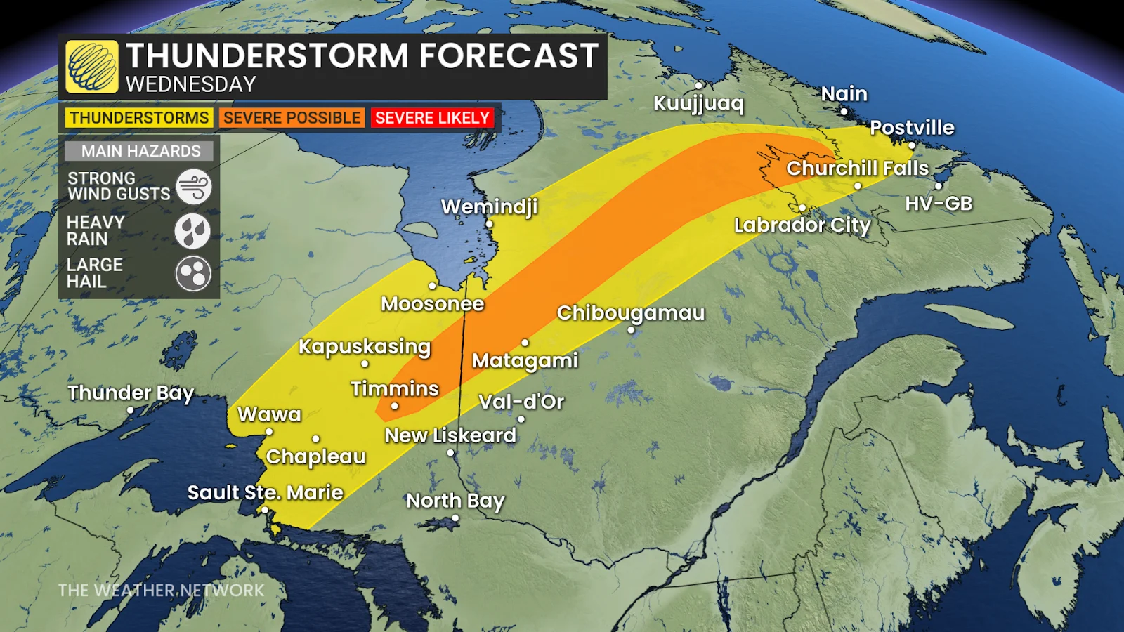
Storm risk, autumn chill shifts into northeastern Ontario Wednesday
The cold front will drag showers and thunderstorms into northeastern Ontario by Wednesday, with the storm risk also extending across northern Quebec and into Labrador.
Storms should stay non-severe across the northeast, but there will be a slight chance for them to reach severe criteria around the Timmins area.
Once the rain and thunder have passed, folks may notice a slight chill in the air as colder temperatures rush in behind the front. Temperatures are expected to drop from the mid-20s on Wednesday to the high teens Thursday and Friday.
The chill isn't expected to last long, however, as we will see temperatures climb back up over the weekend, staying above seasonal through next week.
Stay with The Weather Network for more information and updates on your weather across Canada.