Severe storm threat hits Ontario and Quebec, with risk of tornadoes
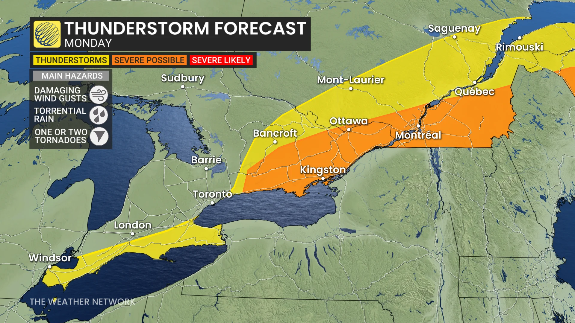
Be prepared for the potential of thunderstorms on Monday, with both Ontario and Quebec under a renewed storm risk, and the chance for one or two tornadoes
Warm and humid air is set to hang over parts of Ontario and Quebec early this week, creating the instability needed for thunderstorms to develop once again on Monday.
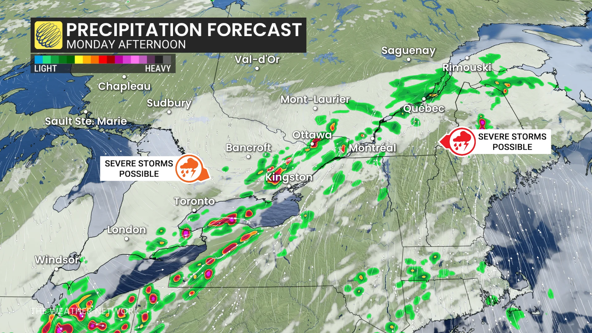
Some storms on Monday could reach severe levels, with Quebec facing an added risk of isolated tornadoes in certain areas.
DON'T MISS: Texas storms triggered a ‘large and deadly flood wave’
Be sure to monitor local weather alerts and incoming conditions throughout the day.
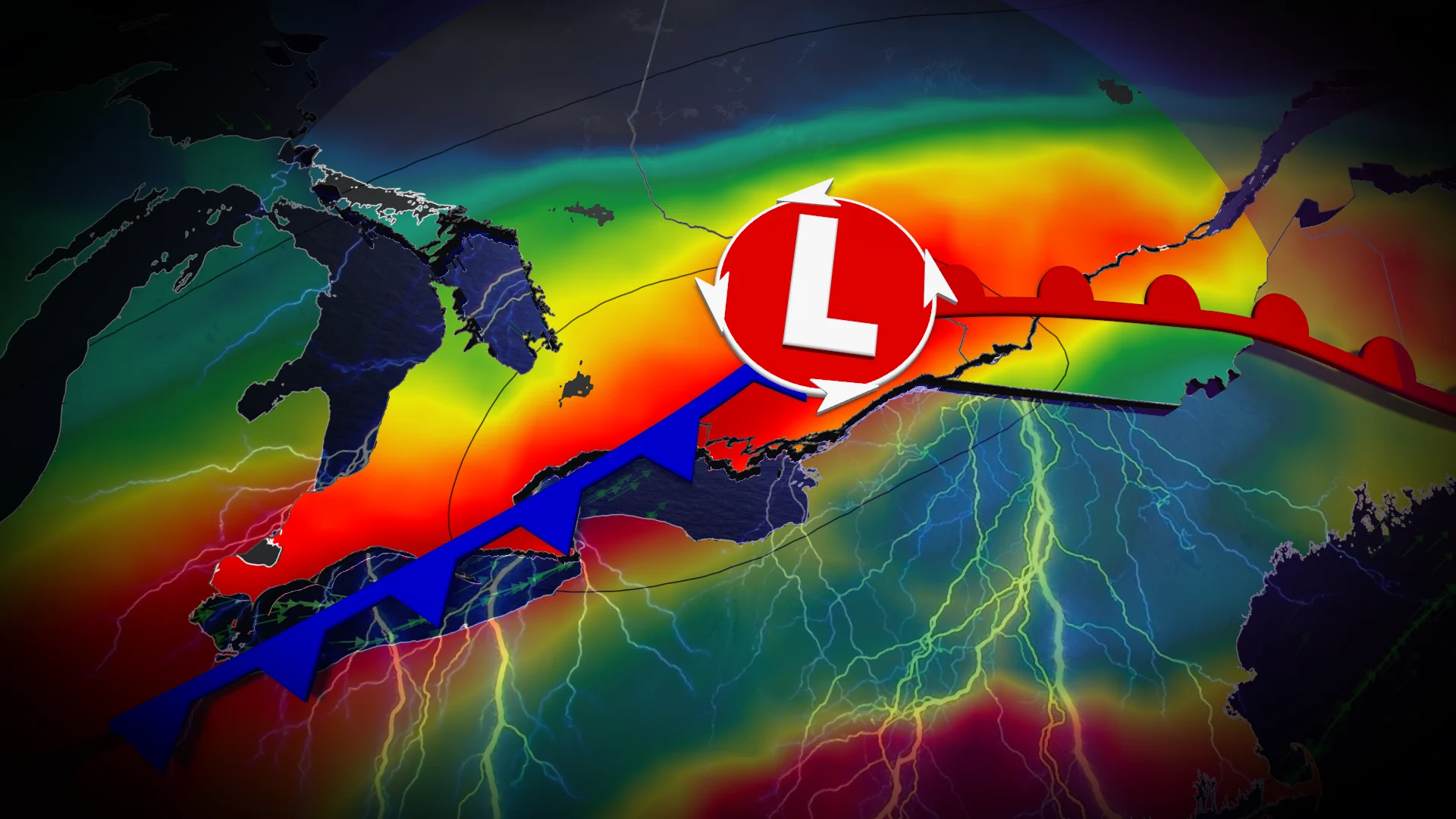
Severe storm threat takes aim on Monday
A cold front sweeping south on Monday could spark severe storms near Niagara and parts of eastern Ontario, as pockets of instability persist through the afternoon.
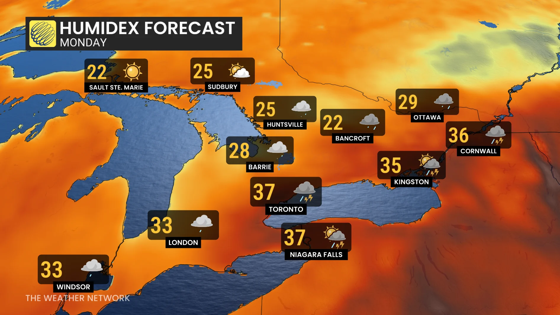
The hot, humid air mass in place is expected to fuel heavy rainfall during any storms that develop.
However, there is some uncertainty over whether storm activity will be concentrated north or south of the border.
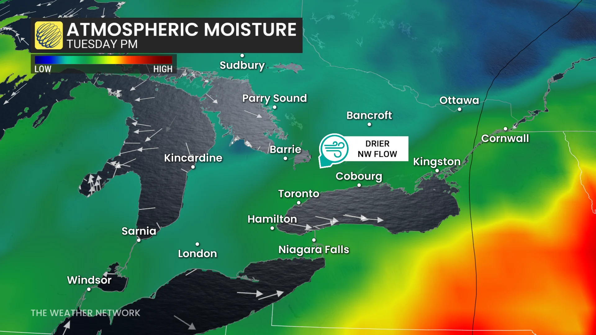
Dew point and humidex values in Ontario will drop significantly by Tuesday, leading to cooler and less humid conditions.
In Quebec, the risk for thunderstorms on Monday will peak early- to mid-afternoon southeast of Montreal. Rotating thunderstorms are possible, and there is a slight tornado risk in this region.
SEE ALSO: A normal July brings Canada drought, downpours, and dizzying heat
Confidence in the severity and coverage of storms is moderate, as the placement of the warm front and extent of cloud cover could impact instability levels.
Primary hazards from Monday's storms include heavy rainfall, strong wind gusts, and torrential downpours.
DON'T MISS: A symphony of storms: How Mother Nature rocks in the ultimate ride
Stay alert for rapidly changing conditions and pay close attention to watches and warnings in your area.
Flooding rains hit parts of cottage country
Monday's storm risk follows the active weather that arrived on Sunday and continued through the overnight hours. Widespread rain and embedded thunderstorms hit parts of cottage country east of Georgian Bay, as well as into southwestern Quebec.
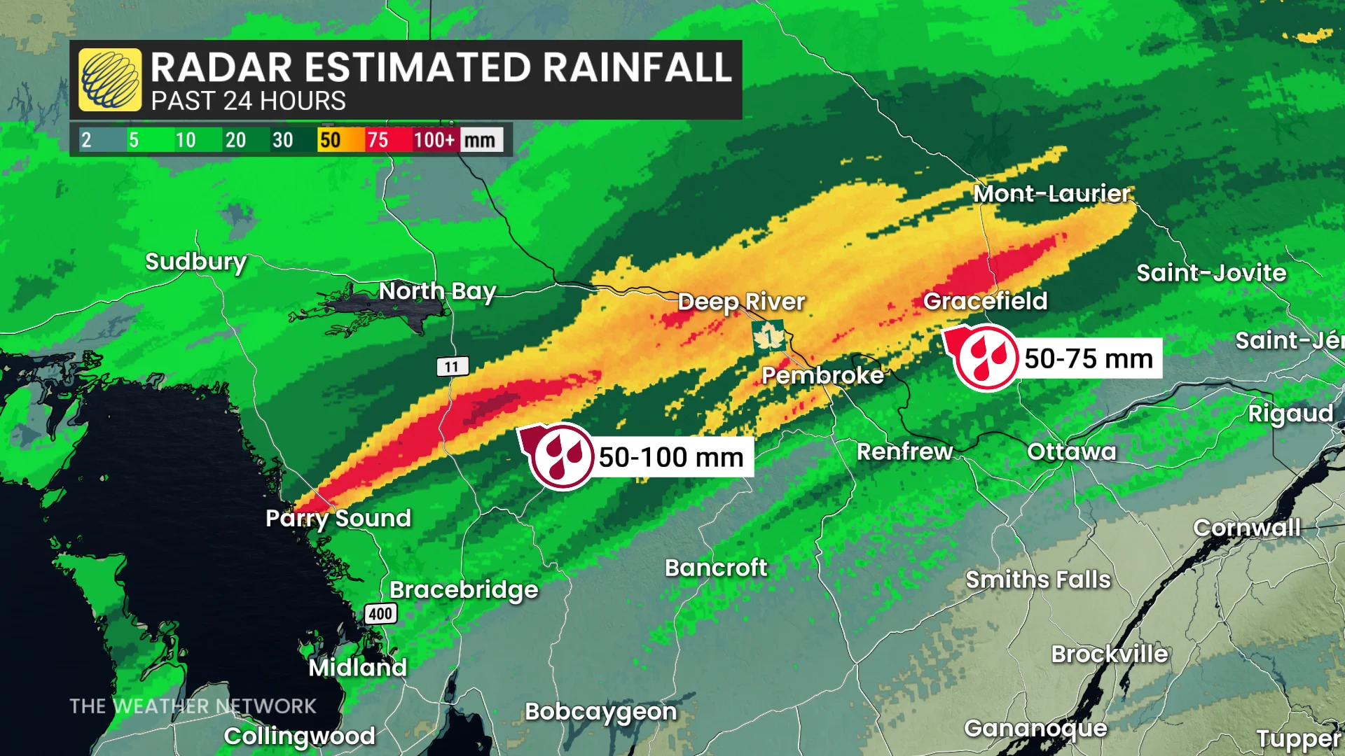
Some areas picked up more than 70 mm of rain as the precipitation lingered along the slow-moving boundary.
Localized flooding was reported, and a section of Highway 559 near Killbear Provincial Park was closed in both directions due to a sinkhole on Monday morning.

Highway 559 closed in both directions Monday, July 7
Conditions across southern Ontario and Quebec are expected to stabilize on Tuesday, with no notable thunderstorm risk in the forecast.
Stay with The Weather Network for all the latest on your forecast across the region.