Severe storms with high winds, flood risk sweeping Ontario, Quebec
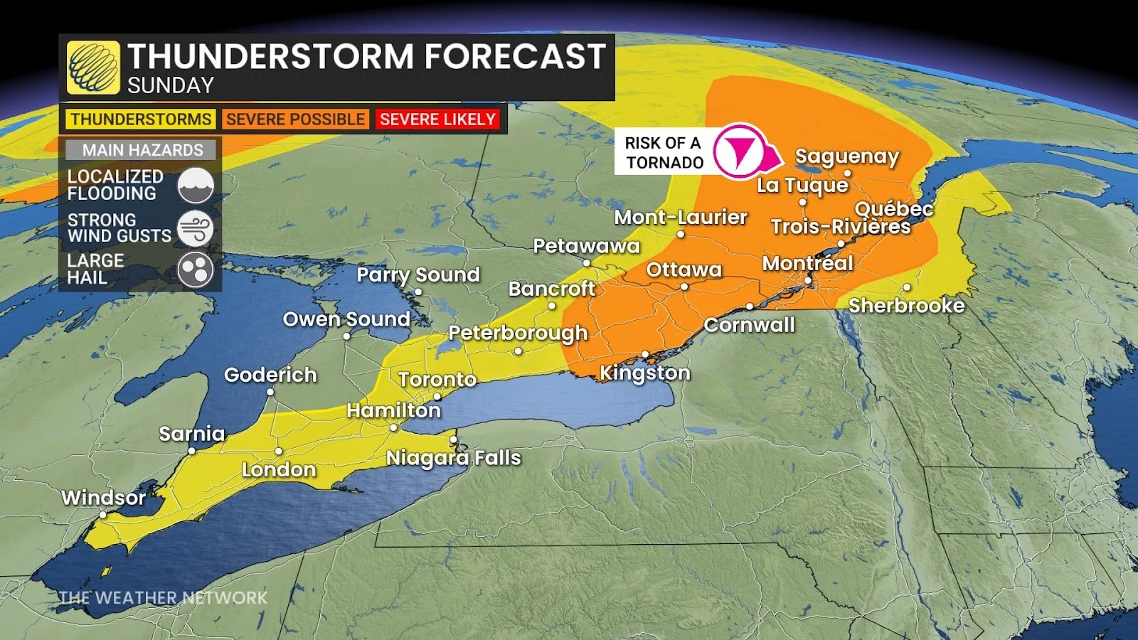
Stay alert for the potential for damaging wind gusts, heavy downpours, and a low risk for tornadoes on Sunday
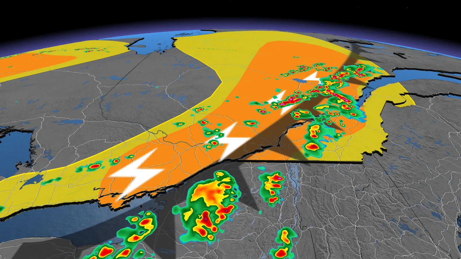
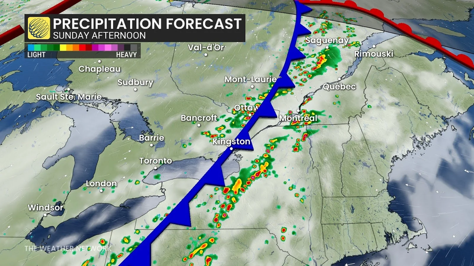
Severe thunderstorms that began rolling through eastern Ontario and southern Quebec on Sunday will continue pushing east through the afternoon and early evening hours.
High instability, tropical-like moisture, and favourable winds aloft will allow these storms to produce damaging wind gusts, as well as heavy downpours that could lead to localized flooding.
DON’T MISS: Microbursts can turn a gentle storm into a harrowing ordeal
Flash flooding and large hail possible in Quebec
The threat for severe storms will peak through the afternoon and evening, with the most intense activity concentrated along the St. Lawrence River, including Montreal.
The strongest thunderstorms are capable of producing strong wind gusts, large hail, and downpours that could lead to flash flooding.
LOOK: More great white sharks in Canadian Atlantic waters isn't cause for concern
Due to increased wind shear in the atmosphere, regions ranging from La Tuque to the Saguenay may face a low-end tornado risk.
Heavy rainfall is a major concern due to the high moisture content in the air, particularly in flood-prone urban areas along the St. Lawrence River corridor.
Eastern Ontario faces a higher storm risk than the southwest
While southern Ontario can expect scattered, hit-or-miss thunderstorms on Sunday, the more intense cells are expected to move east.
From Kingston to Ottawa, the risk of stronger storms increases, with localized flooding, large hail and strong wind gusts projected.
RELATED: How the Great Lakes can trigger storms on a hot summer day
Storms are likely to develop along the cold front, moving from west to east during the afternoon and evening. In the Ottawa Valley, enough wind shear and instability could produce rotating storms or even brief funnel clouds.
Meanwhile, areas in and around the Greater Toronto Area may see non-severe or brief storms with patchy activity and low overall intensity.