Severe weather to hit northwestern Ontario and Manitoba as tornado threat looms
Likely severe storms threaten Fort Frances with heavy rain and a possible Tornado
The severe weather in northwestern Ontario continues after a stormy start to the weekend, with some rain for Manitoba being mixed into this stormy pot.
A low-pressure system up north will help Sunday morning storms move through southern Manitoba along the United States-Canada border into Ontario, where we’ll see most of the severe storm threat from the northwestern border.
Storms may be strong enough to produce one or two tornadoes anywhere along the international border from Fort Frances to just west of Thunder Bay.

Heavy rain is here for the day
Sunday morning will see rain start its movement from southwestern Manitoba, around the same time we’ll see the cluster cross the border into the Brandon area.
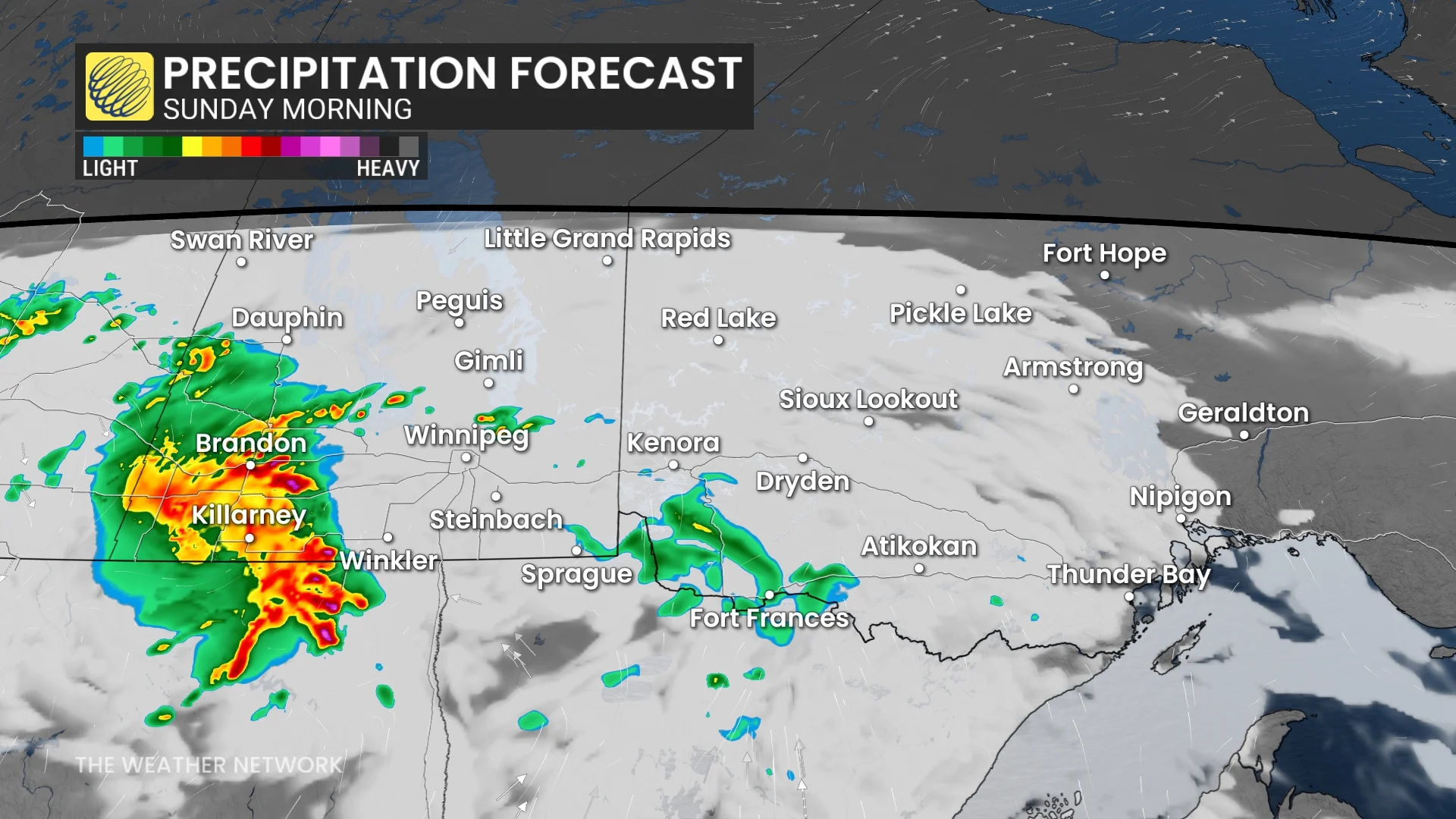
Heavy rain, frequent lightning and hail from the Morning to early afternoon will be the main threats from these storms in southern Manitoba until mid-afternoon when they’ll be pushed out of Winnipeg.
READ MORE: What is the longest domestic direct flight in Canada?
Northwestern Ontario will have its storms influenced by the stationary boundary from the same low-pressure system. Initial storms will push through Fort Frances early afternoon, just hovering on the border.
By late afternoon, we will see a low-pressure system from the U.S. push storms into northwestern Ontario by the afternoon. By late afternoon, the storms will push into Thunder Bay.

Large hail is expected to be the biggest threat, ranging from the size of a loonie to a ping pong ball-sized hail.
Between the afternoon to evening, multiple rounds of storms will continue to hit northwestern Ontario. Heavy rain will be another threat from these storms, with concerns of localized flooding.

Highway 17 and Highway 11 will see the biggest driving threats, where some areas could see up to 50 mm of rain across all of Sunday.
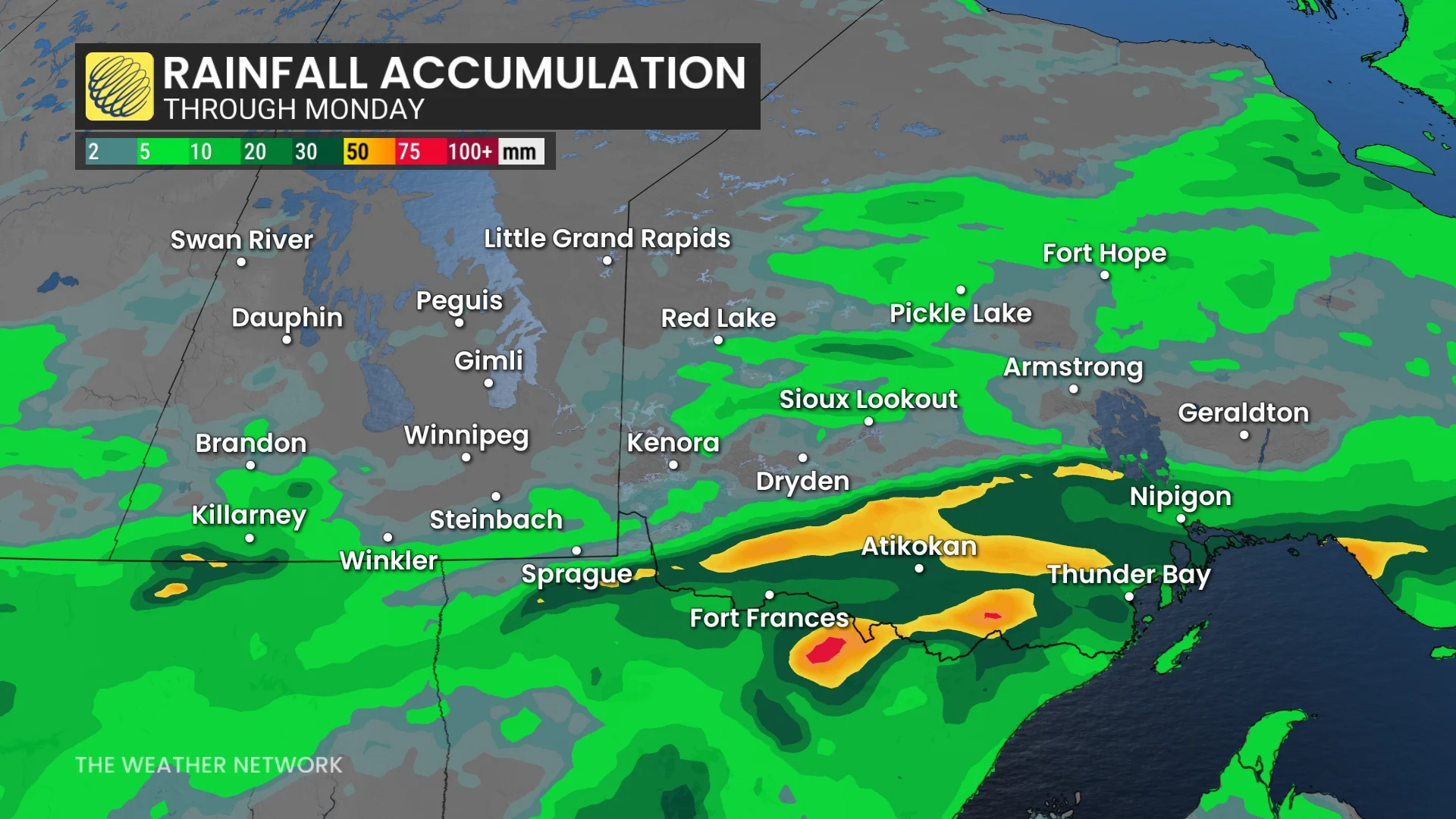
While Fort Frances could see upwards of around 20 mm and Thunder Bay could see anywhere from 10-20 mm of rain across Sunday.
Going into the overnight, these storms will cross Lake Superior, where they are expected to lose a lot of their instability.

Non-severe storms will continue north of Lake Superior during the overnight, with the area including Kenora all the way to Geraldton.

There is still a lot of uncertainty with the timing of these storms and the affected area, as they are dependent on a cold front moving through the area.
WATCH: Nickel, golf ball, baseball; what these hail sizes mean for damage
Stay with the Weather Network for any updates on storms in northwestern Ontario