
Tornado warnings issued in northwest Ontario amid severe storms
One or two tornadoes are possible in Sunday's severe storms across northwestern Ontario
5:44 p.m. CDT - Severe thunderstorms prompted a tornado warning in northwestern Ontario on Sunday evening.
Environment and Climate Change Canada issued a tornado warning for the following areas in northwestern Ontario:
Dryden - Vermilion Bay
Seine River Village - Mine Centre

"This is a dangerous and potentially life-threatening situation. Take cover immediately, if threatening weather approaches," ECCC said in its warning.
The agency added: "Go indoors to a room on the lowest floor, away from outside walls and windows, such as a basement, bathroom, stairwell or interior closet. Leave mobile homes, vehicles, tents, trailers and other temporary or free-standing shelter, and move to a strong building if you can. As a last resort, lie in a low spot and protect your head from flying debris.”
CURRENT TORNADO WARNINGS (ONTARIO):
Dryden - Vermilion Bay
Seine River Village - Mine Centre
The original article with the full forecast for the region continues below.
An active day of severe weather is taking shape across southern Manitoba and northwestern Ontario as multiple rounds of thunderstorms sweep across the region.
In addition to damaging winds and large hail, storms may be strong enough to produce one or two tornadoes anywhere along the international border from Fort Frances to just west of Thunder Bay.
Keep an eye on the radar and stay aware of watches and warnings in your area. Know where to go and what to do if a tornado warning is issued for your location.
DON’T MISS: What is a mesoscale convective system? How an 'MCS' can spell danger
Storms pose wind, tornado threats on Sunday
We’ve already seen one round of severe thunderstorms sweep across northwestern Ontario on Sunday, even prompting a tornado warning for some locations in the 10:00 o’clock hour.
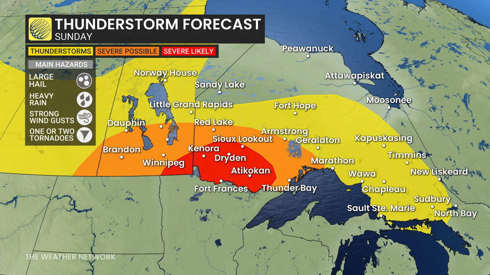
Our second round of thunderstorm activity developed over southern Manitoba during the late morning and early afternoon hours. Heavy rainfall, frequent lightning, and hail are the main threats here, including around Winnipeg.
Thunderstorms are expected to increase in coverage and intensity heading through the afternoon hours as they push through northwestern Ontario. Drivers along Highway 17 and Highway 11 face the greatest threat from these storms.
Any severe thunderstorms that form across northwestern Ontario could pack damaging winds, large hail, and heavy rainfall. One or two tornadoes are possible, especially around the international border from Fort Frances to just west of Thunder Bay.
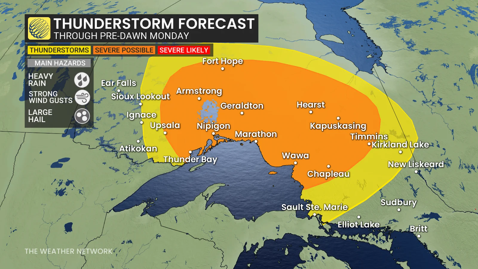
Thunderstorms will continue pushing east across northern Ontario through the overnight hours late Sunday into early Monday morning.
Any of the stronger storms that sweep through communities like Nipigon, Geraldton, Kapuskasing, Chapleau, and Timmins could pack heavy rainfall, strong wind gusts, and large hail.