Stay alert: Severe thunderstorm threat builds with the heat in southern Ontario
Thunderstorms are possible across southern Ontario starting Tuesday afternoon, with the risk for stronger storms spreading into Wednesday. Stay alert and up-to-date on the changing conditions in your area
As temperatures gradually climb this week, the potential for thunderstorms emerges across parts of southern Ontario.
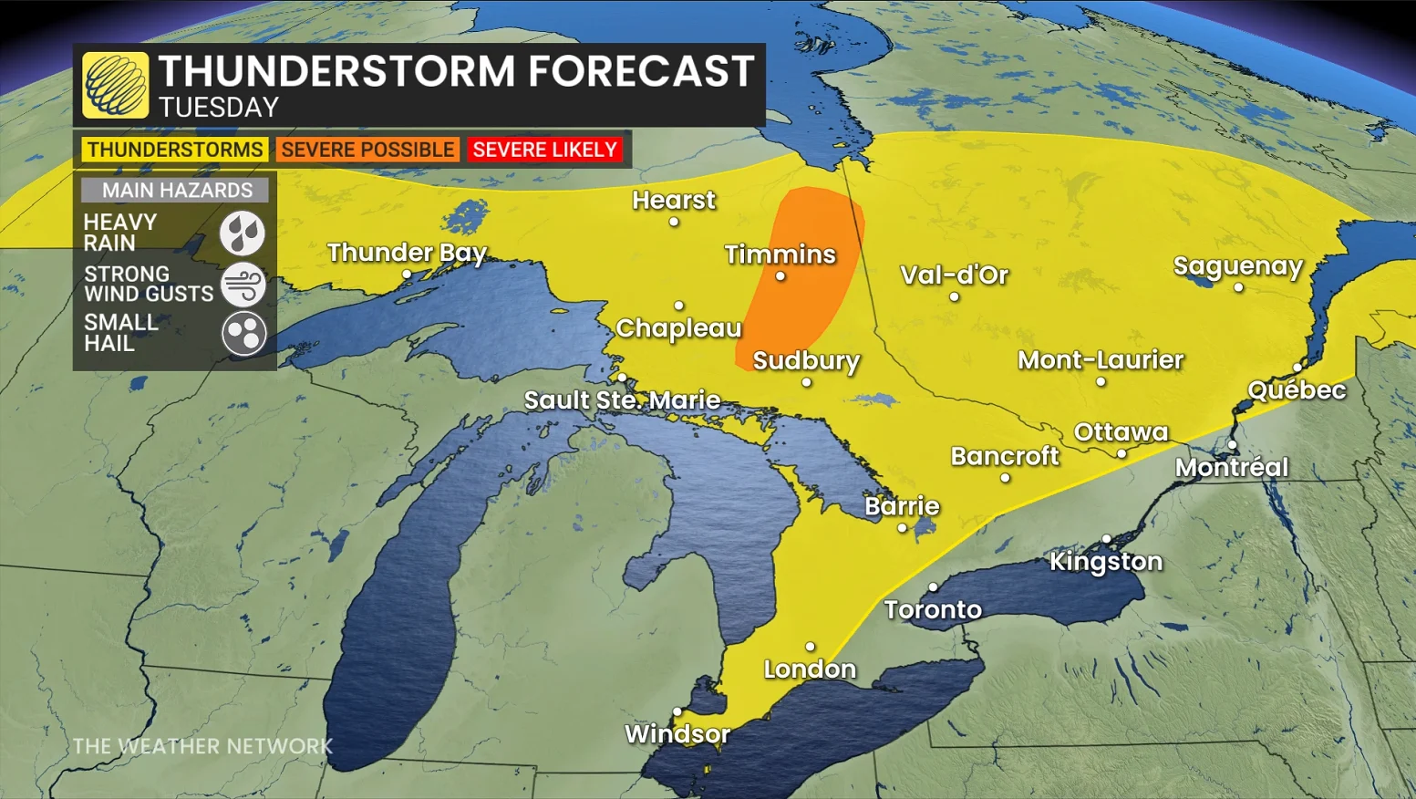
Wednesday will be the day to watch closely, with the threat for severe storms stretching across the region. Powerful winds and heavy rain will be the primary concerns with developing storms, alongside the potential for stronger storms advancing from Michigan and Ohio.
DON'T MISS: Toronto's 270-day heat streak drought is about to end
Pay close attention to watches and warnings in your area as isolated severe thunderstorms could bubble up on both Tuesday and Wednesday.
Storm chances creep in Tuesday, risk of nocturnal thunderstorms
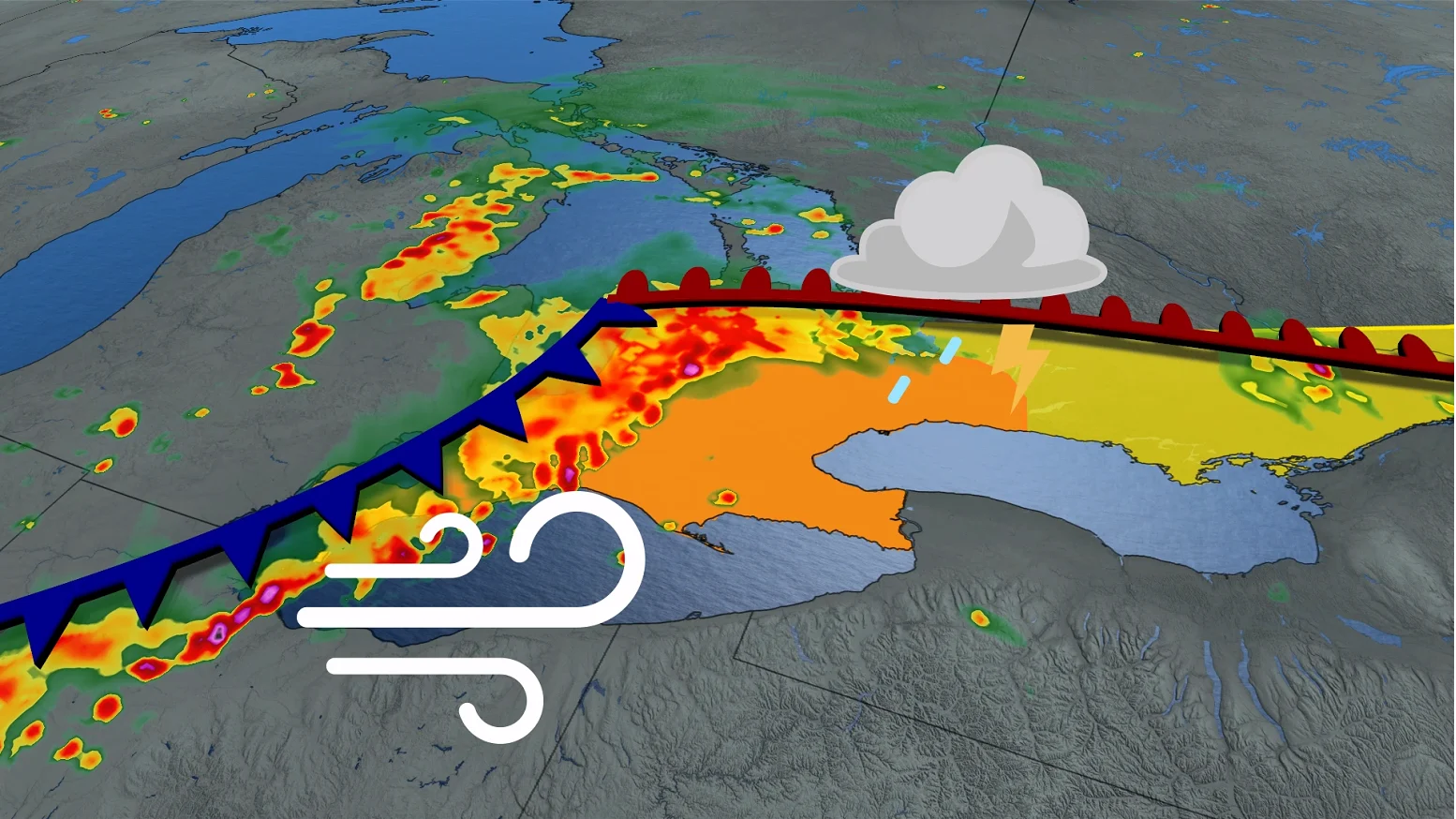
Scattered thunderstorms are expected to develop Tuesday afternoon into the evening, triggered by an area of low pressure moving toward James Bay.
Cottage Country is likely to see thunderstorms later Tuesday afternoon and evening, though activity will remain scattered.
A more organized storm risk unfolds later in the evening and overnight as a warm front lifts through the region. Non-severe nocturnal thunderstorms could affect the Greater Toronto Area (GTA) during this time.
Of note, for the first time this summer, lake-breeze storms may form over the Oak Ridges Moraine on Tuesday afternoon. This localized activity arises from the convergence of breezes from Lake Ontario and Georgian Bay.
WATCH BELOW: Overnight storms have a different set of dangers
DON'T MISS: The Weather Network's exclusive summer 2025 forecast
The primary storm focus later Tuesday shifts to northeastern Ontario, and southern Ontario overnight. Thunderstorm activity in southern Ontario is expected to remain scattered, with most areas unlikely to see storms until later Tuesday evening and overnight.
Stronger storm set up to watch for on Wednesday
A more significant storm setup is anticipated Wednesday as a U.S. Midwest low pressure system approaches.

Stronger, slow-moving storms could develop Wednesday afternoon from southwestern Ontario through to the Kawarthas as a warm front pushes through.
SEE ALSO: What’s the wettest month in your corner of Canada?
A cold front will bring additional risks to the same region Wednesday evening, but could weaken as it advances.
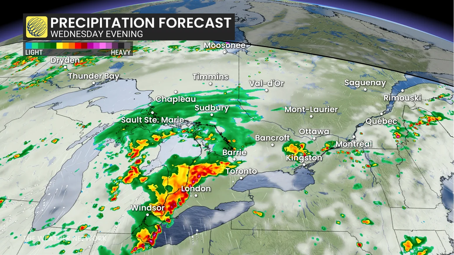
Strong wind gusts and heavy rain will be the main threats with storms that develop. Be sure to remain weather-aware, and stay alert to any of the watches or warnings that may be issued.
Did you know? Ontario has had only one tornado confirmation so far this year on May 20, west of Woodstock. For reference, in 2024, six tornadoes had already been confirmed by this date. This makes this the slowest tornado start since 2021 in the province.
Stay with The Weather Network for all the latest on conditions across Ontario.