Elevated severe storm potential raises flood concerns in southern Ontario
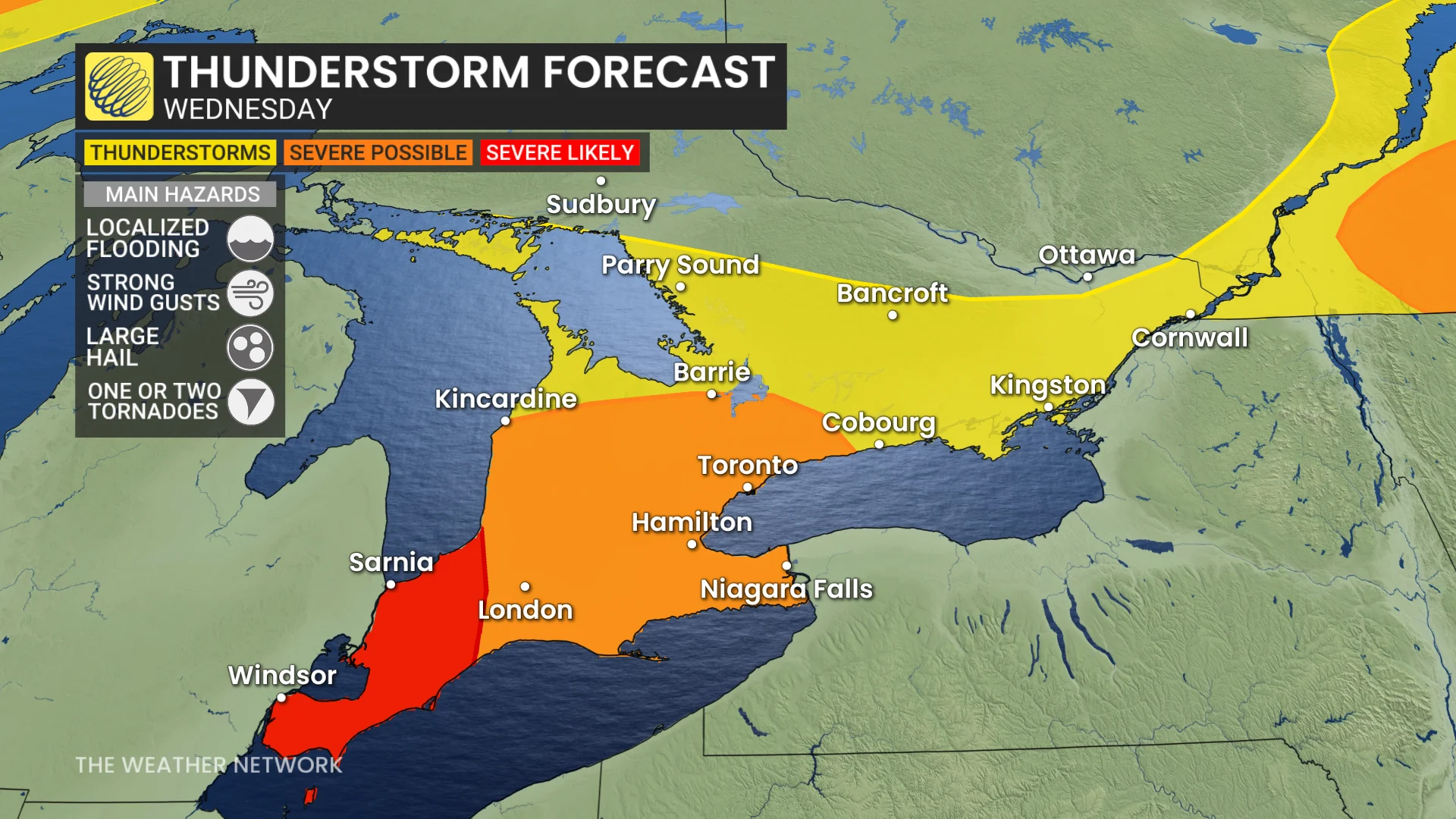
Folks in southern Ontario will need to be alert on Wednesday due to a threat for severe weather, including a heightened risk for localized flooding and one or two tornadoes for southwestern areas
Wednesday will be the day to watch closely in southern Ontario as there will be a threat for severe storms stretching across the region.
Amid rising temperatures, a chance of severe thunderstorms will be present. Powerful winds, heavy rain, hail and localized flooding will be the primary concerns with the storms on Wednesday.
DON'T MISS: Toronto's 270-day heat streak drought is about to end
Also, there is a risk of a tornado or two in southwestern Ontario.
Pay close attention to watches and warnings in your area as severe thunderstorms bubble up on Wednesday.
Stronger storm threat on Wednesday, chance of localized flooding, and a tornado risk in southwest
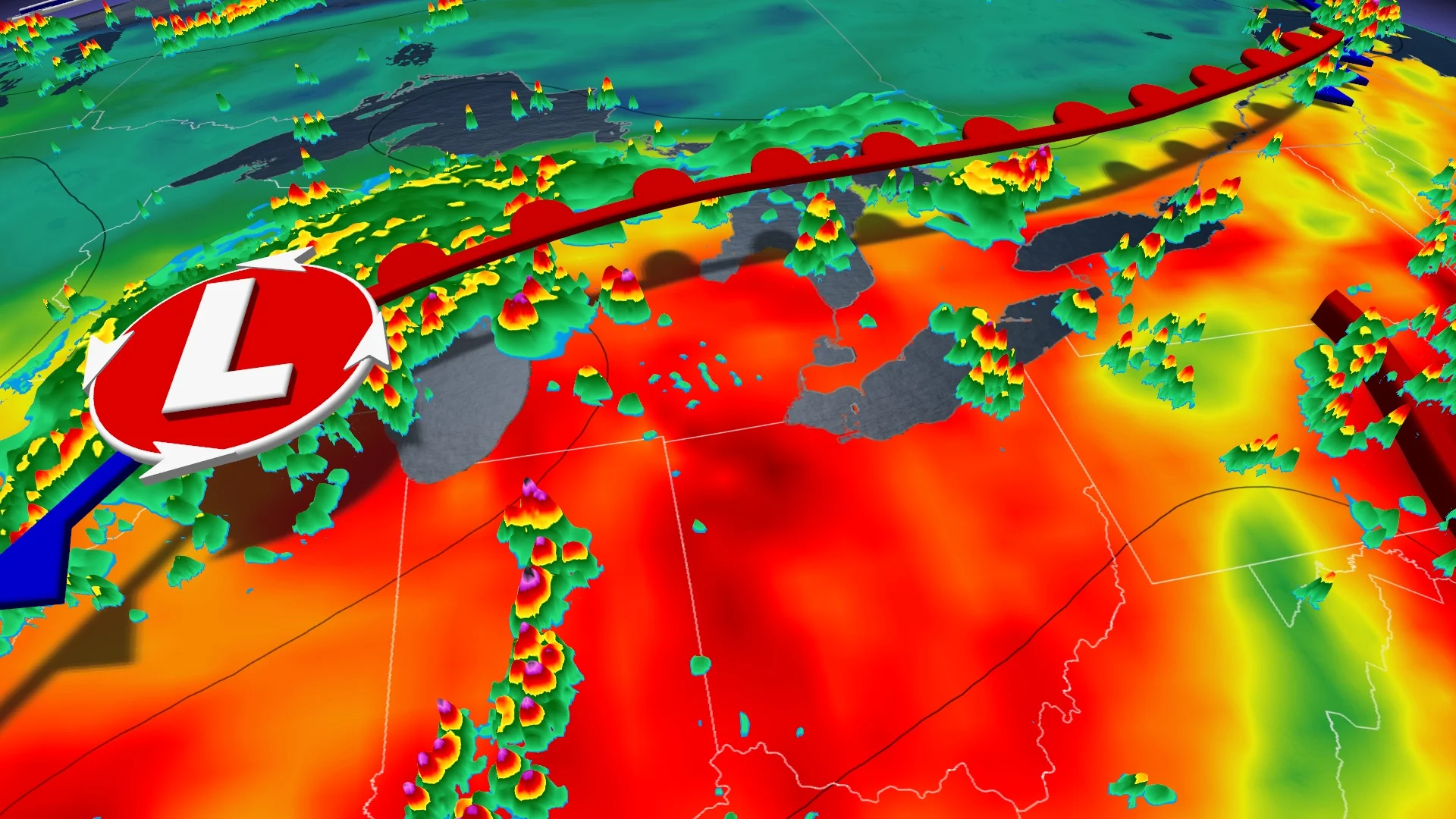
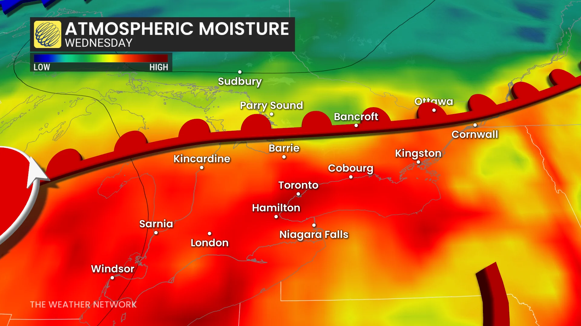
A more significant storm setup is anticipated Wednesday as a U.S. Midwest low-pressure system approaches. There will be two time frames to be aware of for storm development.
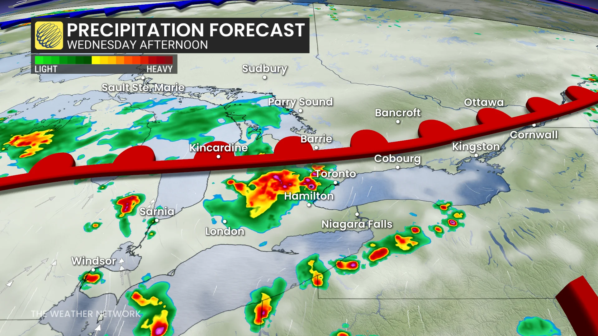
The first round: Along the warm front, storms will develop east of Lake Huron through Kitchener-Waterloo, and then into the Greater Toronto Area (GTA) before easing east of the region.
The first round raises concerns of the threat of flooding due to the amount of moisture in the air, and also how multiple storms are possible back to back.
SEE ALSO: What’s the wettest month in your corner of Canada?
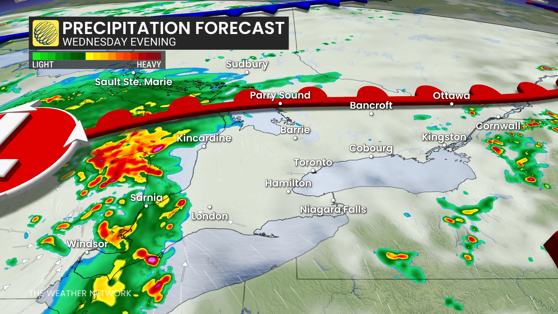
The second round: A cold font moves into southwestern Ontario in the evening.
The timing of the front is key, however. The earlier they push in, the stronger the storms could be. The later the storms arrive, though, the weaker they could become.
Currently, the threat is for strong winds, heavy rain, some large hail (loonie-size), and even the risk of a tornado or two in southwestern sections. The cold front will track towards the GTA for late Wednesday and the overnight hours, bringing a light show with it.
Be sure to remain weather-aware, and stay alert to any of the watches or warnings that may be issued.
Did you know? Ontario has had only one tornado confirmation so far this year on May 16, west of Woodstock, Ont.. For reference, in 2024, six tornadoes had already been confirmed by this date. This makes this the slowest tornado start since 2021 in the province.
Stay with The Weather Network for all the latest on conditions across Ontario.