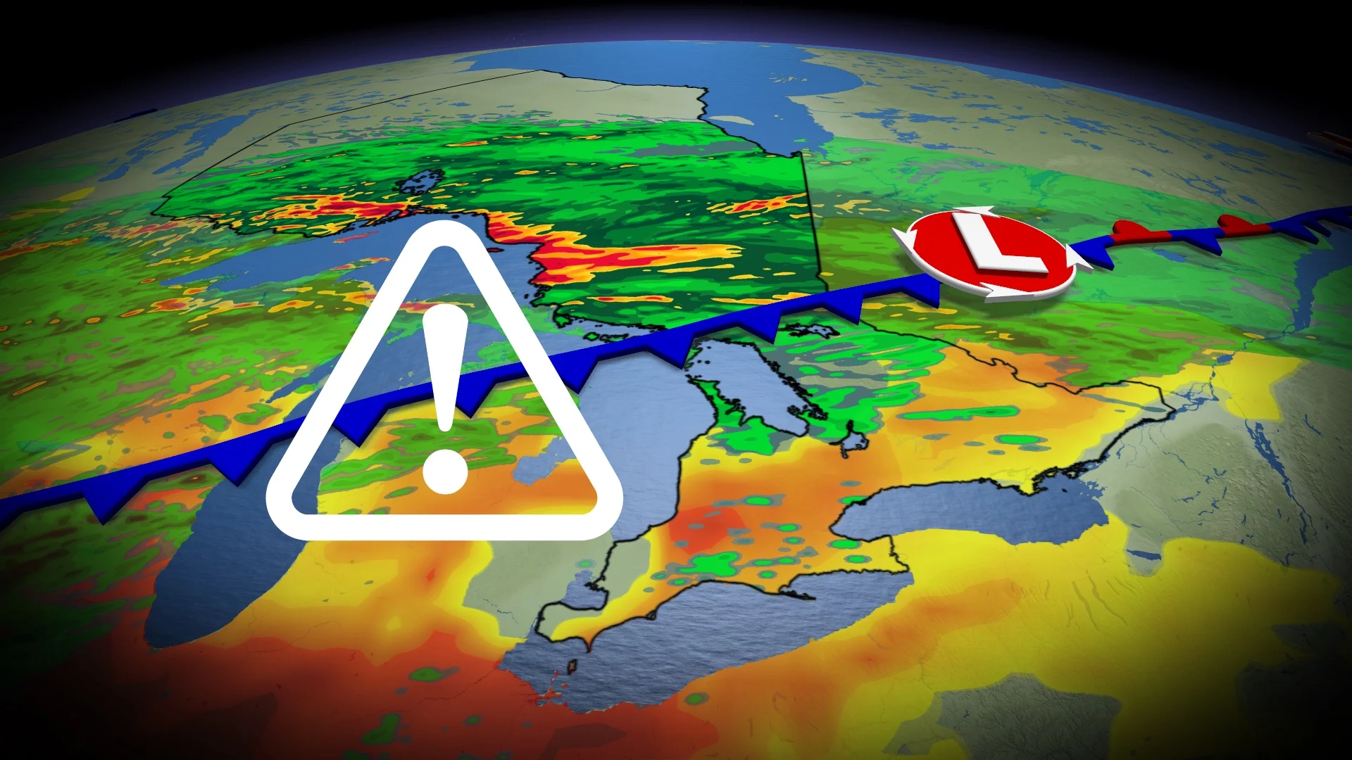
Severe weather threat on the move across Ontario to include south and east
Ontario's ongoing severe storm threats this week will be on the move Wednesday and Thursday, shifting farther south and east in the province to include parts of the lower Great Lakes by late week
It's been an active week across Ontario, and that trend is going to continue as we get closer to the weekend.
A boundary moving across Ontario will bring the thunderstorm threat farther east into the province on Wednesday, extending from west of Thunder Bay to the Quebec border, including Timmins. The swath will include a severe-possible area around Lake Superior, moving north over the Quebec border.
DON’T MISS: U.S heat will soon spill into Eastern Canada, bringing back 30 C weather
On Thursday, the risk shifts farther south and east, and will include parts of the lower Great Lakes. The severe potential with a large hail, strong winds and heavy rain threat will include the Georgian Bay and Lake Huron shorelines, as well as cottage country and eastern Ontario.
Make sure you keep an eye on the radar––especially if you have outdoor plans––and stay aware of any severe weather watches or warnings issued in your area.
Wednesday: Storm risk pops up again, moves east
On Wednesday, forecasters will then turn their attention to the potential for another cluster of storms to develop along the Lake Superior shores.

SEE ALSO: Wildfire smoke, other extreme weather affecting Ontarians' vision: Poll
The area at risk will stretch from Thunder Bay through Wednesday morning to Sault Ste. Marie by the afternoon and evening.
There is some uncertainty on how much thunderstorm energy pass over the Great Lakes, so a lack of could limit the severe risk.
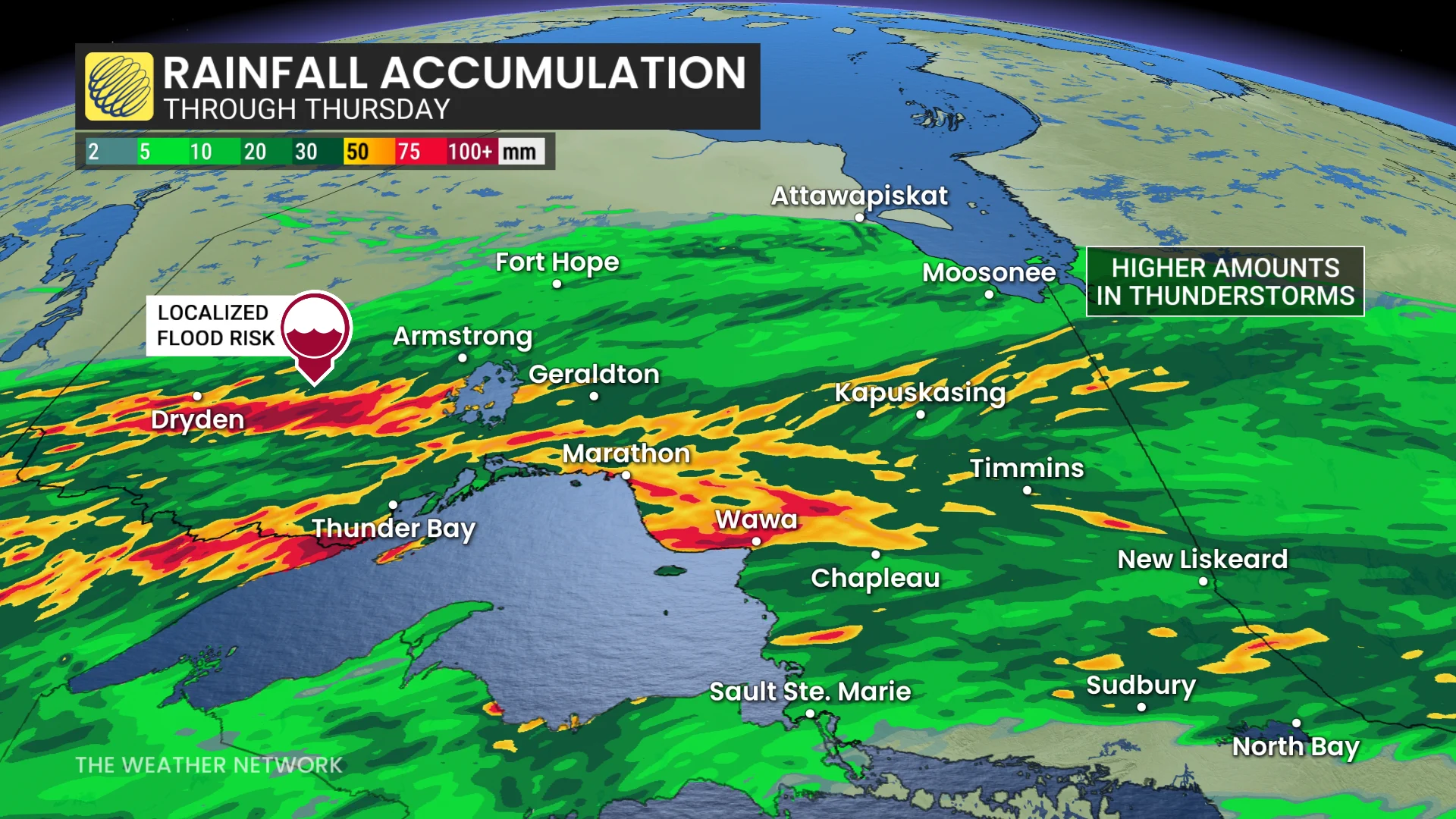
Heavy rainfall and frequent lightning are the main threats. Localized flooding concerns are there with training thunderstorm potential, with some regions possibly on the hook for 50-100 mm of rain.
After a warm start to the week, a strong cold front will track across the region with much cooler weather late next week and on the weekend, continuing well into the first week of August, especially in eastern areas.
Warmer weather is expected for the second week of August, however.
Thursday: Severe weather chance pivots southward into the lower Great Lakes region, eastern Ontario
Thursday appears to feature the most severe and active setup of the week, with the risk pivoting into northeastern and eastern Ontario, as well as the Lake Huron and Georgian Bay shores.
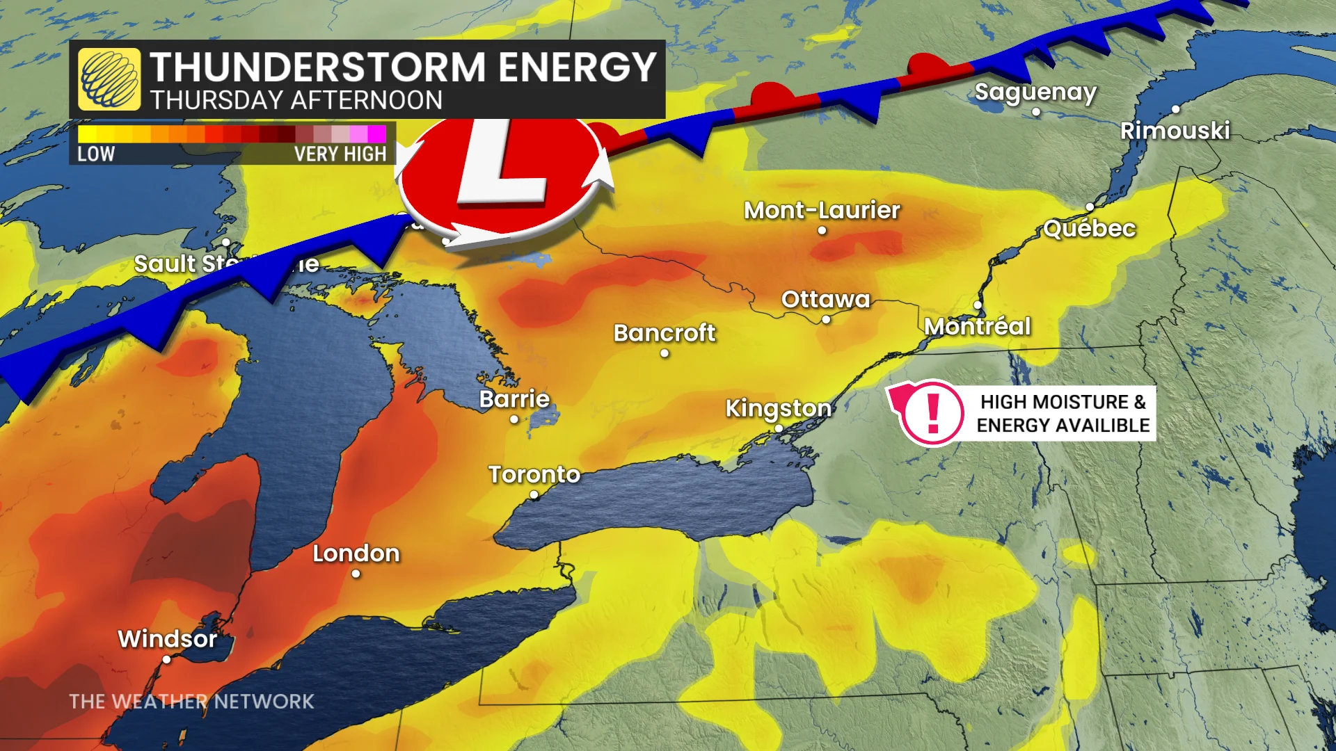
Southern and eastern Ontario will be seeing very muggy air, pushing the humidex into the 40s.
High moisture and thunderstorm energy by Thursday afternoon will help to fuel strong thunderstorms.
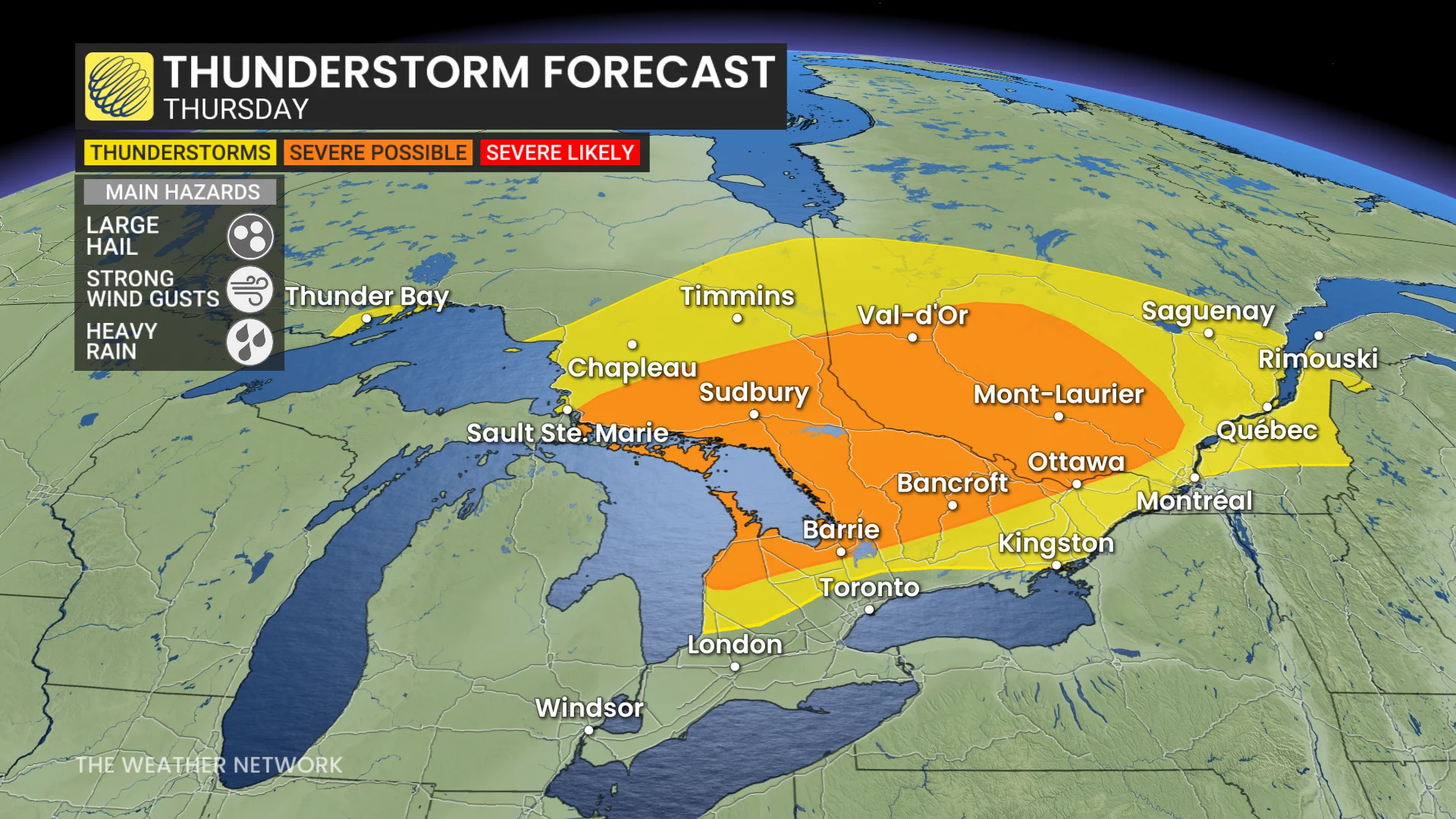
An active boundary slowly slides east, with heavy rain and two-centimetre hail possible from Sault Ste. Marie to Ottawa. Forecasters are monitoring the risk for rotating storms, which are possible but highly uncertain this far out.
The Greater Toronto Area (GTA) could see pop-up storms in the afternoon, but there is still some uncertainty.

Friday will bring another threat for showers and thunderstorms. Saturday will be partly sunny, very warm and humid, again with a risk for a shower or thunderstorm, but most of the day will be dry and cottage country should remain dry. Sunday will be mostly sunny, hot and humid.
WATCH: In a tornado warning? Here’s what you should do
Stay with The Weather Network for more information and updates on your weather across northwestern Ontario.