Snow arrives in Ontario Tuesday, but a white Christmas remains uncertain
Some GTA areas could see up to 10 cm of snow by Tuesday, while others may see minimal accumulation. Temperatures will influence snowfall totals
The Christmas countdown is officially on, with many Ontarians wondering if it'll be a white Christmas or not.
Snow is set to spread across the Greater Toronto Area (GTA) Monday night, but there is still some uncertainty if it'll be enough for the big day.

Temperatures are forecast to climb well above freezing after snowfall ends Tuesday, likely melting most or all of the snow in southern areas.
DON'T MISS: Canada’s magic number: What exactly makes for a white Christmas?
Slower commute times early Tuesday as overnight snow falls
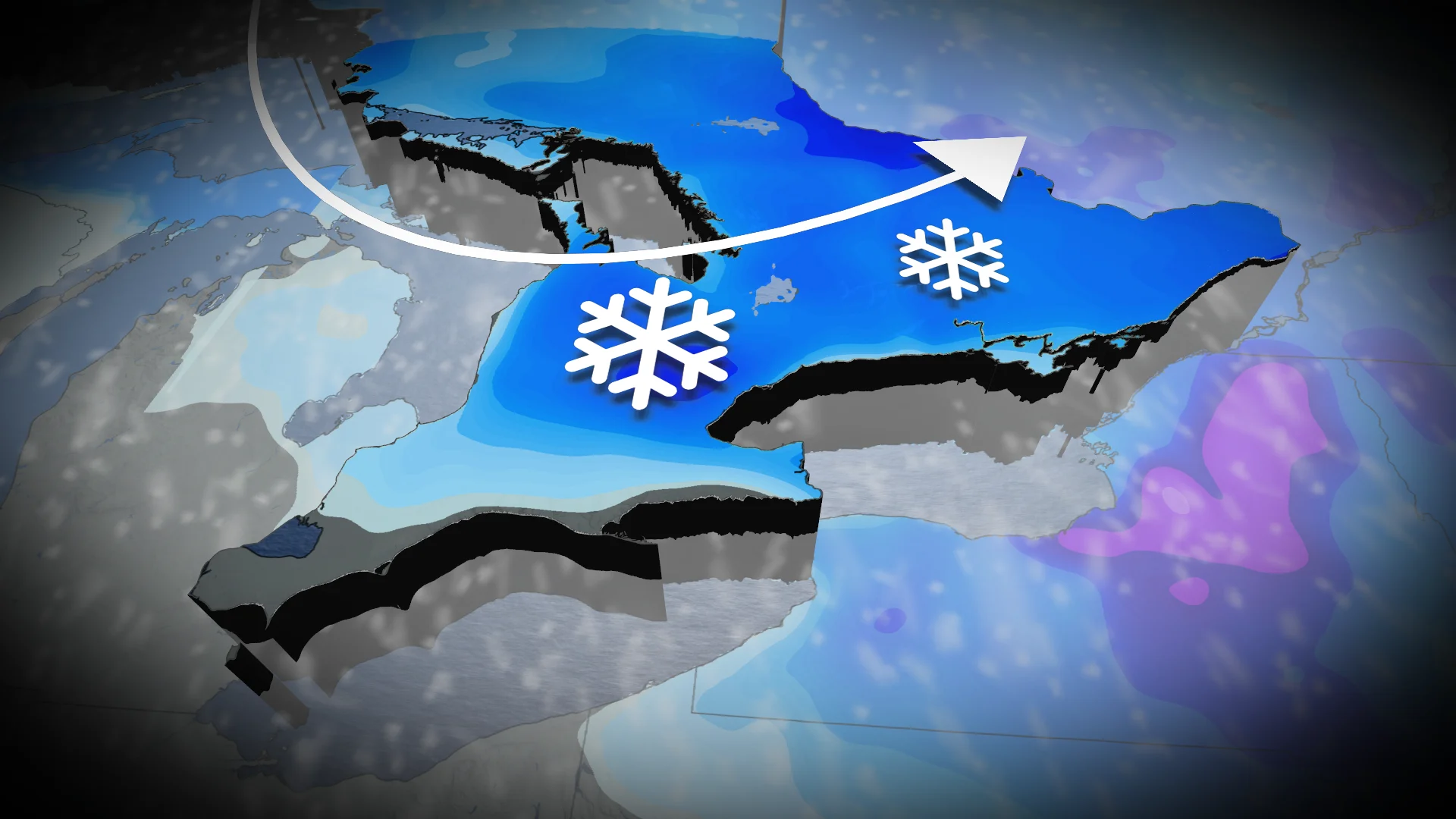
Overnight snowfall is expected in southern Ontario Monday into Tuesday morning.

While there’s potential for 5+ cm north of the QEW, temperatures of 0-1°C along lakeshores create uncertainty in totals. Morning commute delays are possible.
SEE ALSO: Christmas records in peril as holiday heat blankets North America
Fluctuating temperatures leading up to Christmas may melt snow south of Highway 401, including regions from Toronto to Windsor, making a green Christmas more likely.

Eastern Ontario and Ottawa can expect 5-10 cm of snow beginning Tuesday afternoon. Temperatures will remain below freezing during and after the event, ensuring a white Christmas for the Ottawa area.
WATCH: What is the official definition for a 'White Christmas'?
Be sure to check back for the latest weather updates across Ontario