Snow, freezing rain, rain: Messy winter storm targets southern Ontario
A broad Montana low will track across Ontario on Wednesday after impacting the Prairies earlier in the week, spreading some complex and mixed precipitation signals
Southern Ontario finally warmed up enough to turn down the thermostat a tad this weekend, with more tolerable winter temperatures after an extended period of cold, but that milder air has opened the floodgates for messy, wintry storms.
It didn't take long for Mother Nature to capitalize on the warmer temperatures in southern Ontario. A system from the Prairies will bring a swath of messy, wintry weather, including significant snow (10-20 cm) for some, on Wednesday.
DON'T MISS: More than $2M in parking tickets issued in Toronto following historic snowstorm
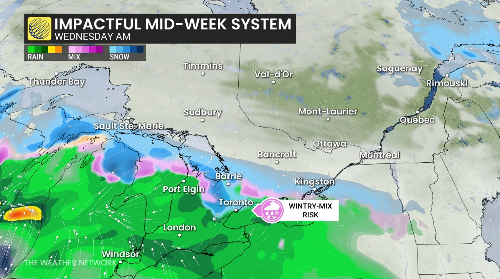
Meanwhile, freezing rain is expected south of the snow and rain is likely to the south of the warm front--with a messy, wintry mix in the middle for some areas. Travel will be heavily impacted as road conditions will be slippery and poor.
However, the exact placement of the warm front is still uncertain, the key on where the location of the heaviest snow in southern Ontario will be.
Don't write off the winter season just yet
A wavy warm front slicing into southwestern Ontario will provide the warmer air to bring rainfall across extreme areas of the region.

A swath of messy precipitation, freezing rain and ice pellets, sets up north of the warm front, but the timing and exact placement is still uncertain.
SEE ALSO: Toronto's record winter highlights snow removal challenges in North America
Small changes in temperature can have drastic impacts on your precipitation. On the colder side, a swath of heavier snow is more likely north of the Greater Toronto Area (GTA), extending from Barrie to Kingston, where temperatures aloft stay below freezing.
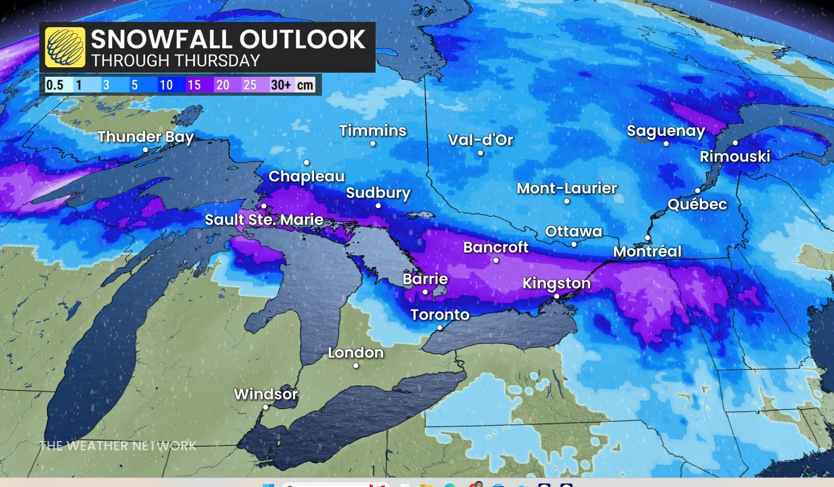
Small shifts in the front’s position mean big differences in the exact impacts, especially for the GTA and the Highway 401 corridor.
Precipitation spreads across southwestern Ontario through the pre-dawn hours on Wednesday. The morning commute will be tricky with locally heavy rain and a wintry mix near the GTA.
Areas inland and at higher terrain could face the stubborn prospect of several hours of freezing rain with cooler air trapped at the surface.

The Wednesday afternoon and evening commute is slow across eastern Ontario, while precipitation begins to ease across the southwest as we progress through the evening.
The exact placement of the warm front is still uncertain, which will be the key to whether the heaviest snow will be across the GTA, or whether it will be to the north across cottage country, with freezing rain and rain across the GTA and rain across southwestern Ontario.