Snow on the way as weekend winter wake-up call reaches Ontario
Prepare for slick roads and tricky travel Sunday into Monday as the first accumulating snow of the season reaches southern Ontario
All eyes are on Sunday’s forecast as much of southern Ontario prepares for a system that could bring the region its first accumulating snowfall of the season.
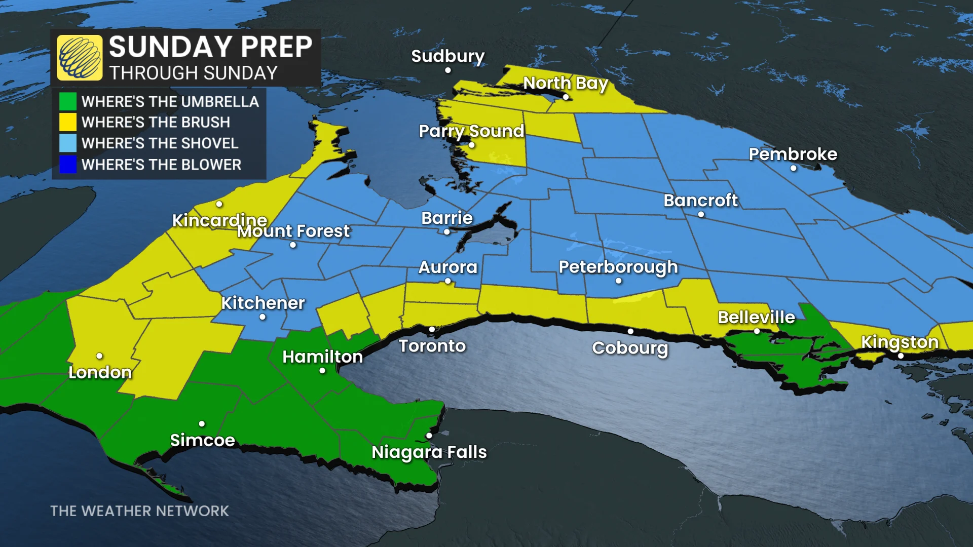
Communities north of the storm’s track could see shovellable snow totals. The storm’s precise path remains uncertain, though, with the potential for significant impacts if its track shifts south.
RELATED: Why the first snowfall of the season can catch drivers by surprise
While it's still the beginning of November, these early season snowfalls remind residents to prepare for shifting driving conditions and ensure vehicles are winter-ready. Residents are advised to monitor any developing weather alerts and to prepare for potentially slippery roads and reduced visibility in affected areas.
DON'T MISS: Winter-proof your home with a heat pump that even works in -30°C
Sunday: Snow dependent on storm track and temperatures
A significant system tracking into southern Ontario on Sunday will arrive just as Arctic air filters into the region from the north. The storm's track will be critical in determining precipitation type and accumulation across the region.
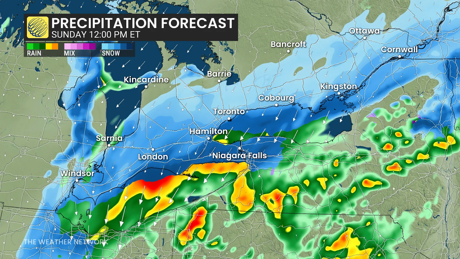
Forecasters are increasingly confident that this will be a mostly snow event down to Lake Ontario’s shoreline as temperatures will hover around freezing as the precipitation falls.
The initial wave of precipitation will arrive during the early morning hours on Sunday. A period of heavier and steadier snowfall should begin as the system draws closer by the late morning, continuing into the late afternoon and evening hours for many areas.
Snowfall totals of 5-10 cm are possible from Kitchener and Guelph toward Brampton into Peterborough, with higher totals on the order of 10-15 cm possible into the National Capital Region. Folks around the immediate lakeshores, including Toronto and Hamilton, may see 2-5 cm of snow from this event.

DON'T MISS: Toronto to go dark again as it nears final 5 p.m. sunset until 2026
It’s important to note that accumulations will be limited to grassy areas and untreated sidewalks. Temperatures close to or below 0°C Sunday morning and afternoon will support potential snow-covered or icy roads, increasing the risk of slow driving conditions.
Road closures are less of a concern in the snowbelt regions thanks to the decreasing lake-effect threat on Sunday night. The greatest concern for travel impacts will remain south of Lake Huron. Residents without winter tires should exercise caution.
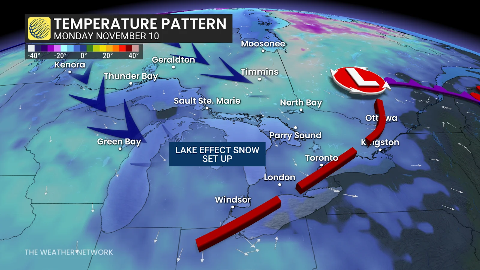
Lake-effect snow chances increase early next week
Following the system, persistent Arctic air will drive multiple days of lake-effect snow in the traditional snowbelt regions on Monday and Tuesday.
RELATED: Do the warm Great Lakes mean lots of snow this winter?
A wintry December is coming
Temperatures early next week will remain chilly, with values struggling to reach the low single digits near and south of the 401, while staying below freezing in areas well north of the 401.
A gradual temperature rebound is anticipated later in the week, with above-seasonal conditions expected as the region moves into the second half of November. However, more consistent winter weather is anticipated to settle in before the start of December, with December shaping up to feature decidedly wintry conditions.
Safety tips for driving in adverse weather
Install winter tires. Winter tires can improve stopping distance by up to 30 per cent in wintry conditions.
Prepare an emergency kit. Include the basics like snacks, first aid kit, flashlights and blankets.
Plan your travel. If possible, postpone trips during active weather and especially freezing rain. Driving is not worth the risk.
Adjust your speed. A gentle reminder that stopping distance increases exponentially as your speed increases.
Header image created using graphics and imagery from Canva.