Early-season snowfall hits southern Ontario, risk of 5-10+ cm
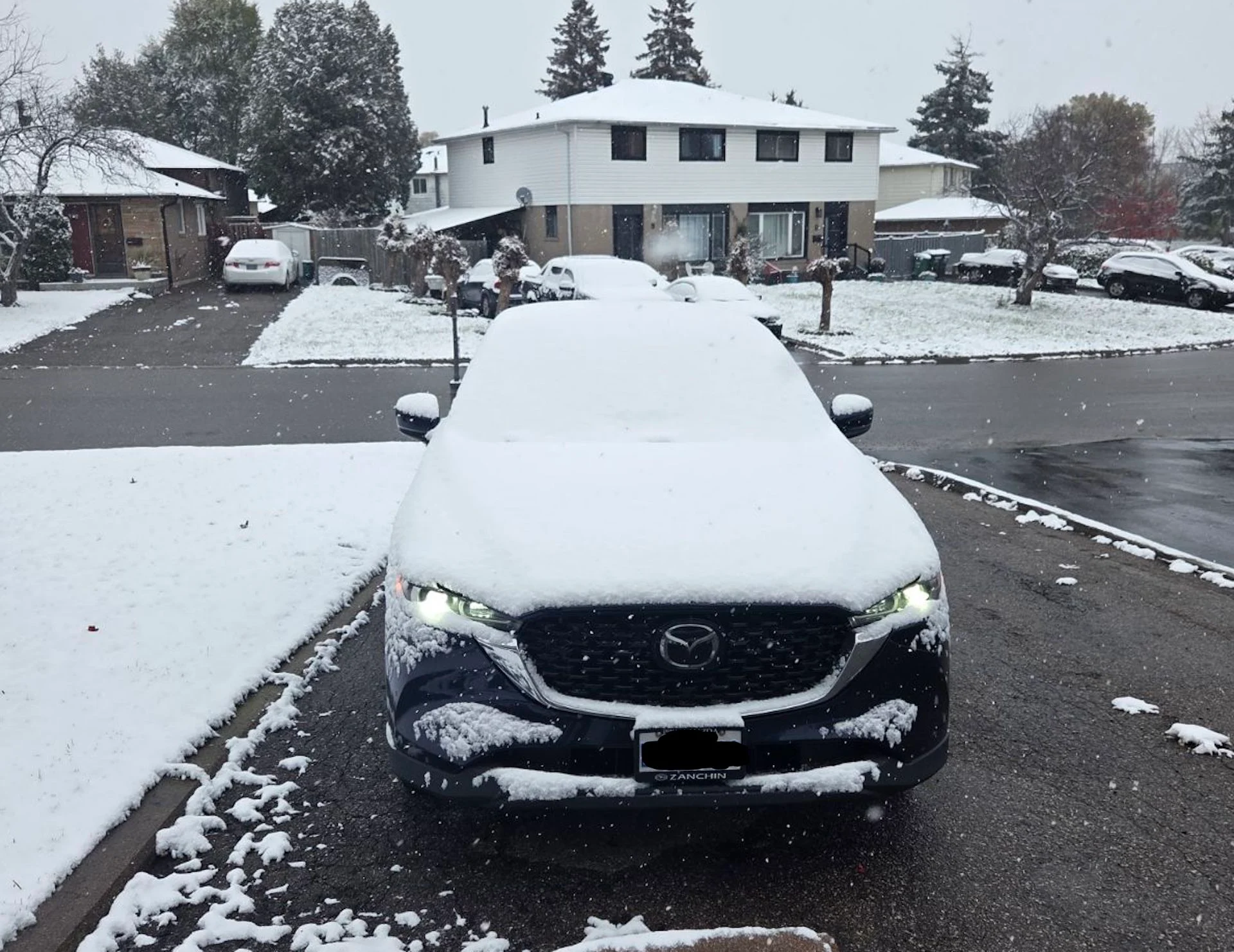
Drivers across southern Ontario should brace for slick roads and travel disruptions on Sunday as accumulating snow is in the forecast for much of the region.
Winter is performing a pre-game show in Ontario on Sunday. A taste of early winter has arrived and will linger into this week for much of Ontario as Arctic air has plunged south into the region.
To complement the colder air, a stateside system has tossed moisture into Ontario, creating a setup on Sunday where up to 20 cm of snow could fall in eastern areas. Generally, 5-10+ cm is anticipated over a larger portion of southern Ontario. Snow has begun in many locales, so make sure you give yourself extra time for any travelling plans.
RELATED: Why the first snowfall of the season can catch drivers by surprise
While it's still the beginning of November, these early-season snowfalls remind residents to prepare for shifting driving conditions and ensure vehicles are winter-ready. Residents are advised to monitor any developing weather alerts and to prepare for potentially slippery roads and reduced visibility in affected areas.
Sunday: Snow begins falling in southern Ontario. Totals dependent on storm track and temperatures
A snowfall event like this typically happens in early- to mid-December for Pearson airport. The average first 5-cm accumulation is Dec. 12 with the median date of the first 10-cm total happening on Dec. 27.
The initial wave of precipitation has moved into the Greater Toronto Area (GTA) as of early Sunday morning. Snow accumulating on grassy surfaces as it is melting on surface. Heavier bursts have been observed in areas from Kitchener to Orangeville as temperatures plummeted below the freezing mark.
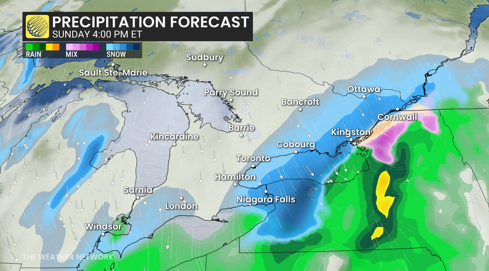
Mixing is likely near the shoreline of Lake Ontario, limiting snowfall accumulations near the water. Lake Erie and Niagara east regions transitioned to rain early Sunday as warm air was temporarily drawn north.
DON'T MISS: Winter-proof your home with a heat pump that even works in -30°C
Heaviest bursts of snowfall forecast throughout Sunday afternoon, leading to further travel disruptions.

Sunday evening: Localized heavier snow bursts continue across the Niagara Peninsula, with the GTA tapering to flurries.
Toronto and GTA core will see about 5 cm, while higher elevations and northern GTA suburbs could see 5+cm. Lakeshore areas will see less than 5 cm.
As the low exists east, Hamilton and Niagara could overachieve with some heavier bursts of snow across higher terrain, possible approaching 10 cm. Residents without winter tires should exercise caution.

DON'T MISS: Toronto to go dark again as it nears final 5 p.m. sunset until 2026
WATCH: Early-season snowfall in southern Ontario may pick up through the afternoon
On Sunday, winds are generally 20-40 km/h out of the northeast, going as high as 50 km/h for the Niagara Peninsula and regions near Lake Ontario and Lake Erie.
Heavy snow is forecast to move into eastern Ontario by later Sunday afternoon, giving some of the highest snowfall totals for the province. The snow snow will linger through the evening hours.
Dangerous driving conditions in the Coburg-Cornwall area with heavy bands of snow and visibility as low as 1000 metres through the afternoon and evening
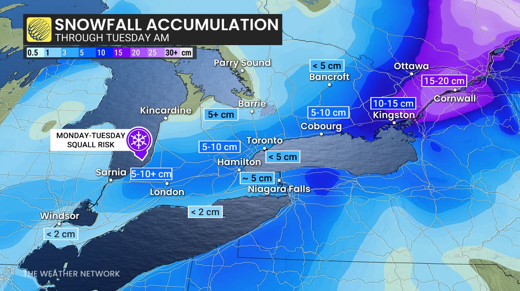
Regional snowfall forecast:
Ottawa and area: 10-20 cm
Kingston-Cornwall Corridor: 15-25 cm
Prince Edward County: 10-15 cm
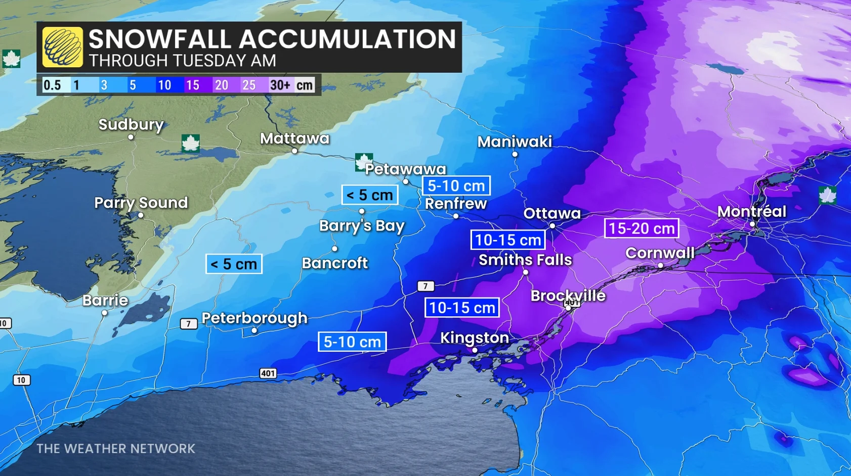
A deeper supply of colder air means Ottawa's precipitation will remain as snowfall for the duration of the event, with a risk of a wintry mix through the evening and overnight near and along Highway 401 between Kingston and Cornwall.10-20 cm of snow is forecast across extreme eastern Ontario, with lesser amounts farther north and west.
It’s important to note that accumulations will be limited to grassy areas and untreated sidewalks. Temperatures close to or below 0°C Sunday morning and afternoon will support potential snow-covered or icy roads, increasing the risk of slow driving conditions. As drivers adjust to winter driving conditions, there can be an increased risk of collisions and accidents.
Lake-effect snow chances increase early this week
As the system departs and winds shift to the north, snow squalls will ignite across Lake Huron and Georgian Bay. Early Monday morning, bursts of snow along Highway 21 (Kincardine to Sarnia), with light snow south of Georgian Bay.

By Monday afternoon, multiple squalls streaming off of Lake Huron and Georgian Bay. There will be an increased risk of localized whiteouts amid rapidly changing weather conditions. As a result, road closures will be possible.

RELATED: Do the warm Great Lakes mean lots of snow this winter?
Northwesterly winds continue to drive snow even as far south as the GTA, from Georgian Bay, with bands dissipated Tuesday morning. Lake Huron will continue to generate squalls through early Tuesday afternoon.
Highly variable, but 5-15 cm of snow with most squall activity, but locally higher (20+ cm) for regions where the squalls remain stationary.
A wintry December is coming
Temperatures early this week will remain chilly, with values struggling to reach the low single digits near and south of the 401, while staying below freezing in areas well north of the 401.
A gradual temperature rebound is anticipated later in the week, with above-seasonal conditions expected as the region moves into the second half of November. However, more consistent winter weather is anticipated to settle in before the start of December, with December shaping up to feature decidedly wintry conditions.
Safety tips for driving in adverse weather
Install winter tires. Winter tires can improve stopping distance by up to 30 per cent in wintry conditions.
Prepare an emergency kit. Include the basics like snacks, first aid kit, flashlights and blankets.
Plan your travel. If possible, postpone trips during active weather and especially freezing rain. Driving is not worth the risk.
Adjust your speed. A gentle reminder that stopping distance increases exponentially as your speed increases.
Header image created using graphics and imagery from Canva.