
Snowfall chances on the rise (again!) across southern Ontario
A soggy weekend will lead into a wintry system pushing into southern Ontario to start next week
Get ready for another active couple of days across Ontario.
Rain arriving this weekend may raise flooding concerns for areas already saturated by Wednesday’s storm.
The main course arrives soon after. Thursday’s warmth will be a wistful memory by early next week as a burst of Arctic air looks to move into Ontario. Widespread snowfall is expected by Monday.
DON’T MISS: Experts predict an above-average 2025 Atlantic hurricane season
Active storm track this weekend
Temperatures rose into the 20s on Thursday on the heels of a storm that brought flooding rains, thunderstorms, and disruptive snow and ice to much of southern Ontario.
The ground is already saturated after many communities saw 50-70+ mm of rain from Wednesday’s event—and we’ve got more heavy rain on the way as an active storm track persists into this weekend.
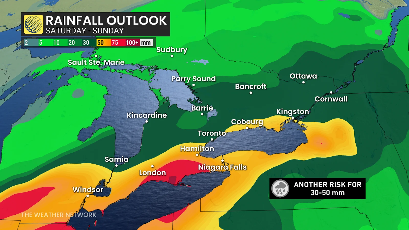
Rain will return by Saturday morning, pushing from Windsor into the Greater Toronto Area. Expect the precipitation to continue for most of the day.
Additional rainfall totals of 30-50 mm will contribute to excess runoff and high water levels, once again raising the prospect of localized flooding throughout the region.
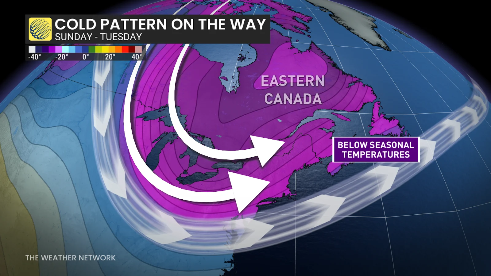
Arctic air, snow to start next week
Winter isn’t done with us just yet. Arctic air is on the move and it’ll spill into southern Ontario following our weekend rainfall.
Temperatures will soon fall below the freezing mark—which is well below seasonal for this time of year. Highs on Sunday and Monday will only reach the lower single digits, with subfreezing nighttime readings in the cards.
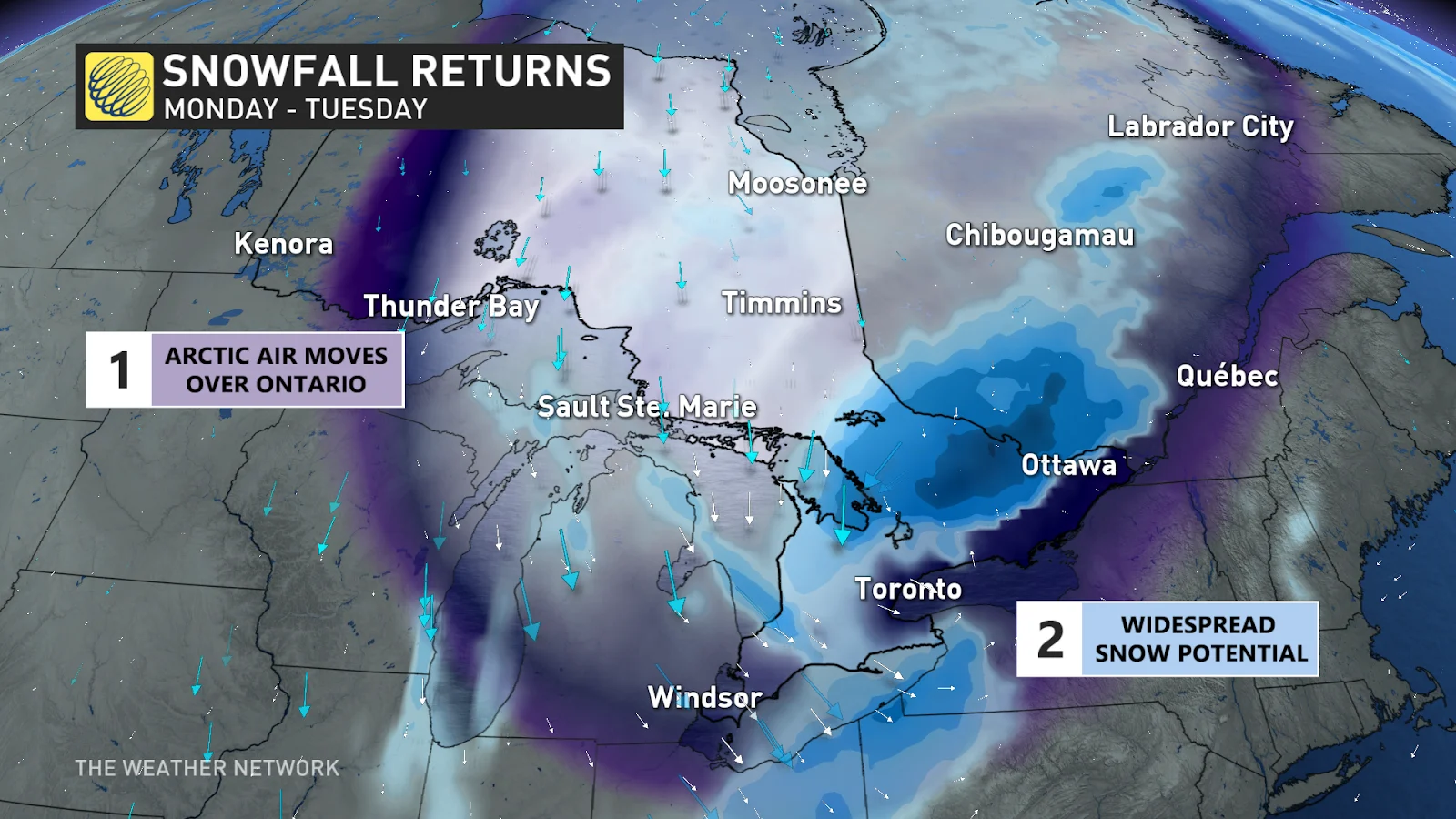
Widespread snowfall is expected to develop through the late afternoon or evening on Monday as a second storm builds in the cold air parked over the region.
RELATED: A typical April’s weather across Canada is one wild ride
There’s still some uncertainty in the storm’s track and intensity, but there’s a chance for accumulating snow across the snowbelts, the Greater Toronto and Hamilton Area, as well as communities to the east.
Given cold winds blowing over the lakes, the opportunity for lake-effect snow will build at the end of the storm on Tuesday.
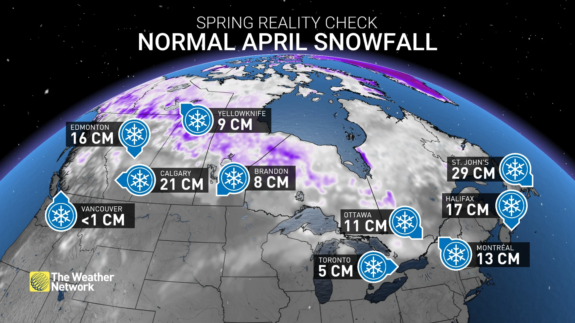
This upcoming system is a reminder that, while unwelcome, April snows are normal in Ontario. Toronto averages about 5 cm of snow in a typical April, while the month usually brings around 11 cm of accumulation to Ottawa.
Stay with The Weather Network for all the latest on conditions across Ontario.