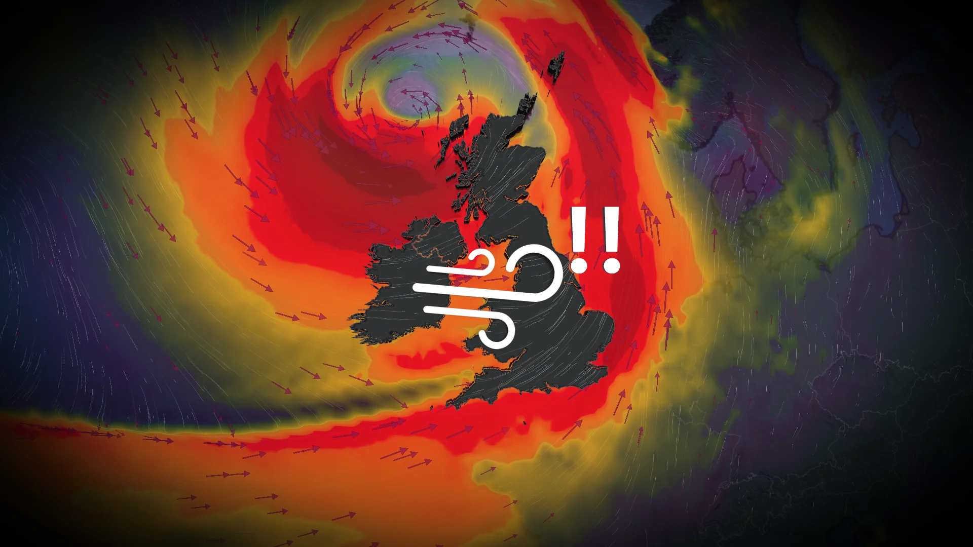
Storm Austen strikes Europe as an even stronger storm looms

After a powerful windstorm struck western Europe on Thursday and Friday, parts of the region are bracing for an even stronger weekend storm
Winds gusted to nearly 130 km/h as powerful Storm Austen swept into western Europe to end the week.
Forecasters warn that an even stronger storm will batter parts of the region heading into this weekend, threatening an additional round of powerful winds and heavy rain.
DON’T MISS: How a powerful El Niño will affect people around the world
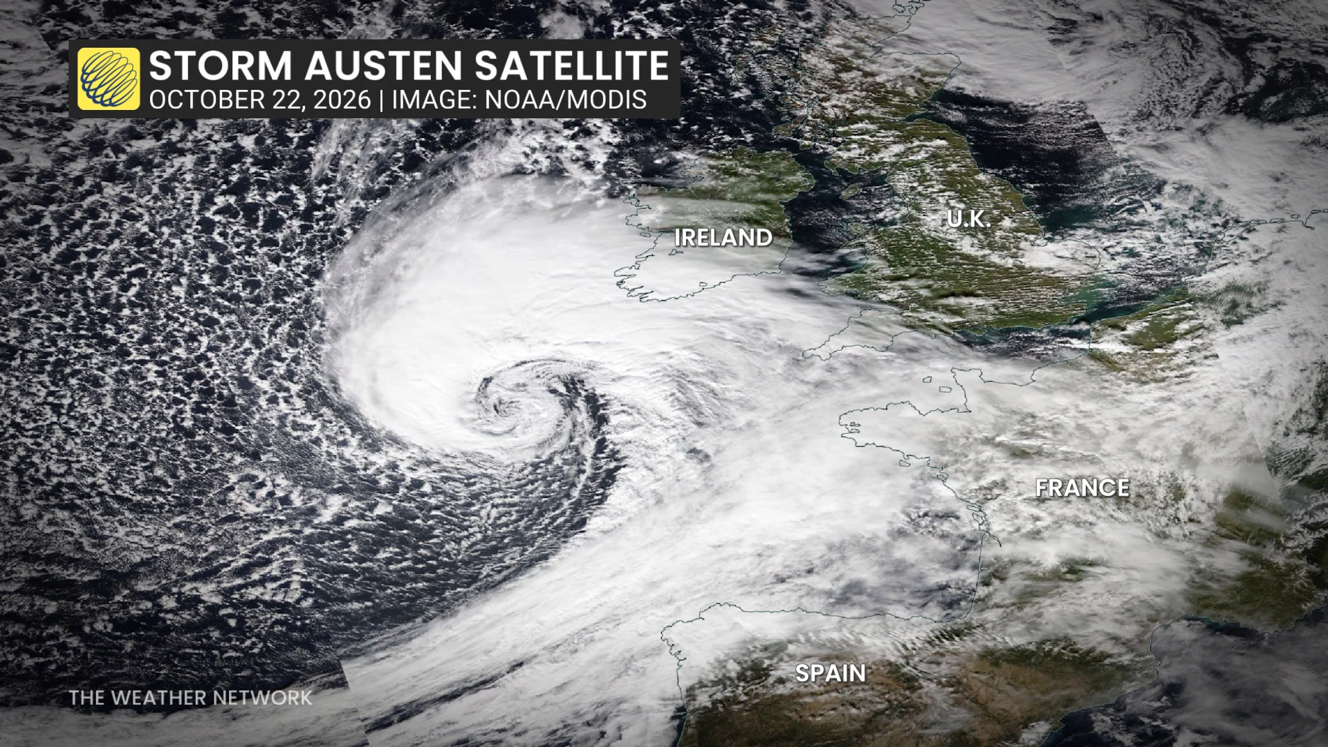
Storm Austen looked remarkable on satellite imagery as it strengthened over the northeastern Atlantic on approach to western Europe on Thursday and Friday.
The centre of the powerful low-pressure system tracked east across the English Channel before weakening as it turned north over The Netherlands and Denmark late Friday.
Heavy rainfall and intense winds hit Ireland, the U.K., as well as northwestern sections of mainland Europe.
Gusts as high as 122 km/h at St. Mary’s Airport, off the southwestern tip of England. Another wind gust of 114 km/h occurred at a military base in Cornwall. Thousands of power outages were reported.
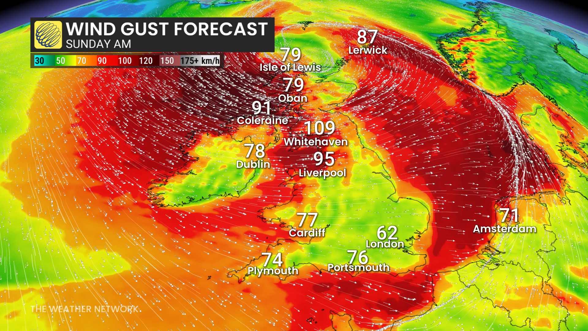
Storm Boelo (pronounced ‘boo-loh’) will follow close behind, affecting northern portions of Ireland and the U.K. through Saturday and Sunday.
RELATED: Weather bombs are powerful storms that rapidly intensify
Forecasters expect the low-pressure system to rapidly intensify, a process called bombogenesis that often results in powerful wind gusts for the affected areas.
The criteria for bombogenesis is generally a central pressure fall of 24 mb in 24 hours. Boelo may intensify 30+ mb in just 12 hours.
U.K.’s Met Office issued an amber warning, a level two on a three-category scale, ahead of Storm Boelo’s arrival on Saturday into Sunday.
Travel disruptions and power outages are likely as the system produces wind gusts of 90-110+ km/h across Scotland, Northern Ireland, and northern England.
Government weather bureaus throughout Europe assign names to powerful storm systems to help the public keep track of these disruptive events.