
Tornado warning issued in southern Ontario
An active pattern continues to bring waves of storms across Ontario.
7:42 p.m. EDT - Severe thunderstorms prompted a tornado warning in southern Ontario on Saturday evening.
Environment and Climate Change Canada issued a tornado warning for the following areas in southern Ontario:
Wingham - Blyth - Northern Huron County
"This is a dangerous and potentially life-threatening situation. Take cover immediately, if threatening weather approaches," ECCC said in its warning.
The agency added: "Go indoors to a room on the lowest floor, away from outside walls and windows, such as a basement, bathroom, stairwell or interior closet. Leave mobile homes, vehicles, tents, trailers and other temporary or free-standing shelter, and move to a strong building if you can. As a last resort, lie in a low spot and protect your head from flying debris.”
CURRENT TORNADO WARNINGS (ONTARIO):
Wingham - Blyth - Northern Huron County
The original article with the full forecast for southern Ontario continues below.
Ontario won’t catch a break from the active weather to kick off this final weekend of July as forecasters look at multiple zones across the province for renewed storm development.
Folks in southern Ontario will see multiple opportunities for thunderstorms during the day Saturday, a few of which could approach severe limits.
PHOTOS: Large hail and 'serious winds' batter parts of Ontario, Quebec

Southern Ontario storms arrive in two rounds
Saturday will start with a weak low-pressure system slowly nudging into Ontario from Michigan, though a strong centre of high pressure over Quebec won’t allow the low to advance very far.
A stationary boundary associated with that low-pressure system will slide into southwestern Ontario through the early afternoon hours, potentially triggering some non-severe thunderstorms across the region.
SEE ALSO: After feeling like the 40s, is Ontario done with extreme heat?
Later in the day, an approaching cold front will help trigger a second round of storms across southern Ontario. This second round will have a higher severe risk between Windsor and Kincardine due to greater instability present in the atmosphere.
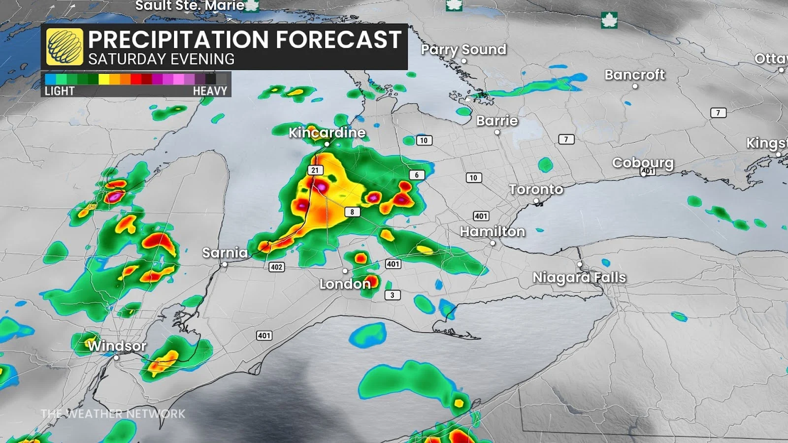
The possibility of severe weather depends on the timing of the cold front. Some models are suggesting that the severe storms could arrive in the late evening into the overnight period.
Stay with The Weather Network for all the latest on conditions across Ontario.