
Severe storm, flooding threat looms over parts of Quebec on Sunday
Plan your afternoon plans around the risk for storms in Quebec, especially in the Eastern Townships. Thunderstorms repeatedly moving over the same areas could lead to a localized flooding risk, as well.
The weekend looks to end on a stormy note for southern Quebec as a cold front slices across the region.
A threat for thunderstorms will engulf parts of the region on Sunday afternoon and evening, thanks to a cold front situated across the St. Lawrence Valley. Areas at greatest risk of seeing severe storms will be in the Eastern Townships and potentially along the Ontario-Quebec border.
DON'T MISS: Surprising tornado deficit continues across Ontario, Quebec
Stay alert for a risk for localized flooding in some of the heavier storms.
Sunday storms develop in Quebec
Saturday’s active weather will follow a cold front east into southern Quebec on Sunday, sparking the risk for some afternoon thunderstorms.
Cold front draped across the St. Lawrence Valley by Sunday morning will heighten the storm risk once again.

Expect storms to develop by the early-afternoon hours in areas north of the St. Lawrence Valley and towards Saguenay, Que. The bulk of the instability moves into the Eastern Townships by the middle of and towards the late-afternoon hours.
A few of the storms could reach severe limits in the Eastern Townships, including around Sherbrooke, Cowansville, and Victoriaville. The strongest storms may produce heavy rainfall and bring a threat for localized flooding for some locales south of the St. Lawrence River.
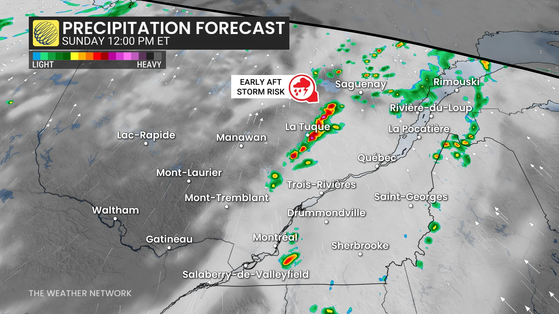
Areas stretching Drummondville to Saint-Georges, and northwards to Quebec City, Que., will see the heaviest swath of precipitation.
Training thunderstorms—cells that move over the same locations one after the other—could lead to a risk for localized flooding in some areas. Never try to drive across a flooded roadway. It’s impossible to tell how deep the water is until it’s too late, and it only takes a small amount of water for a vehicle to lose traction.
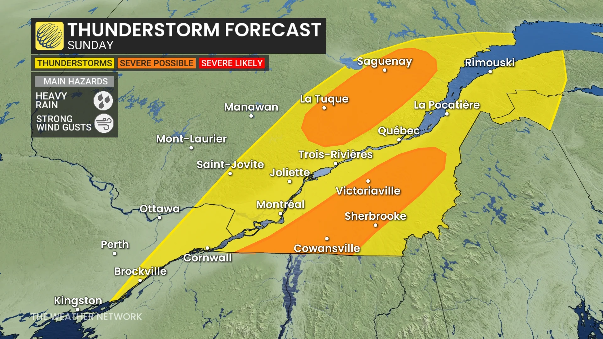
Winds will also be a factor with this cold front, with widespread gusts of 40-50 km/h for Quebec into early week. Localized, stronger wind gusts with thunderstorms.
Showers continue through the overnight and into Monday morning for locales south of the St. Lawrence River.
Forecasters are tracking a fall-like air mass to arrive behind the cold front.
Stay with The Weather Network for all the latest on conditions across Quebec.
Thumbnail courtesy of Samuel Genest.