Storm risk returns to the Prairies as fresh instability arrives Sunday
Strong to severe thunderstorms are possible across southern portions of the Prairies on Sunday
We’re closing out the weekend with a renewed threat for strong to severe thunderstorms across the southern Prairies.
While much of the region deals with thick smoke from ongoing wildfires, another wedge of instability will foster fresh storm activity from British Columbia’s Interior through southern Saskatchewan.
Looking beyond Sunday's storm risk, some areas could see a remarkable drop in temperatures for the start of the new workweek.
Keep an eye on the radar and listen for severe weather alerts in your area as you go about your day.
[don’t miss link]
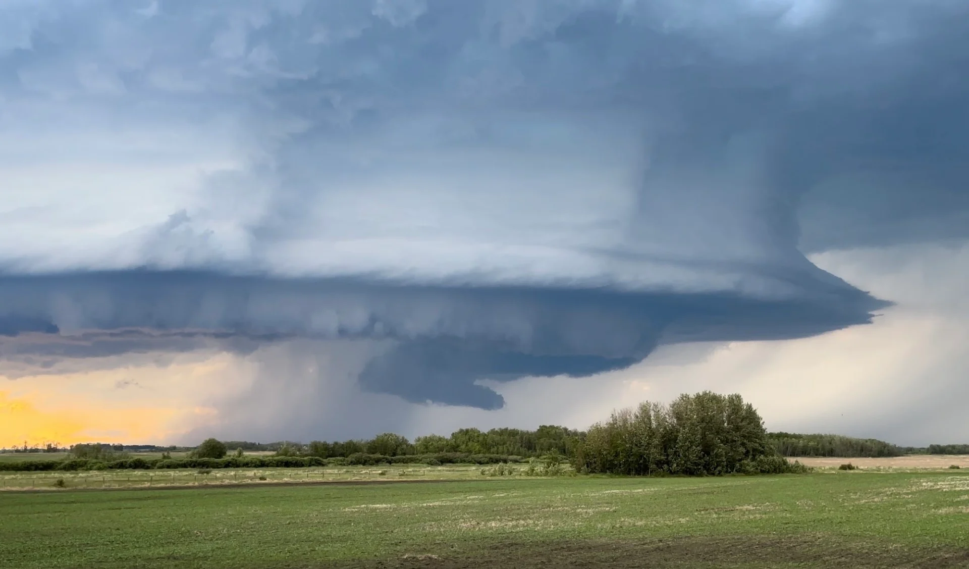
Sunday storm threat includes supercell risk
Sunday morning will see a trough extending from the B.C. Interior through southern Saskatchewan, with modest instability fuelling a risk for non-severe storms for the first half of the day.

Warm air spiralling around a low-pressure system will allow the atmosphere to destabilize across the southern Prairies by Sunday afternoon.
The greatest risk for severe weather will cover southern Saskatchewan, including Regina. This is where ample humidity and the best dynamics may favour the development of supercell thunderstorms.
Any storms in Saskatchewan able to reach severe limits will be capable of producing damaging wind gusts and large hail. We’ll see a modest tornado risk across the region—a funnel cloud or even a brief tornado is possible, but it’s not the primary threat with Sunday’s storms.
Looking ahead to an unseasonable chill
Folks across central Alberta and the Rockies will experience a temperature dip through the day Sunday, but a stronger signal for well-below seasonal temperatures is on the horizon.

The approaching pattern is likely to trigger a remarkable temperature drop Tuesday, with forecast daytime temperatures coming in 10-15 degrees below seasonal across central and southern Alberta.
We could even see some heavy accumulating snowfall in the Rockies above 2200 metres, especially around Jasper.
Header image submitted by Loreen in Saskatchewan.
Stay with The Weather Network for all the latest on conditions across the Prairies.