Flooding rains and lightning: Multi-day storm threat hits Ontario
The threat of thunderstorms persists across Ontario, with Thursday shaping up to be the most active day of the week for severe weather potential
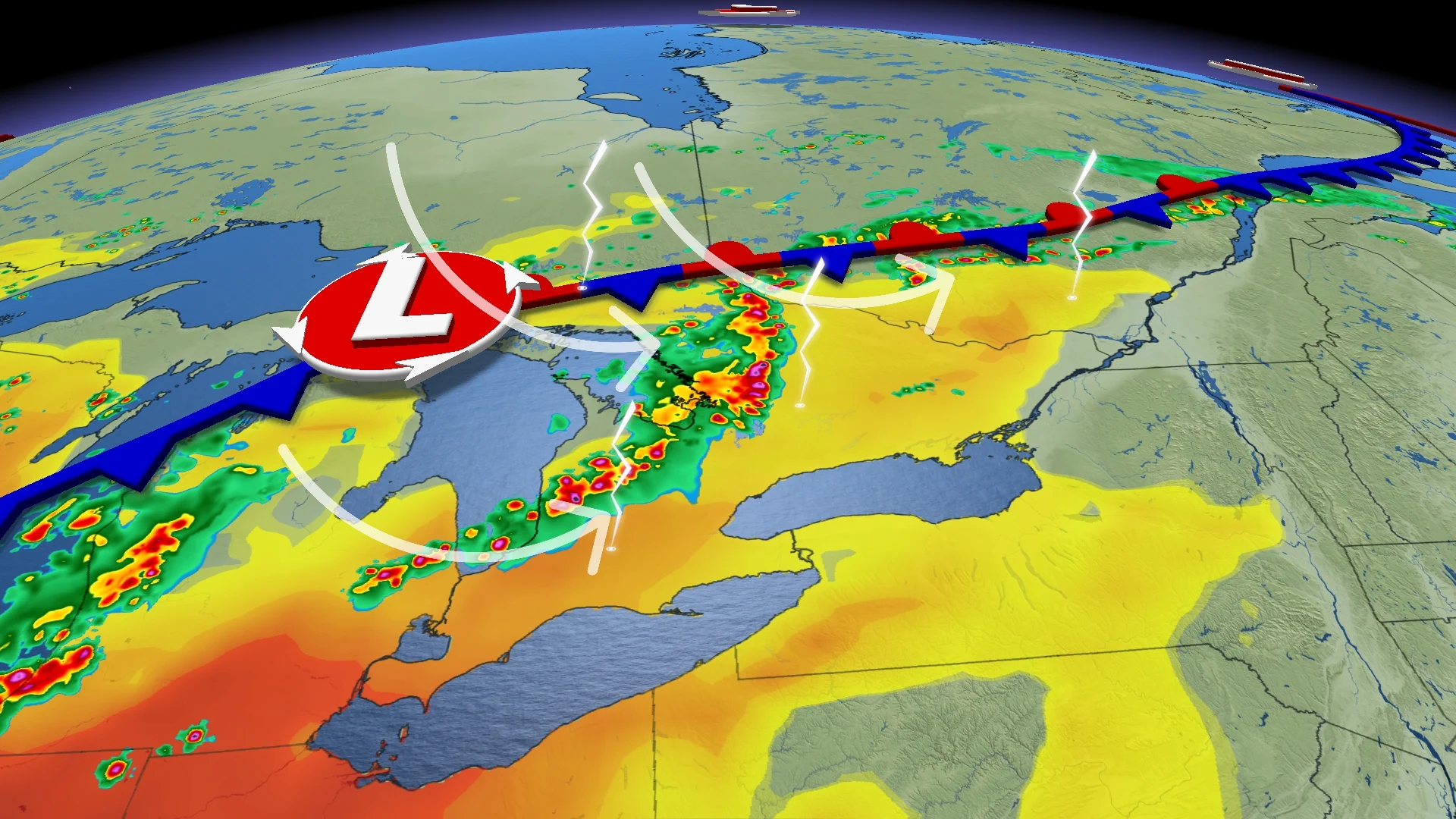
Active weather remains a concern across Ontario this week, as a sluggish system brings storms, heavy rainfall, and localized flooding risks through Thursday and beyond.
DON’T MISS: U.S heat will soon spill into Eastern Canada, bringing back 30 C weather
A boundary moving through Ontario will push the risk of thunderstorms farther east on Wednesday. The affected region will extend from areas west of Thunder Bay through to the Quebec border, including communities such as Timmins. A zone around Lake Superior is highlighted for a potential risk of severe thunderstorms.
By Thursday, the thunderstorm threat will shift farther south and east, encompassing areas around the lower Great Lakes.
Make sure you keep an eye on the radar––especially if you have outdoor plans––and stay aware of any severe weather watches or warnings issued in your area.
Wednesday: Another cluster of storms could bring significant rain to the Lake Superior shores
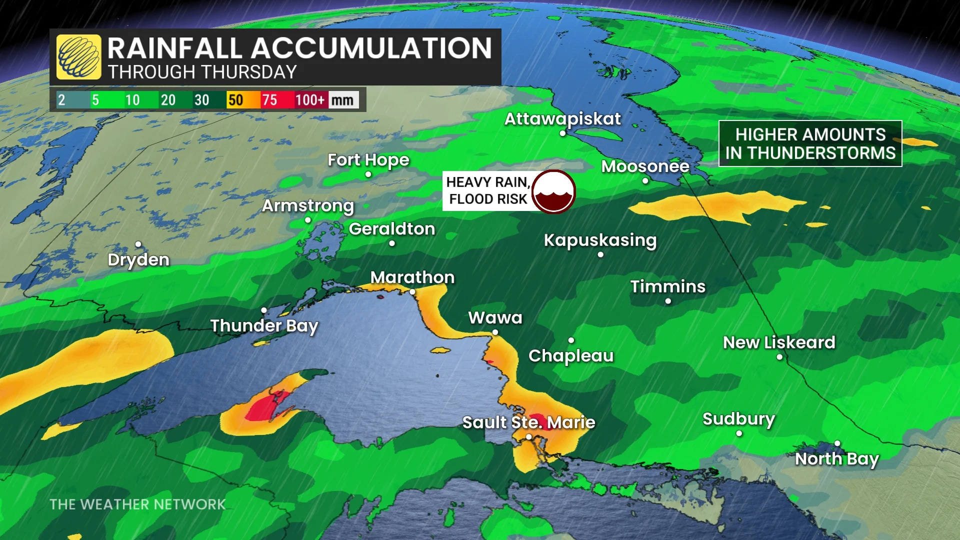
Environment and Climate Change Canada (ECCC) issued a rainfall warning first thing Wednesday for areas along Lake Superior's eastern shores. Intense rainfall rates in heavy downpours are likely.

SEE ALSO: Wildfire smoke, other extreme weather affecting Ontarians' vision: Poll
Communities including Thunder Bay, Sault Ste. Marie, and surrounding regions could see 50-70+ mm of torrential rain, raising localized flooding concerns, particularly where training thunderstorms develop.
Frequent lightning and heavy rainfall are the primary concerns on Wednesday into Thursday for this region.
Thursday: Watching for the strongest storms of the week
The threat of severe thunderstorms escalates Thursday, particularly for northeastern and eastern Ontario, as well as areas near Lake Huron and Georgian Bay.

High humidity will dominate southern and eastern Ontario, with humidex values reaching the low 40s.
Afternoon instability may fuel storms, with the risk of hail up to 2 cm, heavy rain, and intense lightning extending from Sault Ste. Marie to Ottawa.
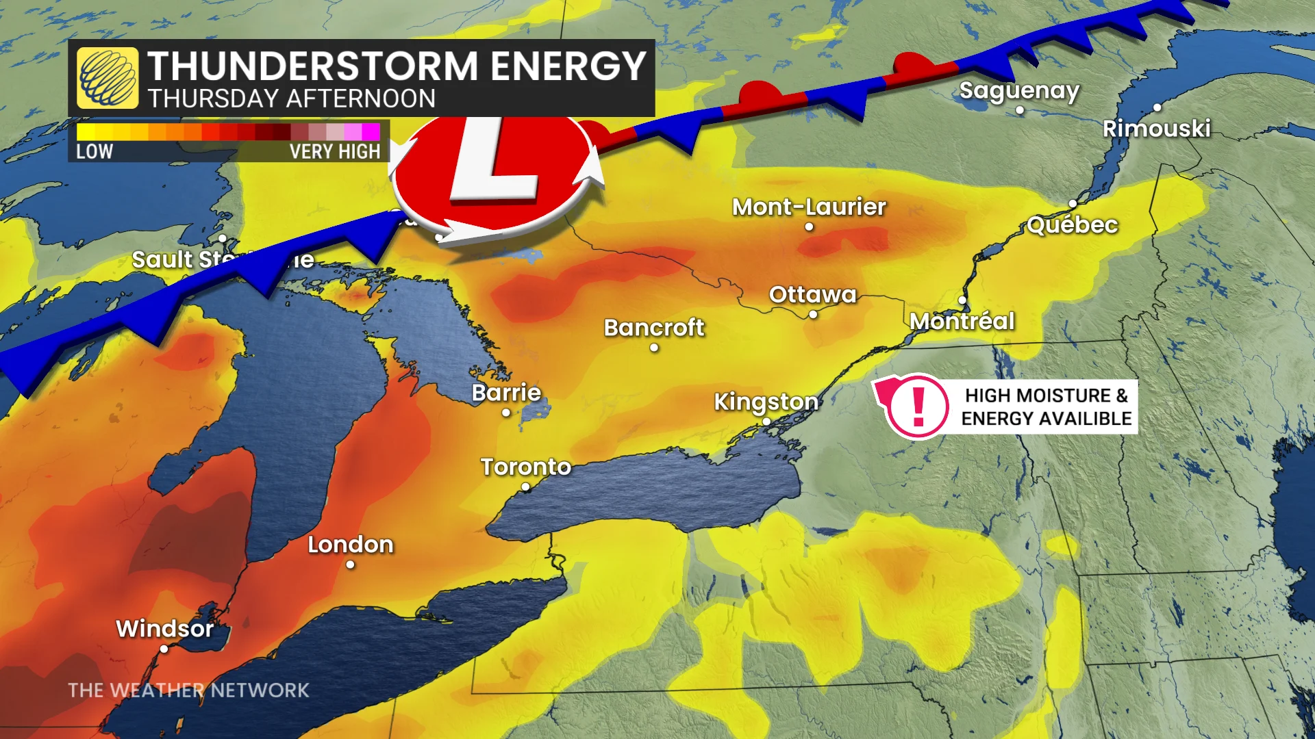
Although rotating storms are being monitored, confidence remains low at this time regarding their formation.
The Greater Toronto Area (GTA) is expected to remain largely rain-free through most of Thursday, but could see isolated thunderstorms develop in the afternoon. The risk broadens Thursday night with rain and storms spreading across southern Ontario.

Friday: Lingering storm risk as we start out the weekend
Clearing conditions are anticipated Friday for northern regions, while central and southern Ontario, as well as southern Quebec, continue to face thunderstorm risks heading into the weekend.
WATCH: In a tornado warning? Here’s what you should do
Stay with The Weather Network for more information and updates on your weather across northwestern Ontario.