Stormy Sunday possible in Ontario, Quebec with rise in severe weather risk
Heavy, moist air throughout southern Ontario and Quebec could help spark severe thunderstorms in parts of both provinces on Sunday, with large hail, heavy rain, damaging wind gusts and localized flooding as the main hazards.
The extreme heat and humidity in parts of Central Canada will come to an end Sunday night, but it could result in a bout of stormy weather before then.
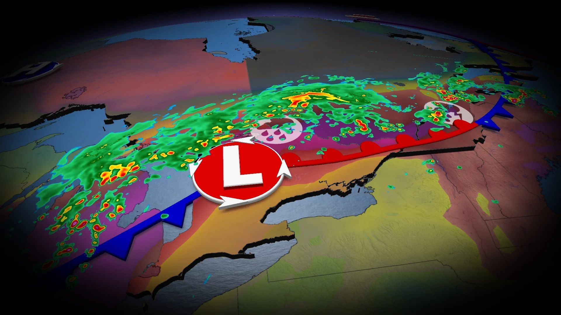
A cold front will serve as the spark needed for widespread thunderstorm development heading through the day Sunday. Storms will be possible just about anywhere from Windsor, Ont., to areas southwest of Rimouski, Que.
DON'T MISS: Texas storms triggered a ‘large and deadly flood wave’
However, we’re watching two areas for the potential for severe weather for locales in between the aforementioned cities. The at-risk zones include along the Lake Huron and southern Georgian Bay shores and another that stretches from eastern Ontario to southern Quebec.
Keep an eye on the radar as you go about your day and pay attention to watches and warnings in your area.
Severe storm risk builds in two regions
Anyone who’s stepped outside this weekend has felt the warmth and mugginess parked across the region. The humid air mass will provide ample instability to any thunderstorms that form.

The cold front will arrive across the shores of Lake Huron and Georgian Bay around the evening period, bringing the risk for severe storms to cottage country and the shorelines. The main concern here will be localized flooding, as well as the risk for large hail and strong wind gusts.
Storms are likely to dissipate as they move farther into southern Ontario off Lake Huron, later in the evening as we lose sunlight.

A much more potent setup will build in eastern Ontario and southern Quebec, where a warm front will provide a boost and focus for strong to severe thunderstorms to develop.
WATCH: How likely are thunderstorms in Ontario Sunday?
The best storm chance will likely be for locales east of Montreal, heading into Quebec City, where stronger dynamics will be established in the early afternoon. Areas from the Nickel Belt to Ottawa Valley could see strongest storms as the centre of the low passes over in the mid-afternoon period.
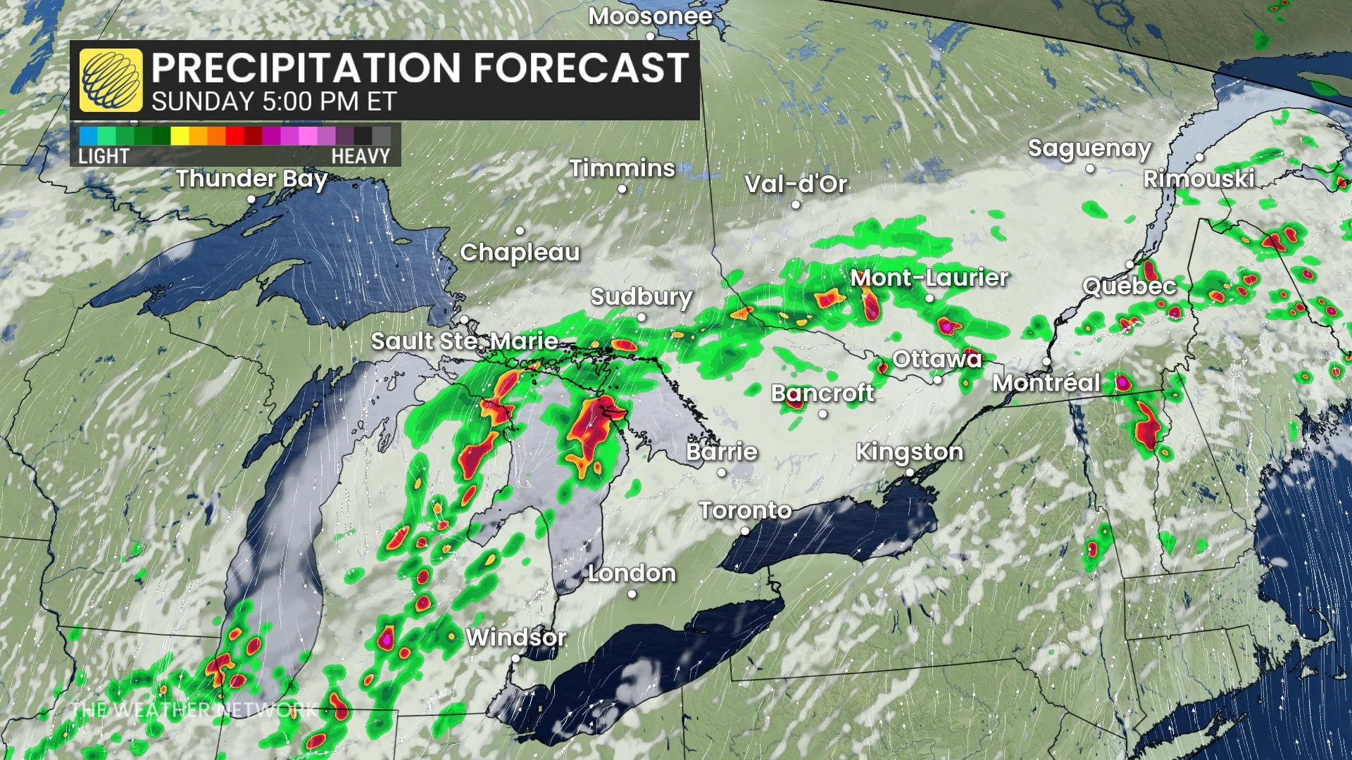
Storms here are expected to develop in the afternoon and stretch into the evening hours, with the start time a bit later for locales along the St. Lawrence River.
The main risk will be damaging wind gusts of 110 km/h and nickel-sized hail. However, rotation and tornadoes can’t be ruled out in southern Quebec. Localized flooding will be a greater threat due to the rich reserve of moisture available for storms to tap into.
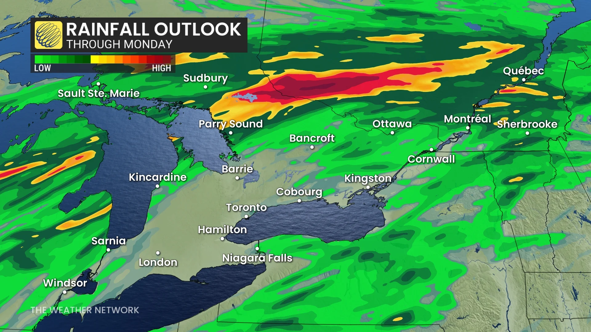
The storms will ease through the late evening and overnight, but widespread rain continues for parts of cottage country, east of Georgian Bay, as well as southwestern Quebec.
Storm potential bubbles up again on Monday, with tornadic opportunity in southern Quebec
On Monday, the thunderstorm threat will reappear and shift in Central Canada, with a focus on southern Quebec again for tornadic potential.
The chance of thunderstorms will stretch from the Windsor-London corridor to the Eastern Townships in Quebec.
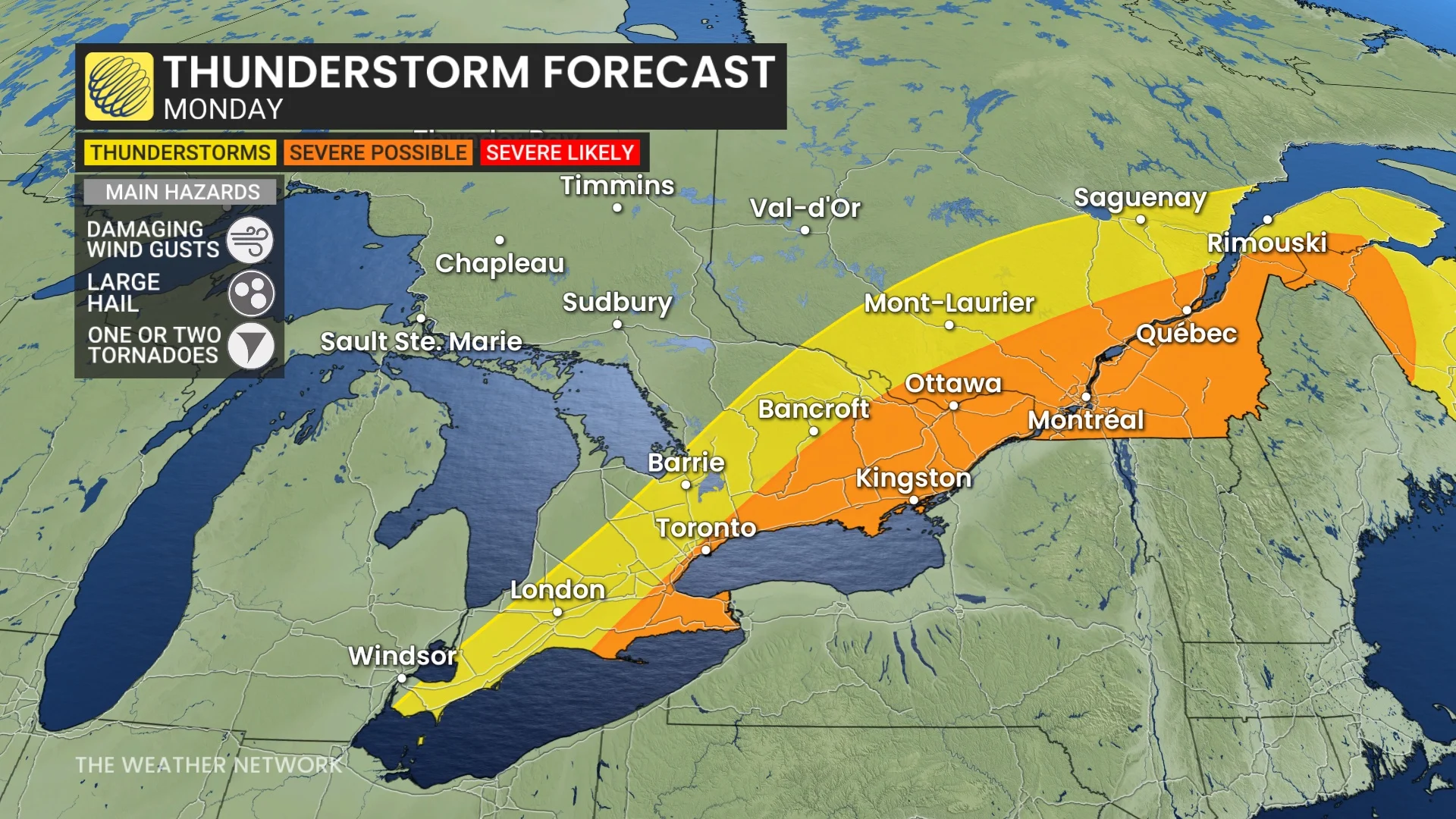
The severe risk will span an area from the Lake Erie and Lake Ontario shores, including the Niagara region and the Greater Toronto Area (GTA), to the Eastern Townships.
A tornado risk will once again surface southern Quebec on Monday, with conditions supporting rotating storms in the region.
Be sure to check back for all the latest forecast information in your area.