Stormy weekend ahead for Ontario with hail, heavy rain and damaging winds
Thunderstorms are expected to intensify across Ontario this weekend, with the northeast having the highest risk, and the potential for rotating storms on Saturday
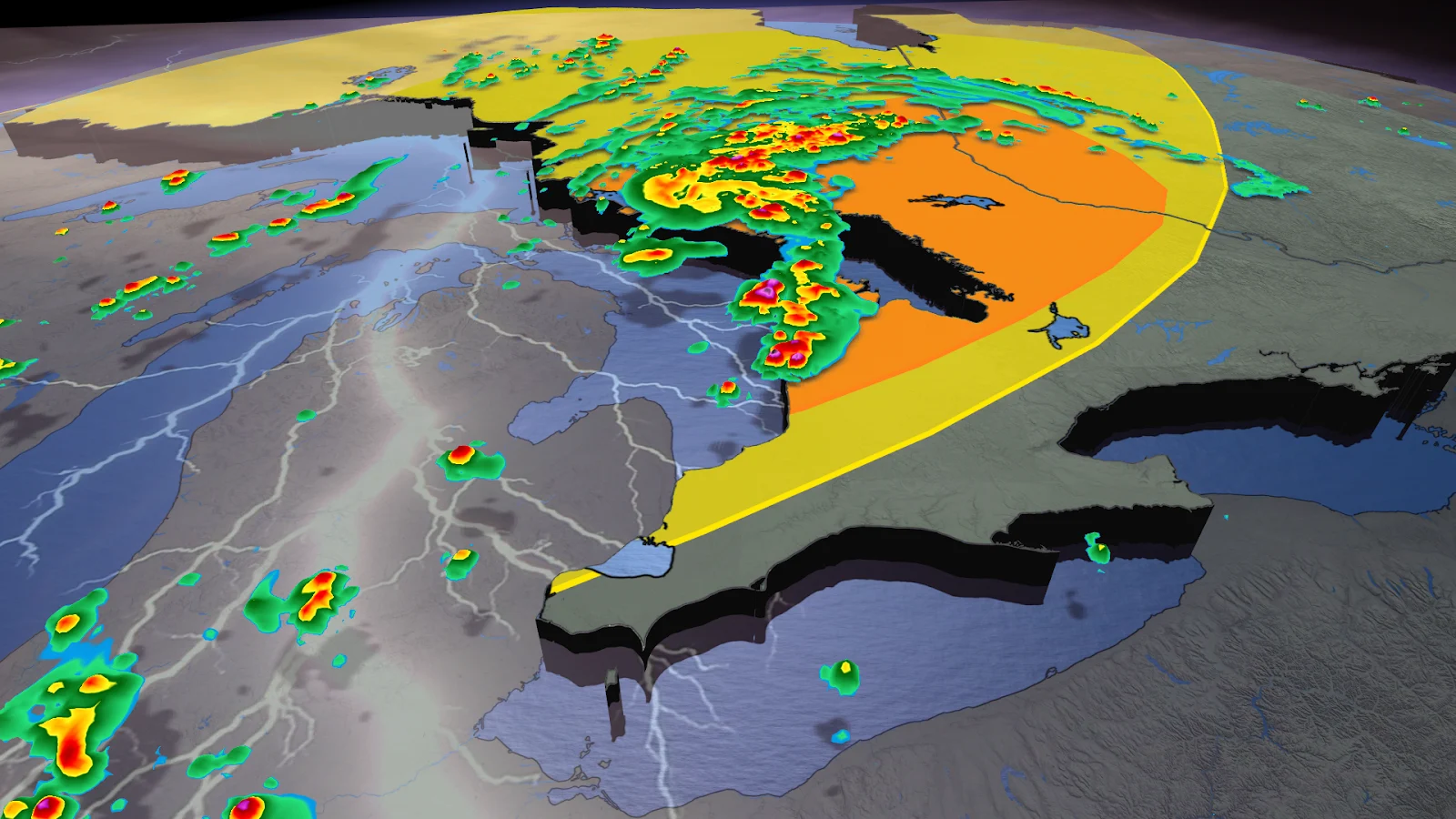
The stormy pattern in Ontario isn't about to stop anytime soon.
After a few isolated storms Friday, the weekend is expected to be much more active, with severe thunderstorms possible from the southwest to the northeast.
A warm, moisture-rich air mass will remain over the province, creating favourable conditions for hail, damaging wind gusts, and torrential downpours—particularly by Saturday afternoon.
Make sure you keep an eye on the radar—especially if you have outdoor plans—and stay aware of any severe weather watches or warnings issued in your area.
Friday is the start of a 3-day stretch of thunderstorms in parts of southern Ontario
Southern Ontario is gearing up for unsettled weather, with thunderstorms expected to develop Friday and linger through the weekend. The risk begins Friday afternoon, with the potential for stronger storms near Windsor and Sarnia, particularly close to the Michigan border.
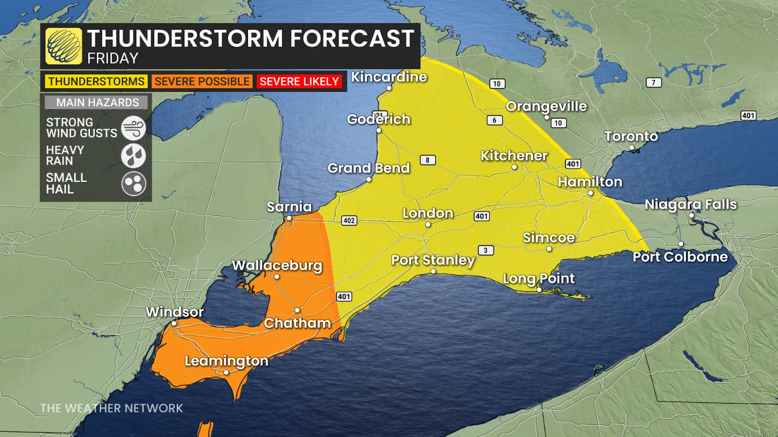
Winds will be a key concern, as strong gusts could accompany these storms. There’s also a chance for small hail in some areas. Thunderstorm activity may extend toward London and the western edge of the Greater Toronto Area (GTA), however, these storms are expected to remain weaker.
CHECK OUT: Struggling with slow internet? Hot weather could be to blame
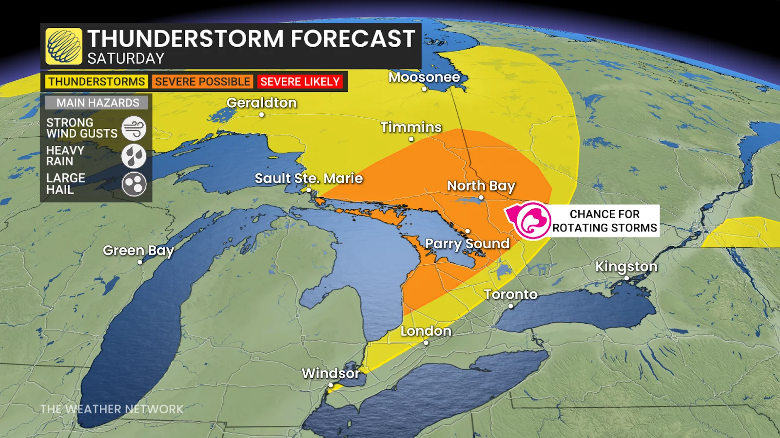
Northeastern Ontario faces highest risk Saturday
The focus shifts north Saturday as a low pressure system moves in, bringing rain and storms to northeastern Ontario, along with the shores of Georgian Bay and Lake Huron.
By the afternoon, conditions could become severe from Sudbury to North Bay, with forecasters keeping an eye out for rotating storms.
MUST SEE: Here's what summer driving can do to your skin
Storms are also expected to develop inland from Grand Bend through Kincardine to Parry Sound by late afternoon.
The main risks include hail over two centimetres, wind gusts exceeding 90 km/h and 30 to 50 mm of rain, all of which could disrupt local travel and outdoor plans.
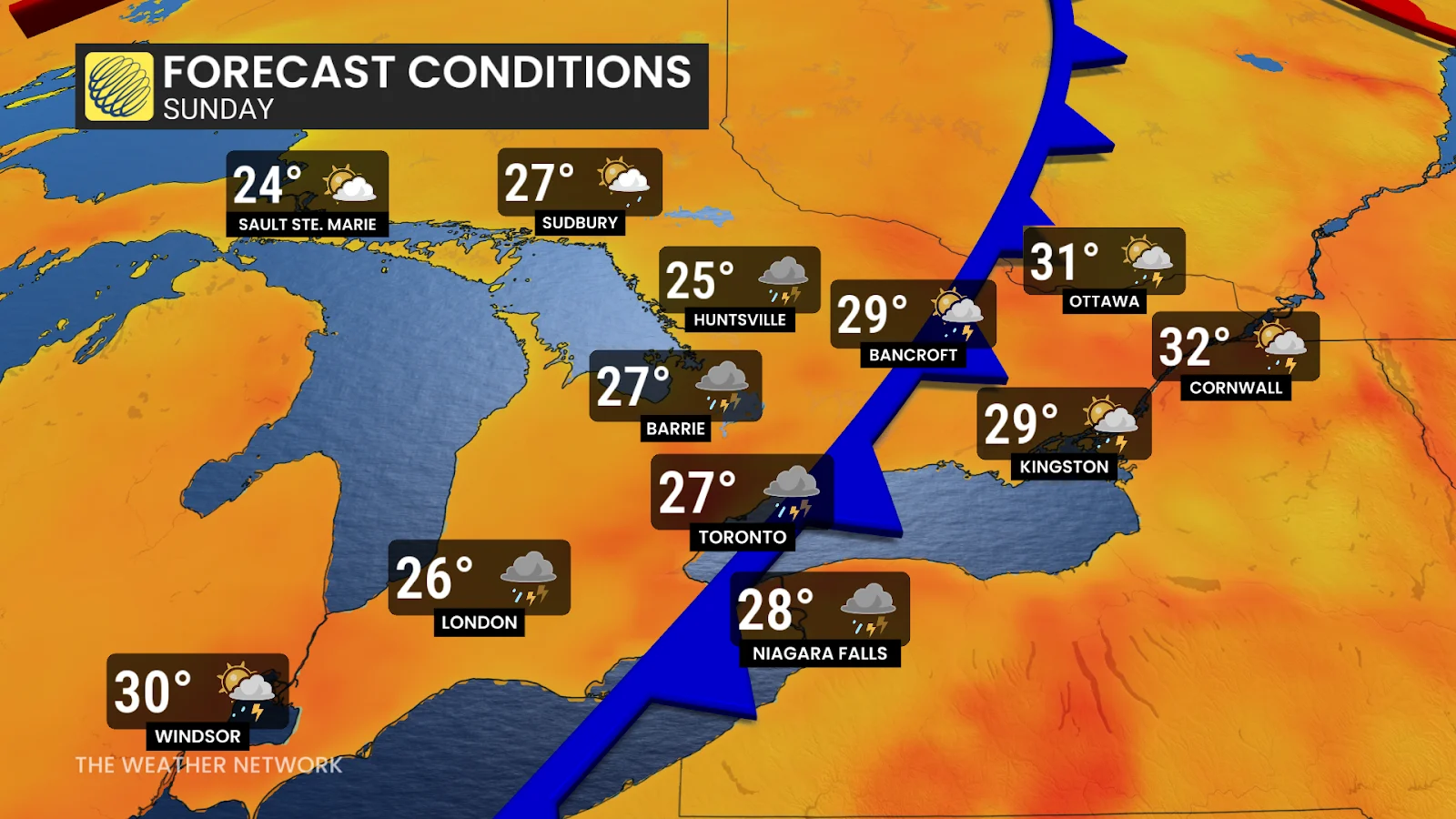
Storm risk spreads south into Sunday
Storms are expected to weaken as the system moves south Saturday night, toward the GTA.
However, that's not the end of the action; on Sunday, a new round of thunderstorms could form inland and move into eastern Ontario and the GTA.
SEE ALSO: Let's get to know Canada's wildflowers
The risk of severe weather continues into Sunday evening, driven by high humidity and unstable air. While exact timing may change, the pattern suggests that more unsettled and muggy conditions will persist through the weekend.
Be sure to check back for the latest weather updates across Ontario.