
Strong U.S. storm threatens snow, difficult Monday travel in Quebec
A U.S. winter storm is set to bring some snow to southern Quebec early next week, driven by Arctic air and Gulf moisture fueling the system
A massive U.S. winter storm is being closely watched as it could bring significant impacts to parts of Ontario, Quebec, and Atlantic Canada through Monday.
DON'T MISS: Extreme cold targets Canada as the polar vortex buckles
A frigid Arctic air mass in Eastern Canada is colliding with warm, moist air from the Gulf of Mexico, forming a boundary that is producing heavy snow and ice from Texas to the East Coast.

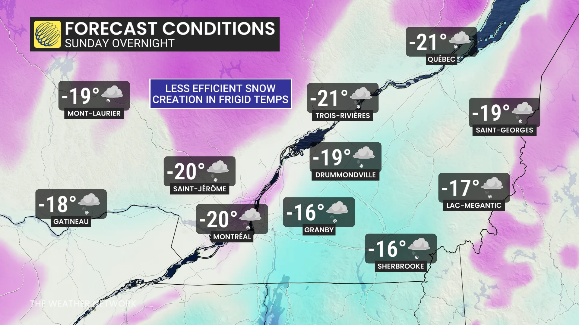
Two lows tracking toward Canada are creating a complex setup, leading to some forecast uncertainty, particularly in Quebec. Initially, frigid temperatures near -20°C could result in lighter snow due to the reduced moisture capacity of extremely cold air, which produces smaller snowflakes.
However, snowfall rates may increase overnight Sunday into Monday as temperatures "warm" to the minus teens, allowing for more efficient snowflake formation. Currently, snowfall totals of 5-15 cm are possible in southern Quebec, while parts of Ontario and the Maritimes could see 20-30+ cm.
Dangerously low temperatures across southern Quebec this weekend, snow moves in Sunday
Frigid Arctic air will sweep across Quebec this weekend, bringing daytime highs near -20°C and overnight lows around -30 with the windchill. Montreal is forecast to hit a high of -21°C on Saturday, a rare occurrence last seen on January 2, 2014.
A strong U.S. storm will track northeast into southern Quebec on Sunday.
DON'T MISS: A winter storm’s track can make or break your forecast
The snowy northern edge of the system will arrive Sunday evening. Initially colder temperatures may limit snowfall totals, with 5-15 cm expected.
RELATED: When is the cold too cold? How extreme cold warnings are issued
Despite these amounts, heavy snow and blowing snow could lead to very difficult travel conditions and a challenging Monday morning commute.
