
Swirling storm system near Alaska breaks summer rules

How does a weather system 1,500 kilometres wide just…stop moving? A look at an unusual pattern developing across the Gulf of Alaska this week, and the impacts expected across Western Canada.
It looks like something pulled from an October 2024 satellite loop, featuring a vast pinwheel of cloud enveloping the Gulf of Alaska.
But this isn’t fall. It’s late July, and what you’re seeing is a rare, cut-off low that isn’t budging.
SEE ALSO: ACHOO! The science behind the solar sneeze
A spinning low that acts like October

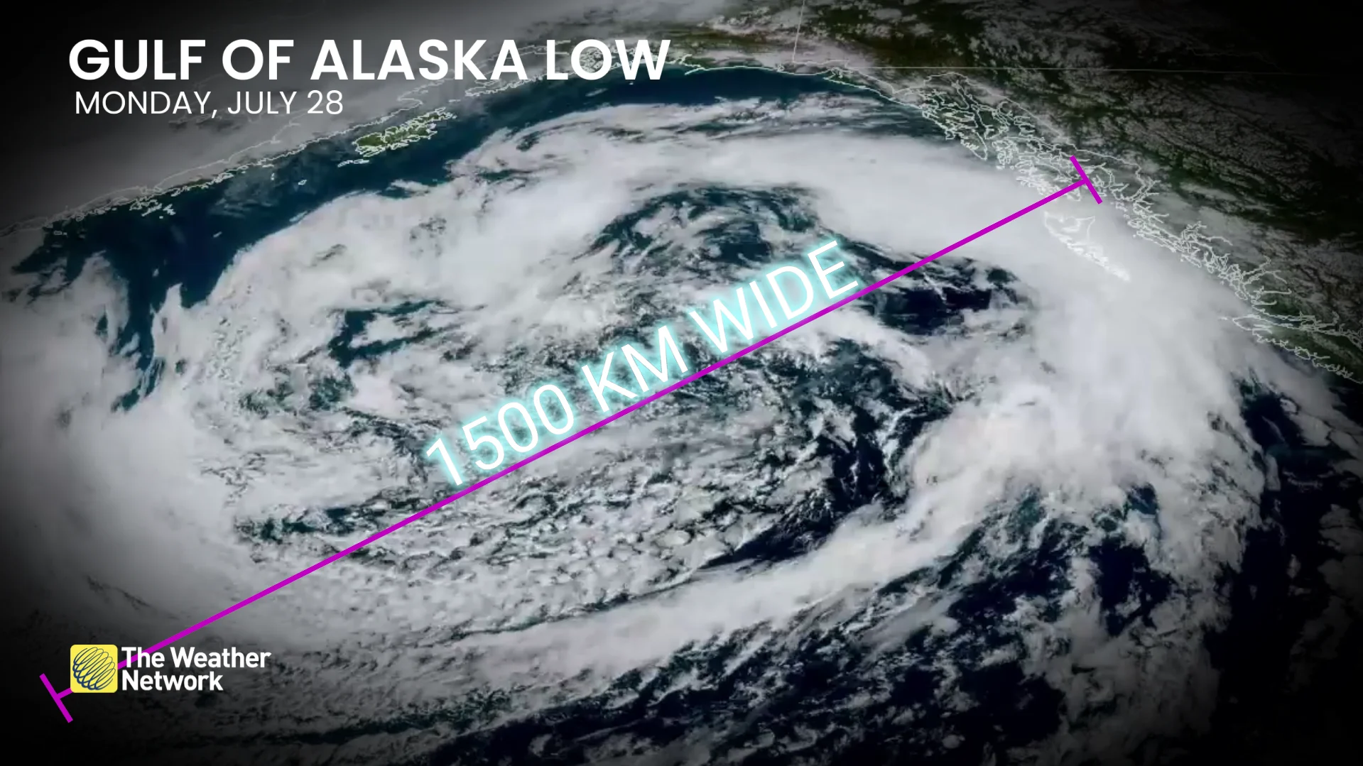
Gulf of Alaska low satellite imagery Monday, July 28. (NOAA)
The stubborn, upper-level trough, now more than 1,500 kilometres in diameter, first gathered steam near the Chukchi Sea last week before diving into the Gulf on Saturday.
Now it’s locked in place, isolated and swirling. We can refer to these systems as cut off from the upper-level flow. On Monday, it sat nearly three standard deviations below normal in the upper atmosphere. That’s meteorological jargon for highly unusual.
Gulf of Alaska low satellite imagery Monday, July 28. (NOAA)
What trapped the trough?
How does a weather system 1,500 kilometres wide just…stop moving?
This system is effectively boxed in. One ridge anchors across Western Canada, delivering another blast of hot weather. Another ridge looms over the Bering Sea. The result is a textbook, atmospheric traffic jam.

An Omega block is nature’s version of a traffic jam, and this one has stalled over the North Pacific.
High above, the jet stream has fractured, or rather split, allowing this cut-off system to swirl in isolation. It’s far from a blockbuster storm at the surface, but aloft, it’s a rare and unusual pattern shaping the weather across North America.
Plus, it’s just beautiful to look at.
B.C. and other Canadian impacts?
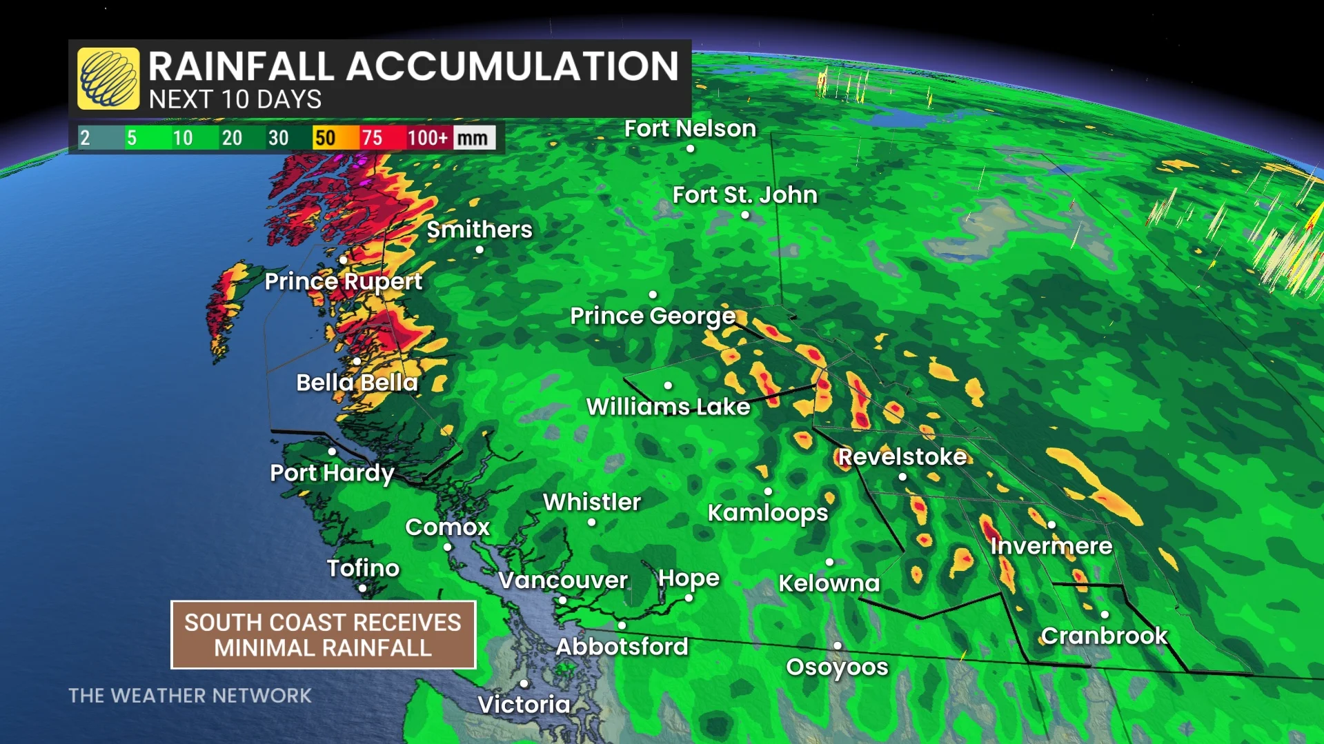
While northern sections of the B.C. coast will deal with clouds and showers, the Interior and South Coast stay well protected by a blossoming ridge peaking midweek.
The trough isn’t just stuck. It’s part of the reason Western Canada is experiencing a significant warm-up this week. Like a gear in a larger machine, it’s actively amplifying the downstream ridge, reinforcing the heat that is forecast to spread as far north as the Northwest Territories.

The stalled nature of the low-pressure system allows the downstream ridge to expand vertically, resulting in several consecutive days of temperatures nearly 10°C above seasonal.
The slow exit begins
By next weekend, the trough will finally begin to push inland after spending an entire week occupying the Gulf of Alaska, finally breaking the heat’s grip with cooler air and much-needed periods of rain across portions of B.C.
It may look like October, but this stalled July system is rewriting the summer script.