
Spring rewind for Atlantic Canada as April-like weather returns
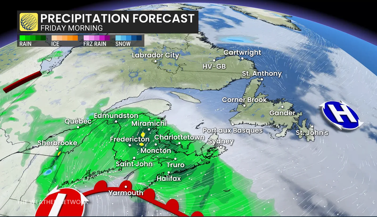
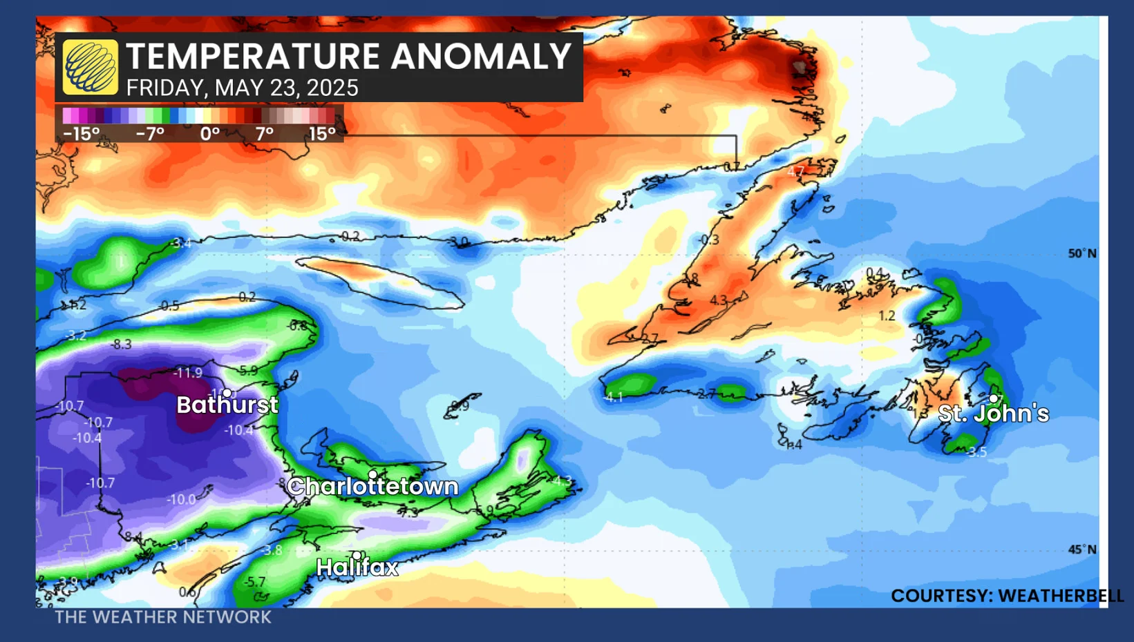
Atlantic Canada will take a step backwards into April territory on Friday with cool temperatures and a bout of rainfall, with some areas feeling the coldest late-May daytime highs in years
With Ontario staring down several days of rainy, chilly weather that reflects more of the end of 2024 than late May, parts of Atlantic Canada will be on deck to face the same kind of gloomy conditions.
SEE ALSO: As climate change worries grow, St. John's plans for future big storms
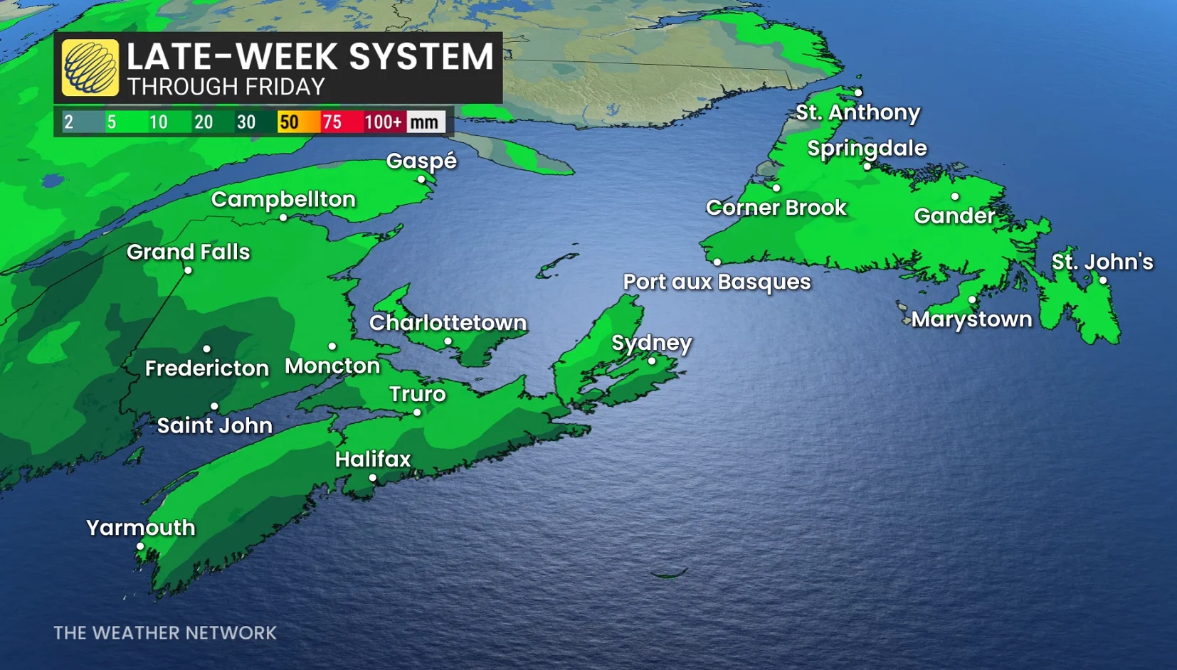
A soaker of a front is forecast to move across the Maritimes on Friday, bringing some unusually cold temperatures with it.
April-like chill comes to the East Coast with soaking rains
It’ll be so chilly that even a few snowflakes could mix in with the rain across northern New Brunswick by the time late week rolls around.
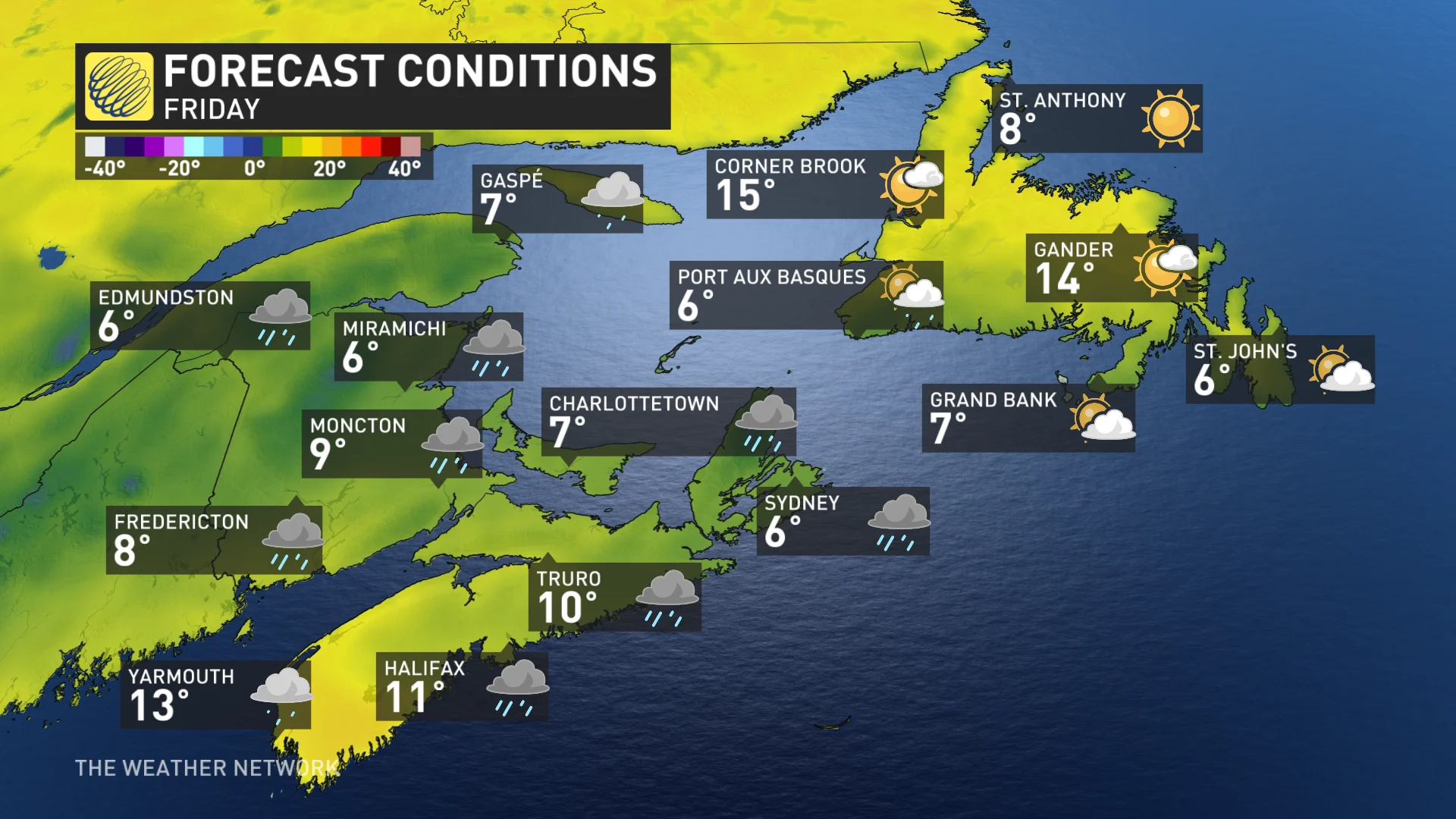
Forecast highs at a glance for the Maritimes on May 23:
Miramichi
Friday: 7°C
Bathurst
Friday: 7°C
Moncton
Friday: 9°C
Charlottetown
Friday: 9°C
Halifax
Friday: 11°C
Most of these daytime highs will be the coldest since late May in 2023. For Bathurst and Miramichi, their projected temperatures will be the chilliest since late May 2014.
DON'T MISS: Inspirational 102-year-old is cleaning up her B.C. community
Did you Know? Highs in the 8-degree range are typical of early- to mid-April weather in the Maritimes.
Beyond this weekend, fair weather is anticipated for a few days next week with no major systems expected. Temperatures will be cooler than seasonal early in the week, but will then trend much warmer to above seasonal by the middle of and late week.
Thumbnail courtesy of Unsplash.
Stay tuned to The Weather Network for the latest forecast updates for Atlantic Canada.