
Thunderstorm threat hits parts of northern Ontario, risk of heavy Monday rain
Parts of northern Ontario face a thunderstorm threat Monday, with the risk of heavy rain and localized downpours
Northern Ontario can expect clusters of storms and periods of heavy rainfall on Monday as energy moves in from the Prairies and U.S. Northern Plains.
DON'T MISS: The Weather Network's exclusive summer 2025 forecast
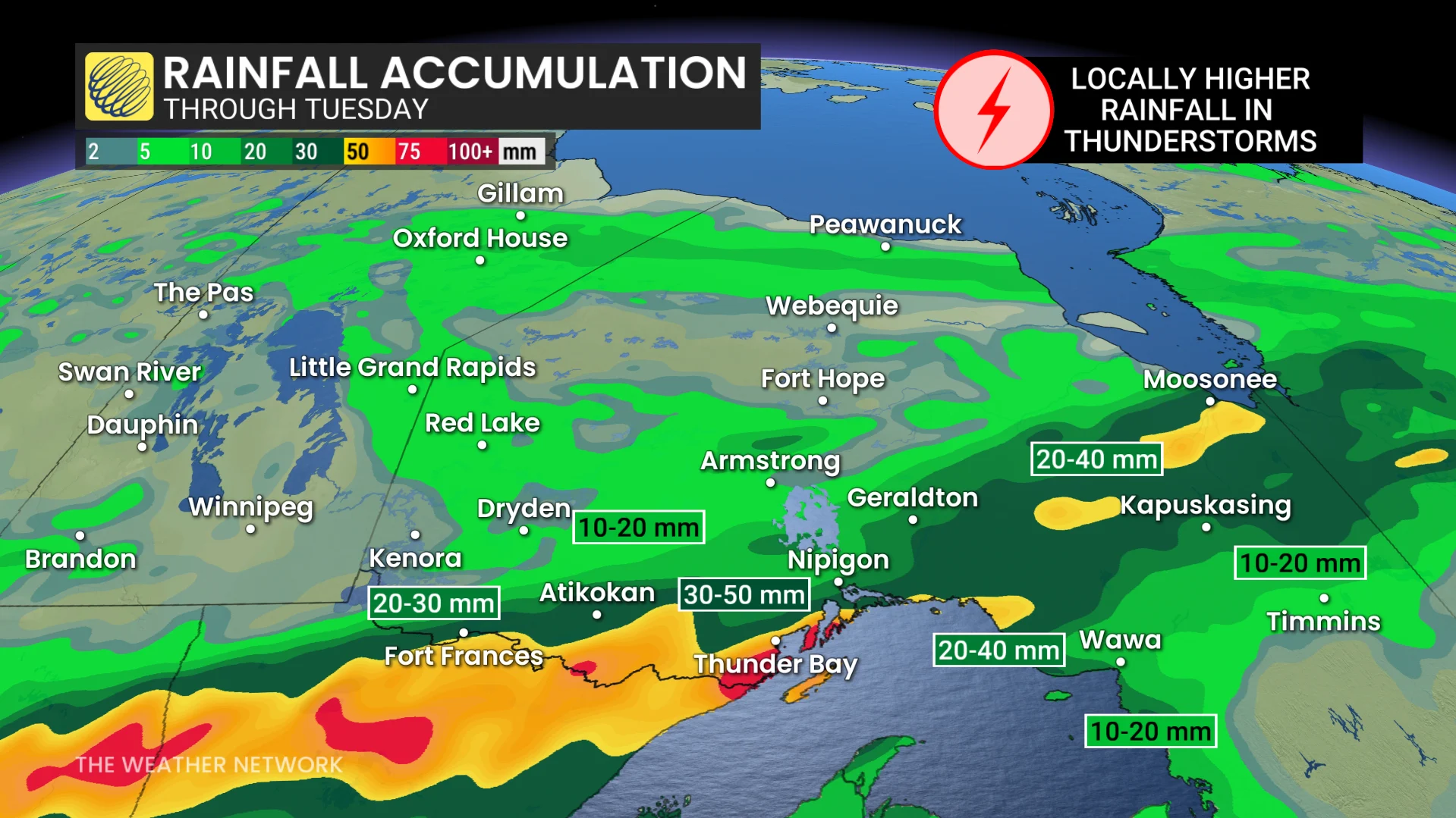
While the strongest storms are likely to remain in Minnesota, localized areas north of the border may see rainfall exceeding 50 mm.
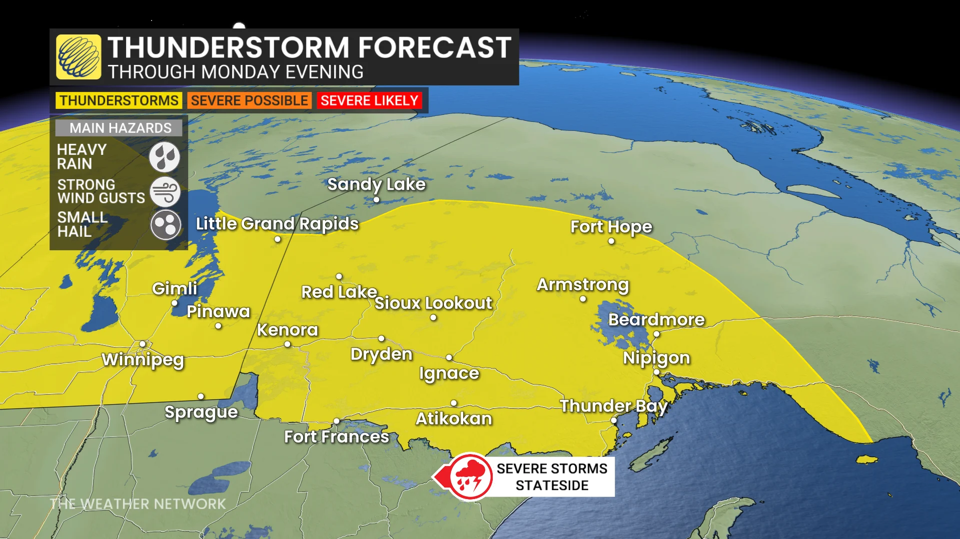
Pay close attention to watches and warnings in your area as isolated severe thunderstorms could bubble up through Monday.
Thunderstorm chances grow through Monday afternoon and evening
Thunderstorm activity is expected to increase by mid-to-late afternoon near Dryden and Kenora. By early evening, clusters of storms will approach the international border.

With significant moisture in the atmosphere—upward of 30 mm of water content—intense rainfall becomes the main weather concern.
Rainfall totals across northwestern Ontario will vary significantly, depending on the exact path and development of these storm clusters.
DON'T MISS: PHOTOS: Funnel clouds sighted in tornado-warned storms in Alberta, Sask.
The situation will remain dynamic into Monday evening, with further updates likely as conditions evolve.
Stay with The Weather Network for all the latest on conditions across northern Ontario.