Heat and hail risk intensify across Alberta into midweek
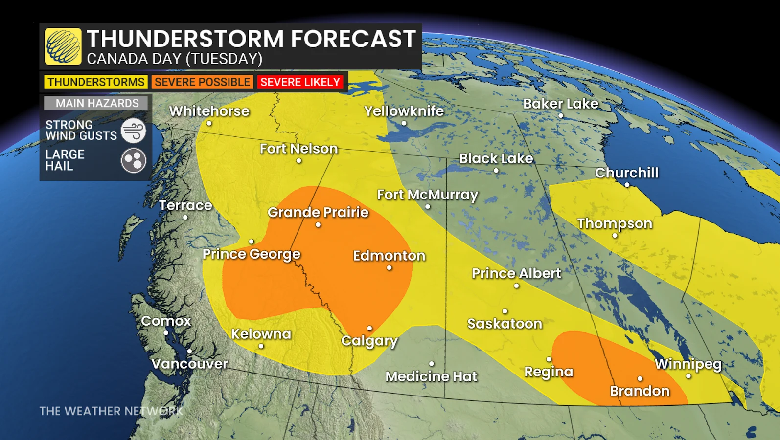
A surge of heat and rising instability has raised the risk of thunderstorms in Alberta, with large hail, strong winds and more widespread severe weather expected by midweek.
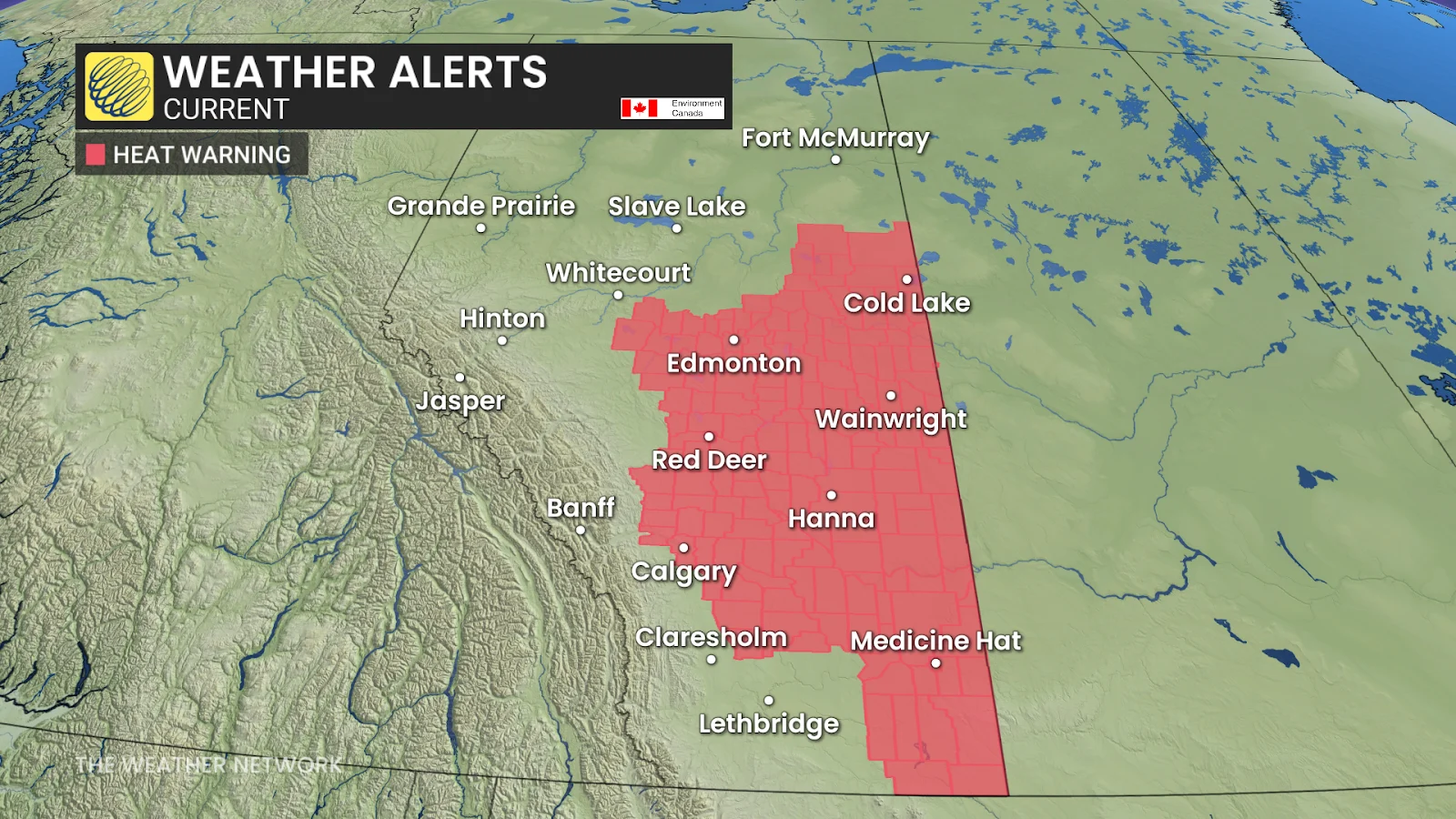
Alberta continues to swelter in rising temperatures as the Canada Day long weekend comes to an end, with heat warnings in effect and isolated thunderstorms building across the province.
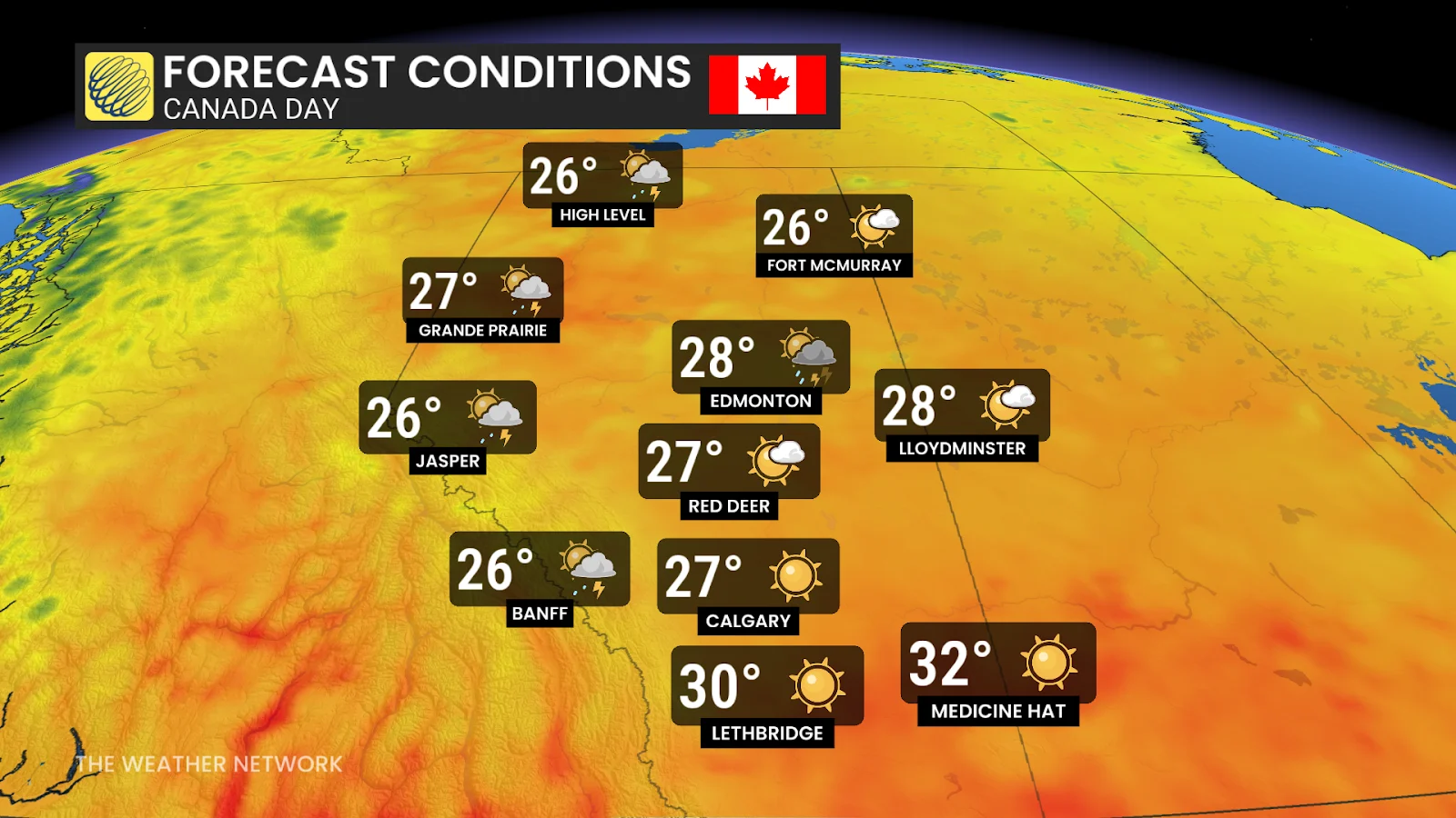
Tuesday brought increased instability, with storms possible from the foothills northeastward into central Alberta, including Calgary, Edmonton and Red Deer.
While many thunderstorms are expected to be mild, some may become severe, bringing strong winds and large hail.
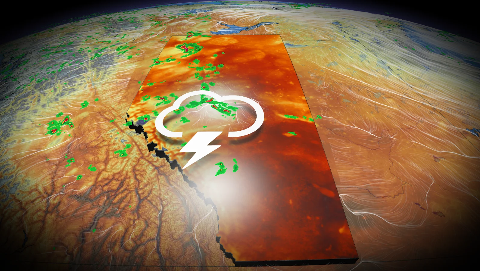
Tuesday: Storm risk extends from the foothills to Edmonton
Storms began to form in the foothills between 1 and 2 p.m. and moved northeast toward Whitecourt and Edmonton by late afternoon.
The greatest risk of thunderstorm activity in Calgary is after 7 p.m., with storm development possible near the Banff region.
The biggest threats are gusty winds and large hail. However, confidence in storm coverage near Calgary remained low as of Tuesday afternoon.
Wednesday: Extreme heat and severe hail threat
Temperatures are expected to peak mid-week, with southern Alberta reaching 5-10°C above seasonal averages on Wednesday.
This next round of heat will combine with even greater instability, renewing the threat of more widespread and potentially severe thunderstorms, including the possibility of very large hail.
The public is advised to monitor weather alerts and be prepared for rapidly changing conditions as Alberta remains under both heat and storm watches through midweek.