Large hail and strong winds: Thunderstorms spreading across Atlantic Canada
Thursday looks to both be a hot and stormy day for parts of Atlantic Canada
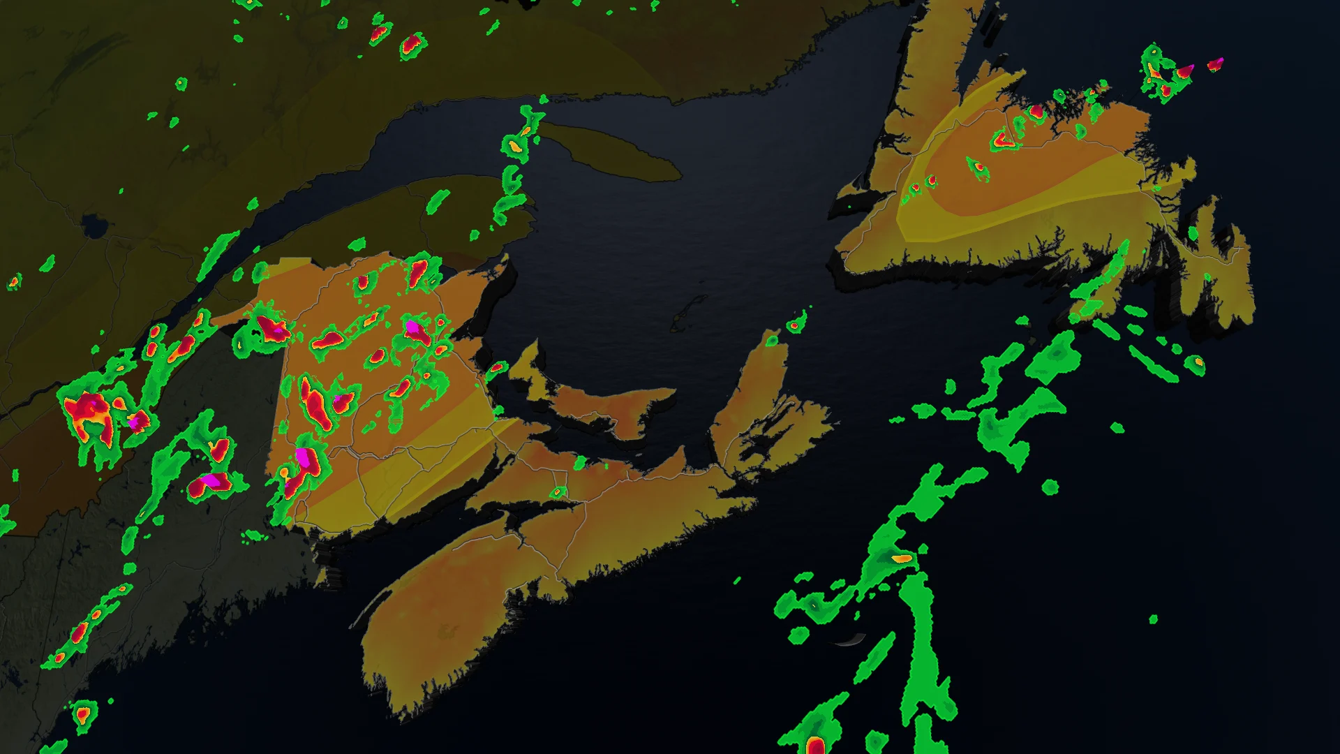
Things are heating up across eastern Canada, and with that comes the risk of some severe thunderstorms Thursday into Friday.
As the day progresses, residents of New Brunswick, Prince Edward Island (PEI), and Newfoundland should brace for a significant weather system that is expected to bring thunderstorms, some of which could become severe.
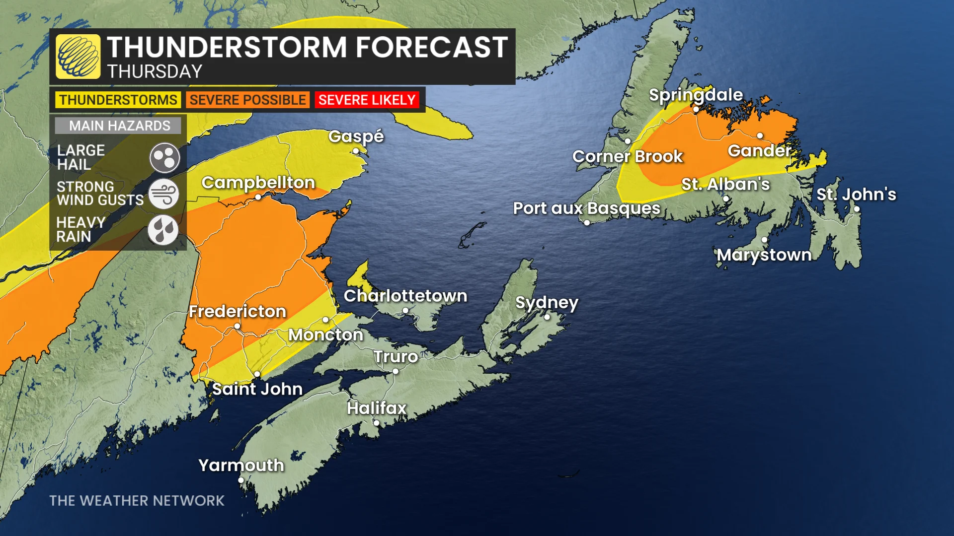
Meteorologists are predicting the development of storms this afternoon, which will continue into the evening hours, posing risks of large hail and strong wind gusts.
DON'T MISS: Canada's July weather outlook
Thursday's weather outlook
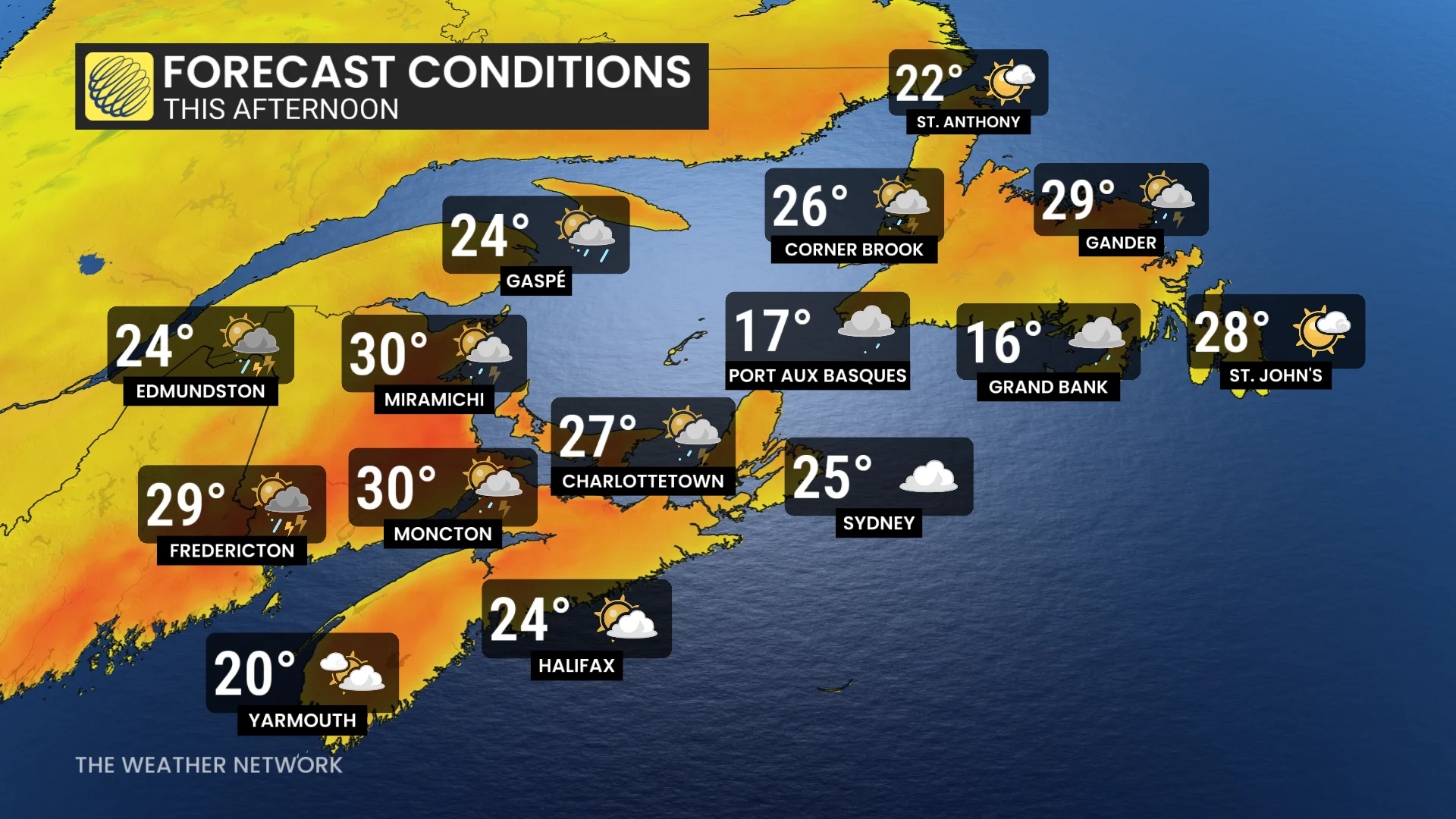
The day starts with heat continuing to blanket New Brunswick and inland Nova Scotia, making it crucial for residents to stay hydrated and take precautions against heat-related illnesses.
RELATED: Hair suddenly standing straight up? Take cover immediately
As the day progresses, the atmosphere will become increasingly unstable, leading to the potential for severe thunderstorms.
New Brunswick and Newfoundland are particularly at risk, with forecasters warning of conditions that could generate large hail and damaging winds.
DON'T MISS: Look up for meteors and more! What's going on in the July night sky?
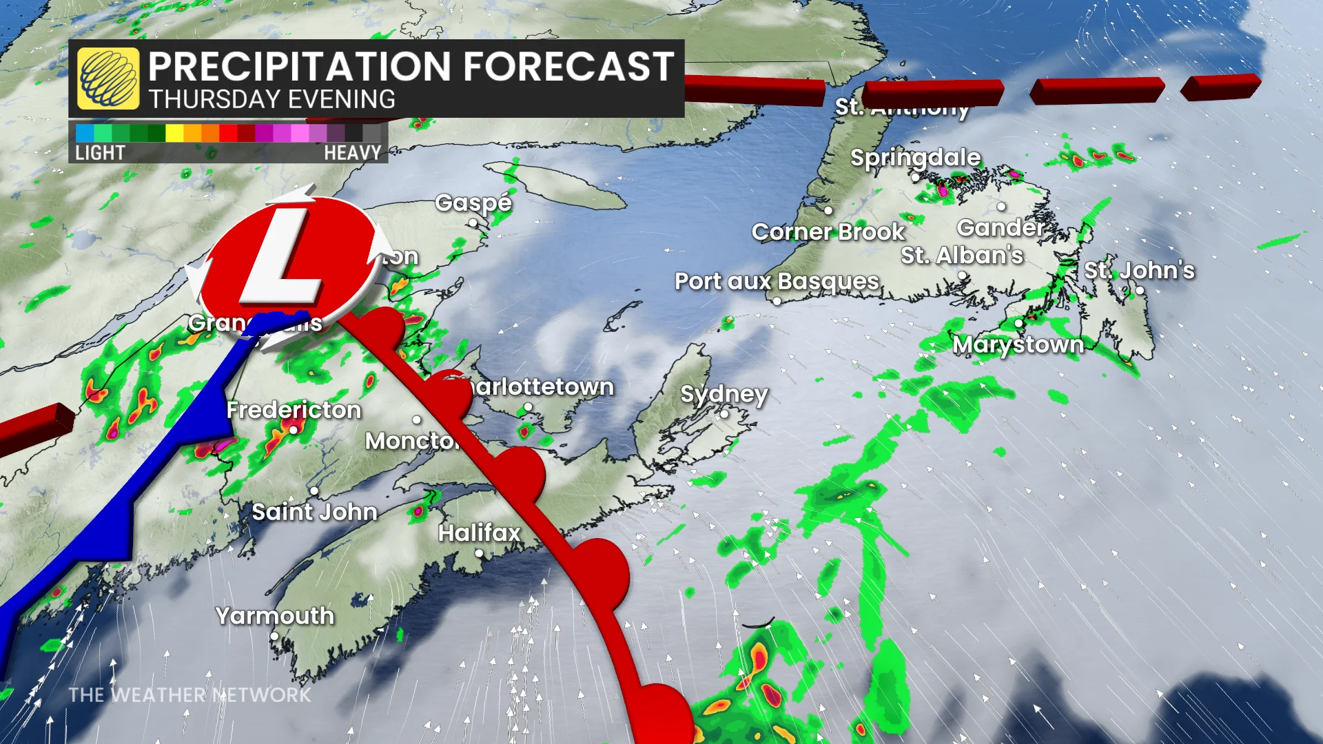
In addition, persistent rain is anticipated to continue from Thursday night into Friday, especially for the Avalon Peninsula, where rainfall amounts of 15-40 mm are possible. This could lead to localized flooding, so residents are urged to remain vigilant and prepare for wet conditions.
Friday's weather transition
As we move into Friday, Atlantic Canada will experience a shift in weather conditions. Cooler temperatures are expected across the region, providing some relief from the heat. However, the risk of scattered thunderstorms remains, particularly in the Maritimes.
RELATED: Don’t make this deadly mistake when waiting out a storm
Thunderstorm safety
As we navigate through these dynamic weather patterns, it is essential to stay informed and prioritize safety. Whether bracing for severe thunderstorms or enjoying cooler temperatures, being prepared can make all the difference.
Below are a few thunderstorm safety tips to keep in mind throughout the summer:
Stay Indoors: If you hear thunder or see lightning, seek shelter indoors. Avoid windows and doors to prevent injury from flying debris.
Unplug Electronics: To protect your devices from power surges, unplug electronics and avoid using corded phones during a storm.
Avoid Flooded Areas: Never attempt to walk or drive through flooded areas, as water depth can be deceptive and currents can be dangerous.
Stay Informed: Keep an eye on local weather updates and alerts. Use a battery-operated weather radio or a reliable weather app for real-time information.
Have an Emergency Kit Ready: Ensure you have supplies such as water, non-perishable food, flashlights, batteries, and a first aid kit in case of power outages.
Stay with The Weather Network for more information and updates on your weather across