Tornado watch issued in northern Ontario as storms develop
Stay alert for severe storms and have a safety plan in place in case of tornado warnings
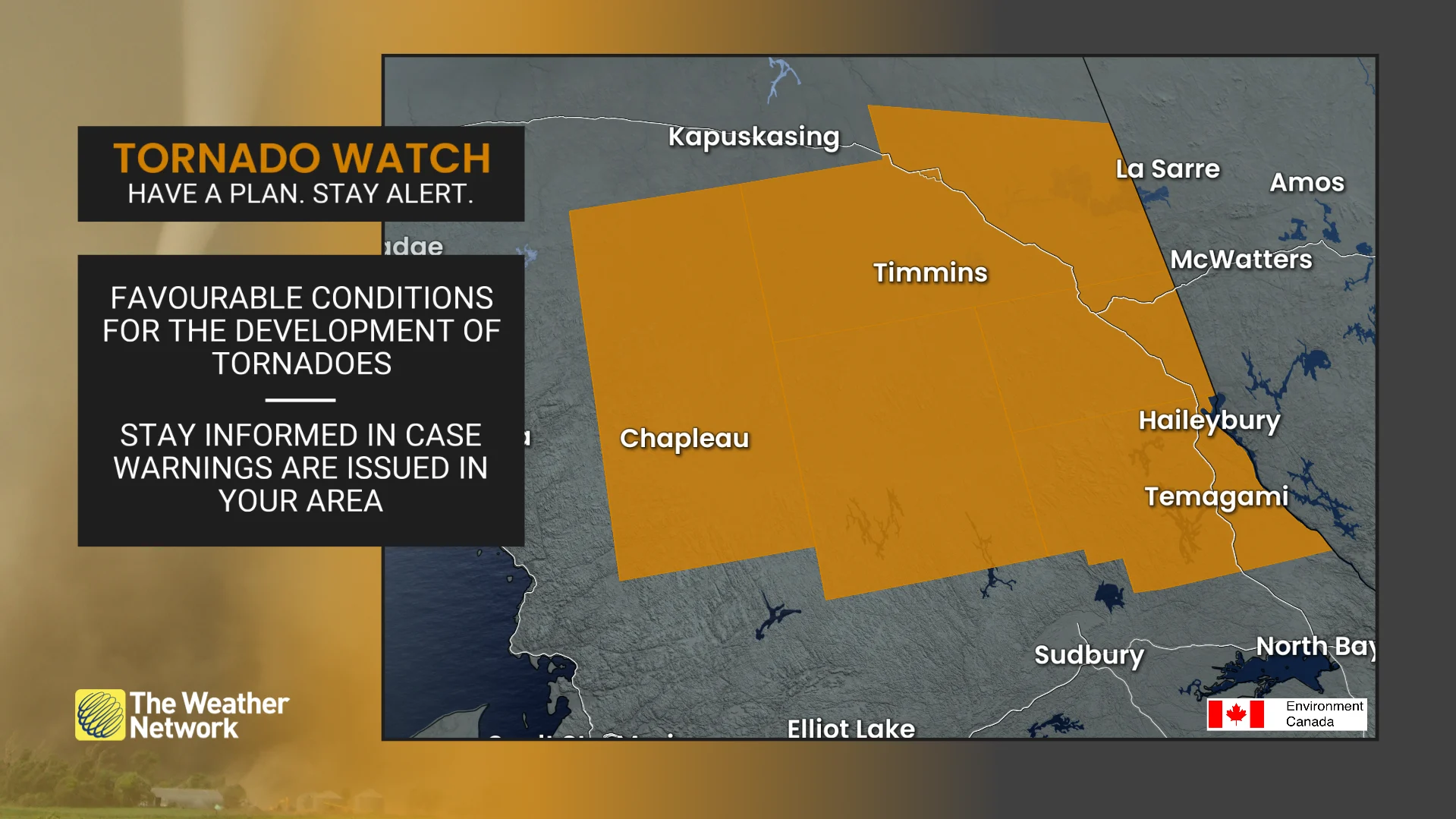
3:21 p.m. EDT - A tornado watch is in effect across portions of northern Ontario amid a severe storm threat on Saturday afternoon. A tornado watch means that conditions are favourable for the development of tornadoes.
Wind gusts to 110 km/h, nickel to toonie sized hail, and heavy rainfall rates are also likely, Environment and Climate Change Canada (ECCC) added in its watch.
Pay close attention to the latest alerts in case the tornado watch is upgraded to a tornado warning in your area. Have a plan in place to seek safe shelter in case severe weather threatens your home, your office, or while you’re driving.
The forecast for northern Ontario continues below.
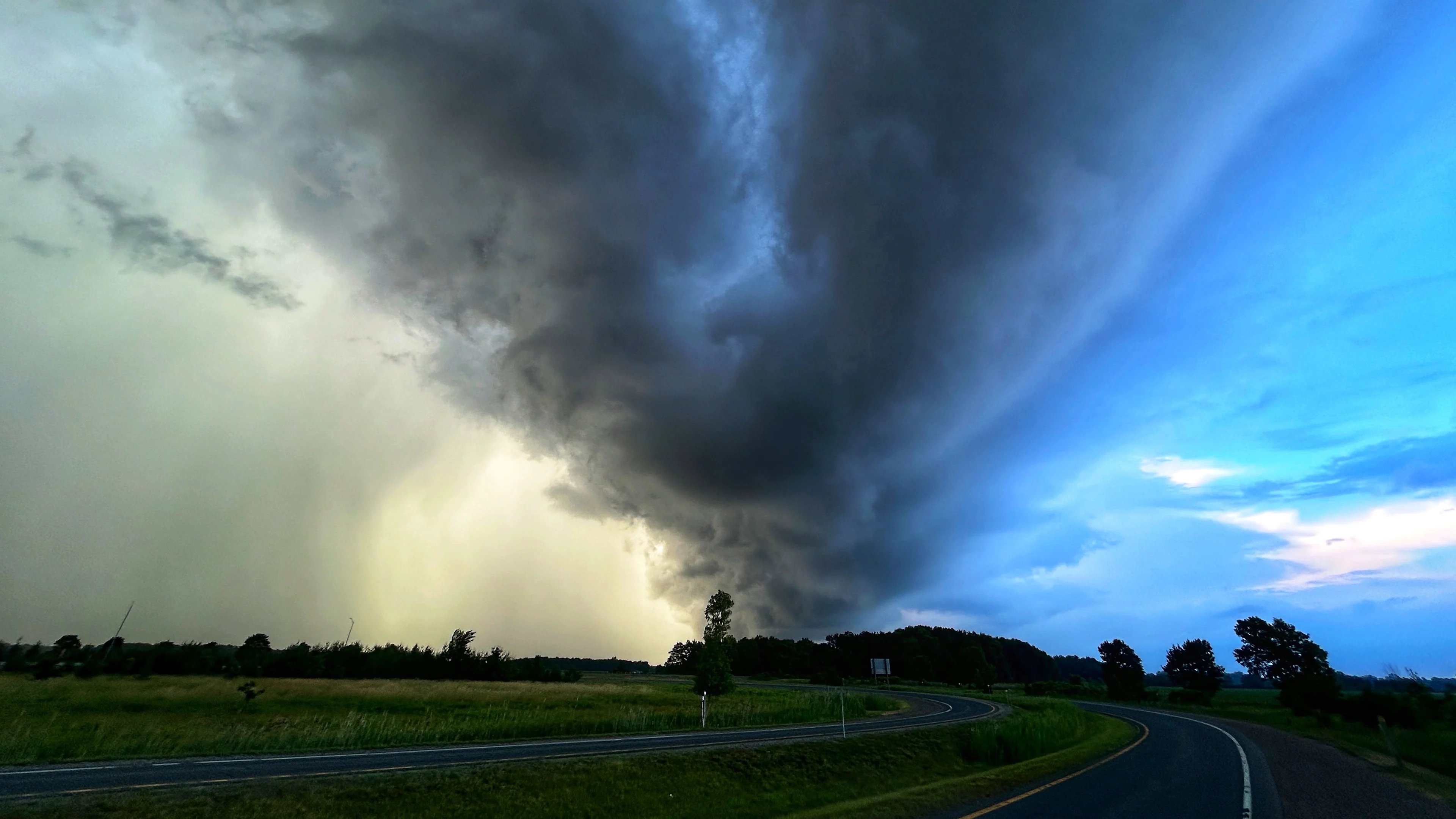
Severe thunderstorms are likely across northern Ontario on Saturday afternoon as a favourable environment drapes across the region.
High instability and ample wind shear will allow thunderstorms to thrive through the afternoon hours, potentially producing one or two tornadoes, as well as large hail, damaging wind gusts, and heavy rainfall.
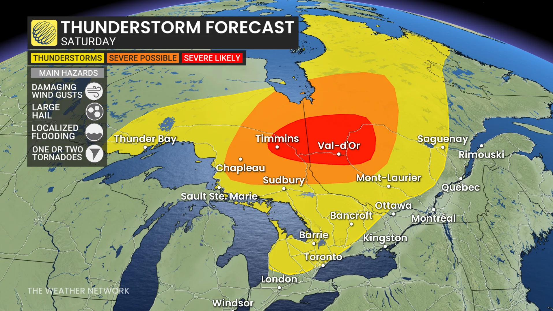
The active weather will continue through Ontario for the remainder of the afternoon, while the risk will grow for northern Quebec heading into Saturday evening.
Make sure you stay aware of severe weather alerts in your area. To turn on severe weather alert notifications for your area, open The Weather Network App and go to settings, and then notifications.
Have a sheltering plan in place for tornado warnings whether you’re at home, at work, or on the road. The goal of tornado safety is to put as many walls and barriers as possible between you and flying debris.
Stay with The Weather Network for the latest on conditions across Ontario.