
Toronto's 270-day heat streak drought is about to end
It’s been a while since we’ve seen such steady warmth on the way for southern Ontario, and this slow pattern flip is setting the stage for the regions first extended taste of summer. But be warned, it could escalate quickly.
It's beginning to feel a lot like summer in Toronto and southern Ontario, with an extended stretch of heat set to arrive shortly after the official start of the season on Friday.
Temperatures in the high 20 and even the low 30s for some, along with high humidity, are forecast for a good portion of the region by Sunday in southern Ontario. In fact, a solid, more than eight-day stretch of 25-degree weather is forecast for Toronto, Ont.
SEE ALSO: What’s the wettest month in your corner of Canada?
That hasn't occurred since September 2024, when the city saw nine days of that weather. Its 270-day heat drought streak is about to end.
The heat will mark a pattern shift for the region for the second half of June, which will feel more like summer, but we will also have frequent threats for showers and thunderstorms.
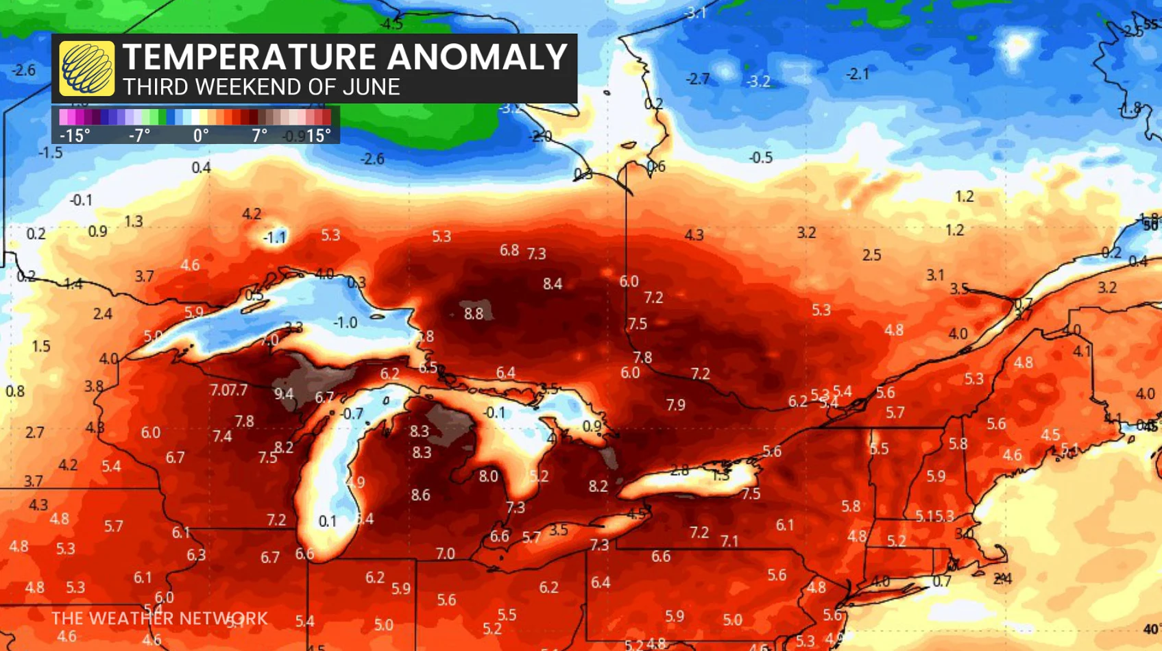
Extended stretch of heat comes to southern Ontario
An amplifying upper ridge is projected to build over the region by late next weekend, lingering through the third week of June, fed downstream by troughing over Western Canada.
That won’t just be a tease of warmth, either, it’ll have a slow ramp-up.

Keep in mind, though, that 30-degree temperatures have been a true rarity this year. Toronto has only recorded just a single day of it on June 4, and there has been no more than two consecutive days above 25°C since September.
It’s been 270 days since we've had at least three days above 25°C, but who’s counting?
Eastern Ontario hasn’t faired much better, with Ottawa just tacking on three consecutive days exceeding 25°C this year (June 6-8).
How hot is too hot?
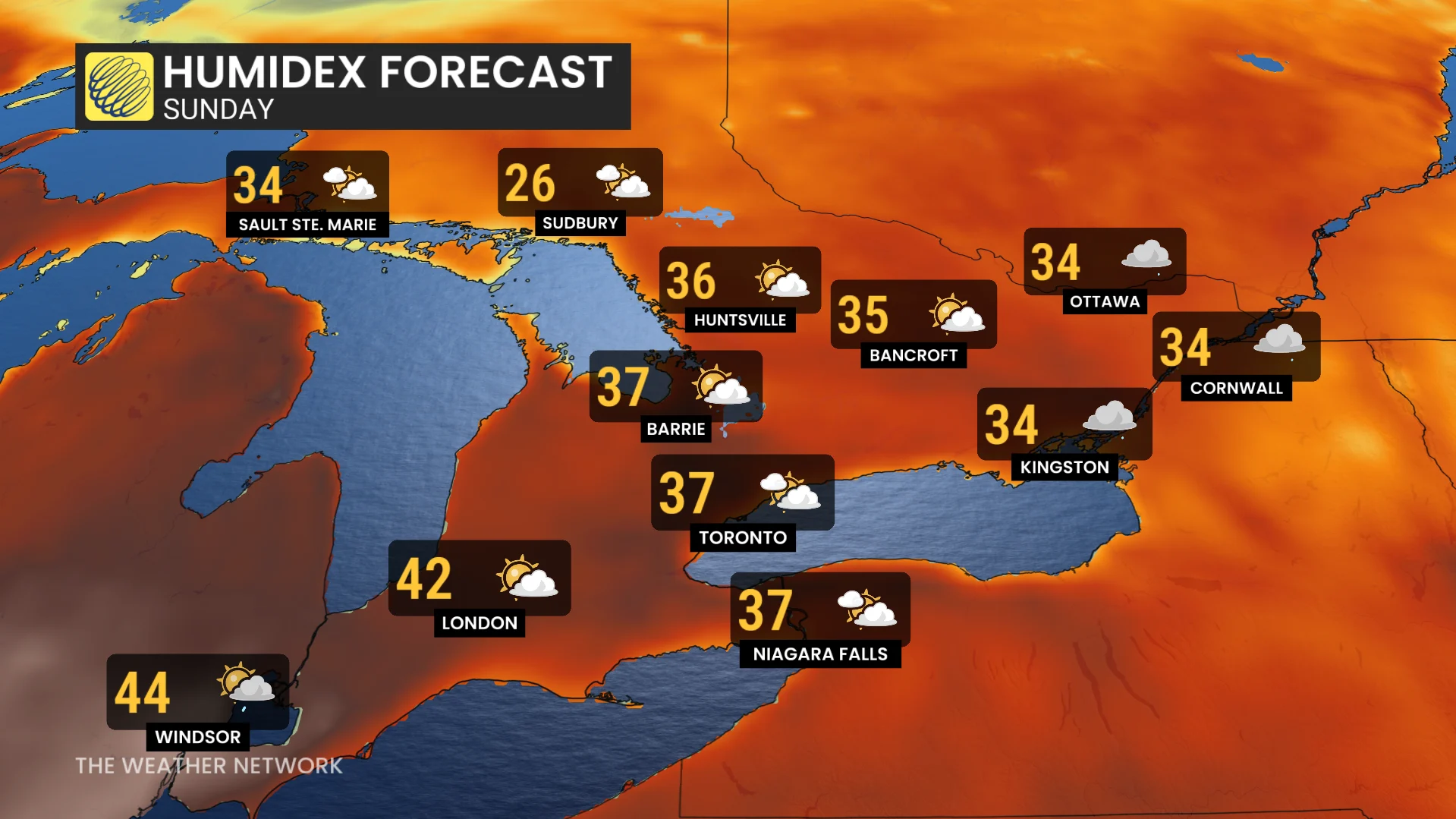
Model support is high for truly hot temperatures to move in by Sunday and Monday (June 22-23), with temperatures surging into the 30s all across southern Ontario, with humidex values pushing above 40 at times.
It’s not just hot. It will be oppressive, especially given the lack of warm-weather experience this year. This kind of heat we’ll need to be vigilant with, making checks on those without air conditioning and the vulnerable populations.
As is often the case with these warm bouts, overnight lows can remain locked into the 20s, meaning there will be limited relief.
However, as we progress through the week, we should have an increasing threat for showers and thunderstorms, which will impact temperatures.
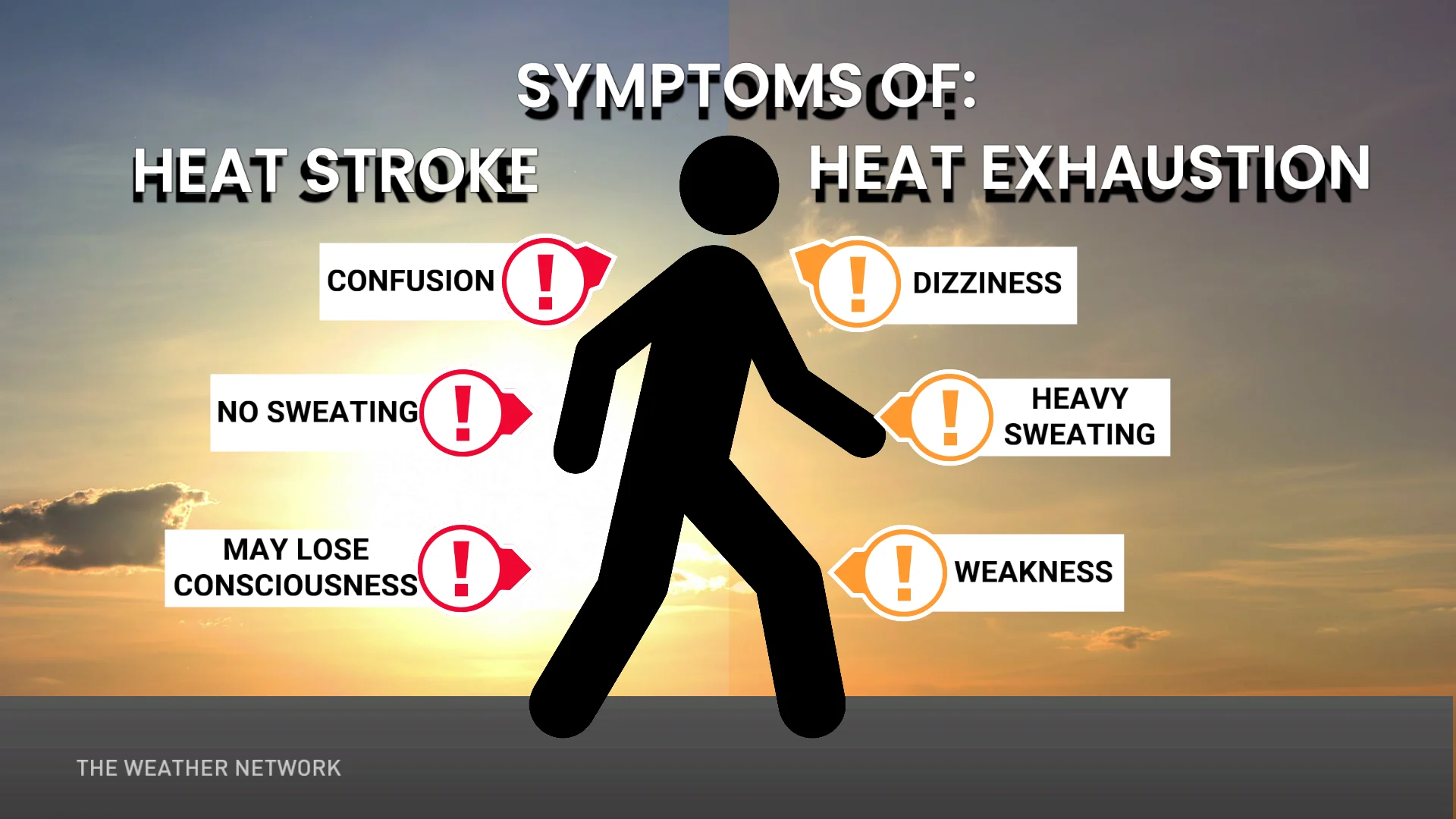
Hot weather safety tips
Drink plenty of water. Avoid caffeine and alcohol, which can be dehydrating.
Avoid direct sunlight, especially during peak hours and when the UV rating is high.
Wear lightweight, loose-fitting clothing.
Use air conditioning when possible. If you do not have access to air conditioning, consider visiting a cooling centre, a shopping centre, or a public library.
Check on elderly relatives and other vulnerable neighbors.
Avoid strenuous activities during the hottest parts of the day.
If you experience symptoms of heat-related illnesses like dizziness, nausea, or confusion, seek medical attention.
WATCH: Car batteries struggle in summer heat, how to reduce the strain
Stay with The Weather Network for all the latest on conditions across Ontario.