Fernand hitting the open waters of the North Atlantic, may throw waves at N.L.
Tropical Storm Fernand nears Bermuda Monday morning, but will likely remain offshore as it moves northward--limiting any impacts to life and land. However, it may send some waves to the Newfoundland coast this week
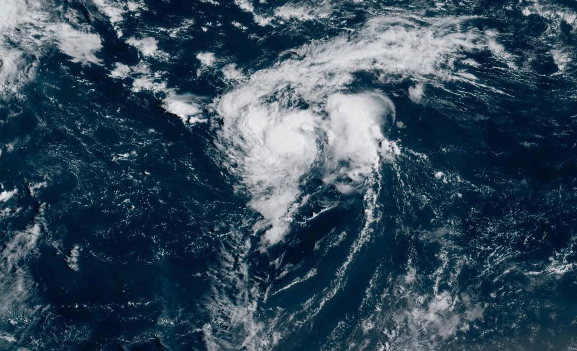
Tropical Storm Fernand formed in the southwestern Atlantic Ocean on Saturday afternoon.
Forecasters expect the storm to strengthen over the next 48 hours before it weakens and moves north, eventually curving out to sea with no significant threats to land.
However, some rough surf could be felt across Newfoundland by the middle of the week, and an area of convection off the Carolinas will pull Fernand north and bring heavy rain to southern areas of the Atlantic provinces by Wednesday.
DON’T MISS: The high-stakes factors that decide where a hurricane tracks
The new storm is another reminder that we’re quickly coming up on the peak of the Atlantic hurricane season.
Fernand forms far from land
The storm formed on Saturday on the heels of former Hurricane Erin, which lost tropical characteristics as it raced into the northern Atlantic Ocean on Friday.
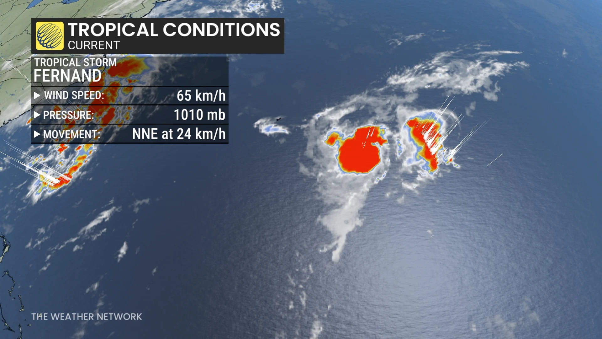
The U.S. National Hurricane Center (NHC) expects Fernand to strengthen over the next 48 hours, but it could fall short of hitting hurricane status. Maximum, sustained winds are near 65 km/h with higher gusts, as of Sunday morning. A weakening trend is expected by Tuesday.
On the forecast track, Fernand should move well east of Bermuda and across the open waters of the subtropical North Atlantic.
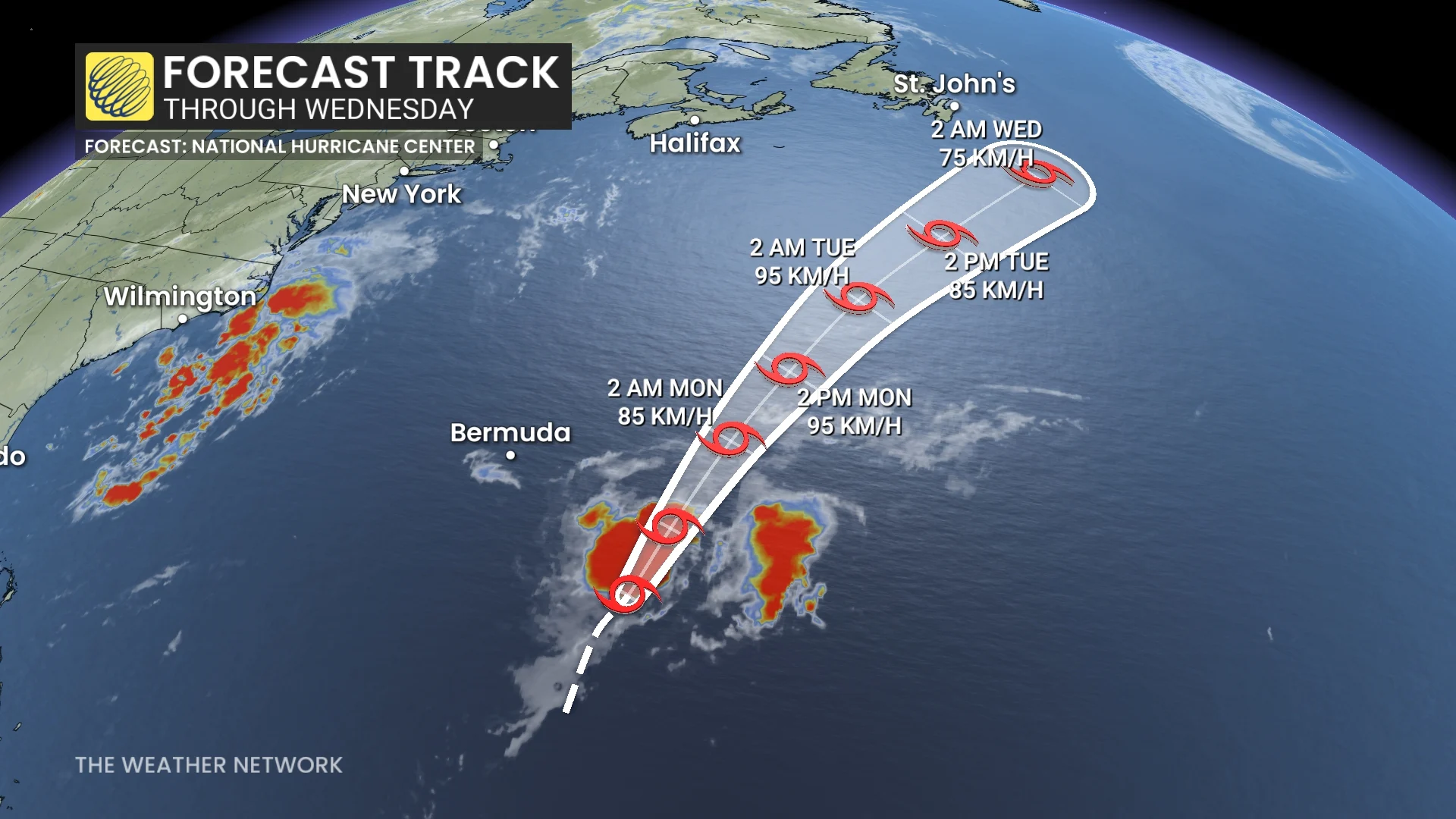
While no major land impacts are expected, Bermuda is on the western extreme of the track on Sunday night and into Monday morning.
However, some rough surf could be felt across Newfoundland by the middle of the week, and an area of convection off the Carolinas will pull Fernand north and bring heavy rain to southern areas of the Atlantic provinces by Wednesday.

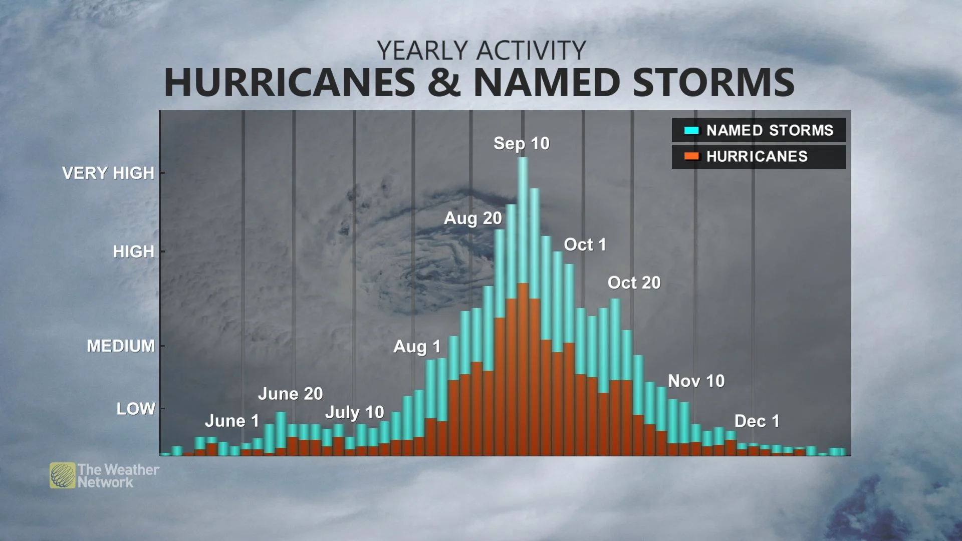
Atlantic hurricane season nearing its peak
We’re quickly approaching the heart of the Atlantic hurricane season, which historically peaks around the second week of September.
Fernand’s formation continues to place us a few steps ahead of the progress of an average season. We normally wouldn’t see the Atlantic’s sixth named storm develop until Aug. 29.
It only takes one storm to make for a bad hurricane season. Folks across Eastern Canada should prepare for hurricanes well before any storms threaten the region.
Ensure you have emergency plans and supplies in place for the duration of the season. Remember that the wind, rain, and tornadoes from landfalling storms can even affect Ontario and Quebec.
Header image created using graphics and imagery from Canva.