
Tropical Storm Wutip sets eyes on China with flooding rains, strong winds
Tropical Storm Wutip becomes the Western Pacific's first named storm of the typhoon season, threatening to bring flooding rains and potent wind gusts to parts of China soon
With eyes focused on the East Pacific hurricane season this week, things are getting more active on the other side of that region with Wutip setting sights on China.
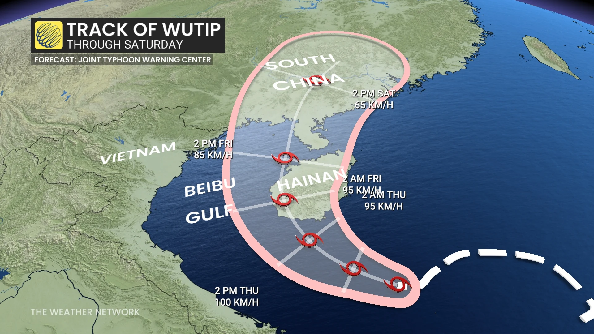
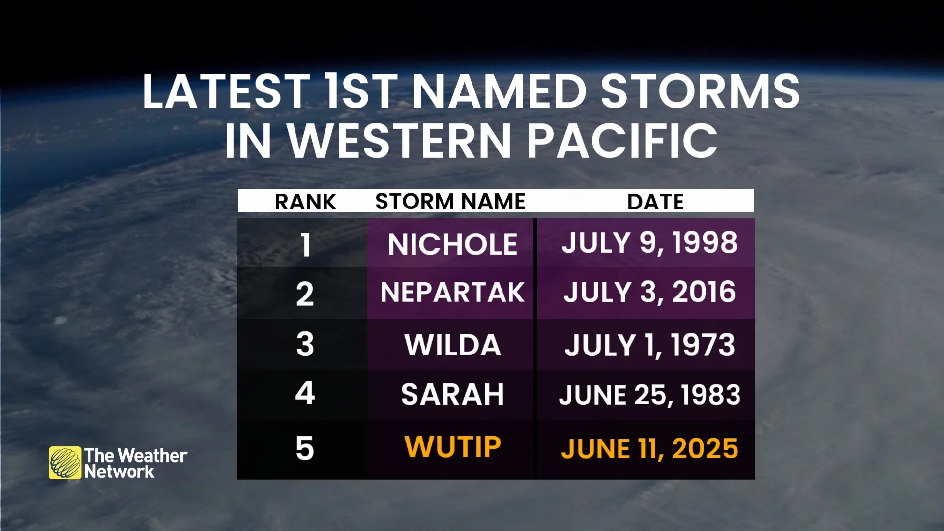
Tropical Storm Wutip, situated at approximately 243 kilometres from Da Nang, Vietnam, is the first named storm of the West Pacific typhoon season--the fifth-latest in the year for an initially named storm in the region.
DON'T MISS: Barbara expected to weaken as eyes shift to the next Pacific disturbance
The only first storms to be named later than Wutip include Nichole on July 9, 1998, Nepartak on July 3, 2016, Wilda on July 1, 1973 and Sarah on June 25, 1983.
Wutip currently boasts maximum wind speeds of 75 km/h, with gusts up to 95 km/h, and is moving west at nine kilometres an hour.
The storm is expected to make landfall on Hianan, China, on Thursday and then move onto the mainland.
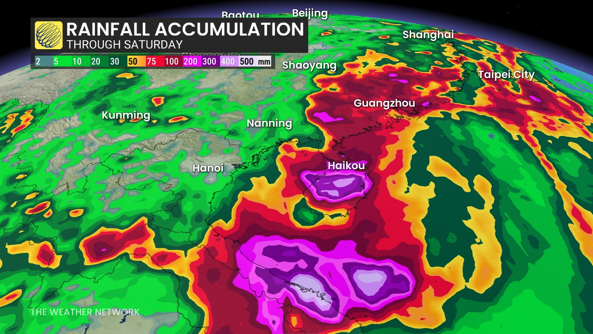
About 100-200 mm of rain is expected to fall in the path of the storm, with local amounts up to 300 mm in the mountainous regions on Hainan.
The western Pacific is the most active region for named tropical systems in the world, averaging 26 named storms per year, compared to the 14 in the Atlantic Ocean.
Thumbnail courtesy of RAMMB/CIRA.