
Severe storms prompt a tornado warning in Saskatchewan
A severe thunderstorm capable of producing a tornado has been detected in southern Saskatchewan. Residents in the affected region should be in their shelters.
A tornado warning has been issued in southern Saskatchewan as meteorologists with Environment and Climate Change Canada (ECCC) are tracking a thunderstorm that is potentially producing a tornado.
In addition to potentially producing a tornado and intense winds, large hail and locally intense rainfall are possible. See below for the details.
Current tornado warnings
R.M. of Great Bend including Radisson and Borden
R.M. of Laird including Waldheim Hepburn and Laird
8:07 PM CST: Environment Canada meteorologists are tracking a severe thunderstorm that is possibly producing a tornado. Damaging winds, large hail and locally intense rainfall are also possible.
This storm is located north of Borden, moving east at 30 km/h.

This is a dangerous and potentially life-threatening situation.
Take cover immediately, if threatening weather approaches. If you hear a roaring sound or see a funnel cloud, swirling debris near the ground, flying debris, or any threatening weather approaching, take shelter immediately.
Go indoors to a room on the lowest floor, away from outside walls and windows, such as a basement, bathroom, stairwell or interior closet. Leave mobile homes, vehicles, tents, trailers and other temporary or free-standing shelter, and move to a strong building if you can. As a last resort, lie in a low spot and protect your head from flying debris.
Current tornado watches
Saskatchewan
MOOSOMIN - GRENFELL - KIPLING - WAWOTA
CARLYLE - OXBOW - CARNDUFF - BIENFAIT - STOUGHTON
YORKTON - MELVILLE - ESTERHAZY
Manitoba
MELITA - BOISSEVAIN - TURTLE MOUNTAIN PROVINCIAL PARK
VIRDEN - SOURIS
MINNEDOSA - RIDING MOUNTAIN NATIONAL PARK.
Tornado watches are issued when atmospheric conditions are favourable for the development of thunderstorms that could produce tornadoes.
This is a dangerous and potentially life-threatening situation.

Be prepared for severe weather. Take cover immediately, if threatening weather approaches.
In the event of a tornado, or if a tornado warning is issued for your area, it is recommended you take the following actions: Go indoors to a room on the lowest floor, away from outside walls and windows, such as a basement, bathroom, stairwell or interior closet. Leave mobile homes, vehicles, tents, trailers and other temporary or free-standing shelter, and move to a strong building if you can. As a last resort, lie in a low spot and protect your head from flying debris. Lightning kills and injures Canadians every year. Remember, when thunder roars, go indoors!
Wednesday overnight: Threat for severe, nocturnal storms continues in Saskatchewan and Manitoba
These storms are expected to continue into the overnight hours, extending the severe weather risk across Saskatchewan and Manitoba into early Thursday morning.
Thunderstorms that triggered on Wednesday evening are expected to continue overnight into early Thursday morning.

Storms will track east into southern Manitoba, including Winnipeg and the Interlake region, potentially bringing large hail of two to three centimetres in size, frequent lightning and heavy downpours.
Thursday: Heavy rain and severe storm risk shifts eastwards
On Thursday, a large, organized low-pressure system will take shape over northern Saskatchewan and Manitoba, bringing a mix of widespread rain and severe weather risks.

DON'T MISS: 2025 is Canada's second-worst wildfire season on record for area burned
Northern regions will experience steady rainfall, while southern Manitoba and northwestern Ontario face the potential for severe storms along the system’s cold front. Areas near Winnipeg and Kenora, Ont., may be impacted by these stronger storms. Damaging winds, hail, and heavy downpours are possible.
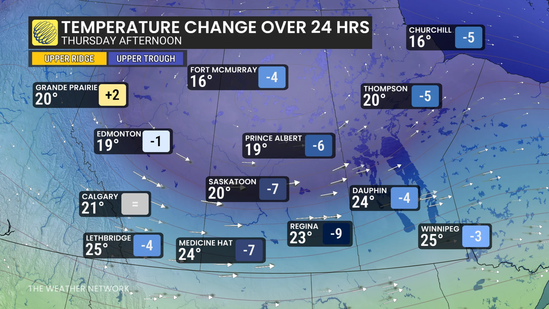
Cooler air will sweep into the western Prairies on the backside of the low pressure system. In Regina, Sask., temperatures are expected to drop sharply from 32°C on Wednesday to 23°C by Thursday.
Be sure to check back for the latest updates across the Prairies.