Warm nighttime lows to accompany Manitoba's sizzling, summer-like heat
With summer-like warmth expected to make a short stay in Manitoba over the coming days, could Canada see its first heat warning of the season?
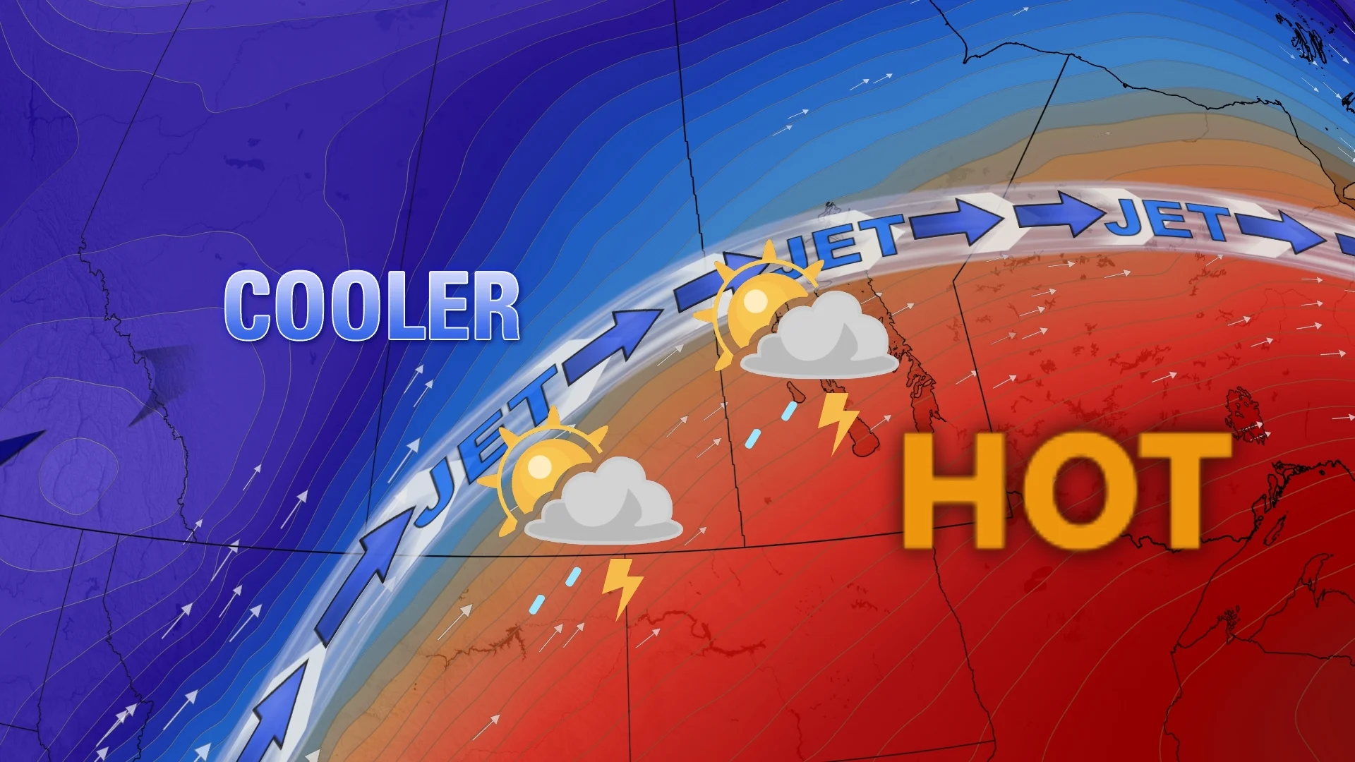
Mid-summer-like heat, potentially record-breaking, will be the story on the southern Prairies this weekend, including on Mother’s Day.
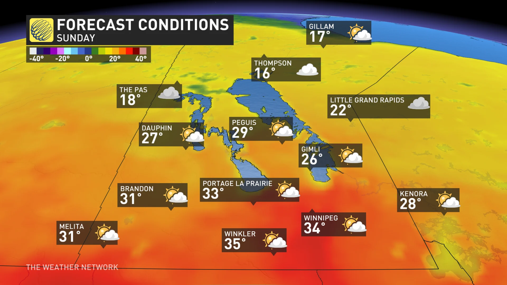
That same heat will make its way into Eastern Canada soon, but before it does, Winnipeg, Man., is expected to finally join the ever-growing 30-degree club in 2025. Daytime highs in Manitoba will jump into the upper 20s and low 30s, potentially even hitting the mid-30 mark in some locales––including Winnipeg, where record-breaking heat is possible.
RELATED: The quest for 30 degrees: When will Eastern Canada feel the heat?
The Prairies ridge responsible for the heat will continue into the middle of next week.
The heat, though, brings the raised risk of health-related hazards, particularly those susceptible in the outdoors. Limit time outdoors and make sure you stay hydrated. Those looking for relief at night won't get much help--overnight lows will remain in the upper teens or even low 20s.
Could Canada see its first heat warning of the season?
Some parts of the province have already recorded 30°C temperatures, but that was a brief stint, and Winnipeg’s airport just missed it by 0.1°C last weekend.
With the high amount of heat, we could see the first 35°C of the year on Sunday at the Manitoba-U.S. border--a forecast that could prompt Canada’s first heat warning of the year, if it verifies.
A ridge of high pressure builds throughout the weekend, ushering in a very mild, southwesterly flow across Saskatchewan and Manitoba.Heat is expected to persist until Wednesday when an upper trough flushes out the anomalous warmth.
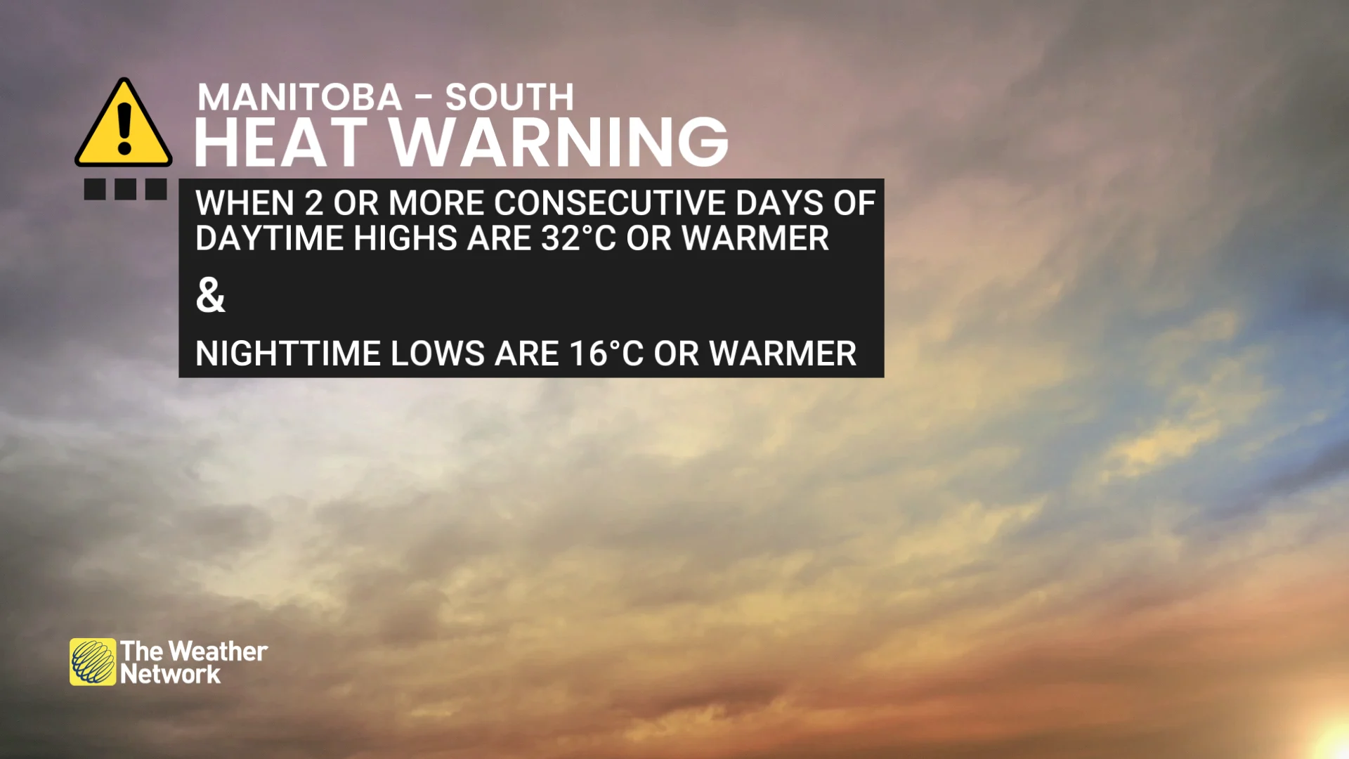
Parts of Manitoba, including Winnipeg, may meet the criteria for having consecutive days of daytime temperatures reaching 32°C and nighttime temperatures above 16°C.
DON'T MISS: Sprawling 3,500+ km 'weather-free zone' to emerge over Canada
Remarkably warm overnight temperatures are anticipated throughout the heat event––temperatures remaining above 20°C for locations like Winnipeg.
On Monday, Winnipeg has the opportunity to reach 35°C--one of the earliest instances of hitting that value on record for the city.
The earliest occurrence of 35 degrees on record happened on May 5, 2016 (35.2°C), with the second-earliest taking place on May 8, 1874 (35°C).
Be on alert for heat warnings issued by Environment and Climate Change Canada (ECCC) as this event is close to verifying the criteria for a heat warning.
Please make sure to stay hydrated, check on family and friends who may be more vulnerable to the heat and avoid strenuous activity outdoors.
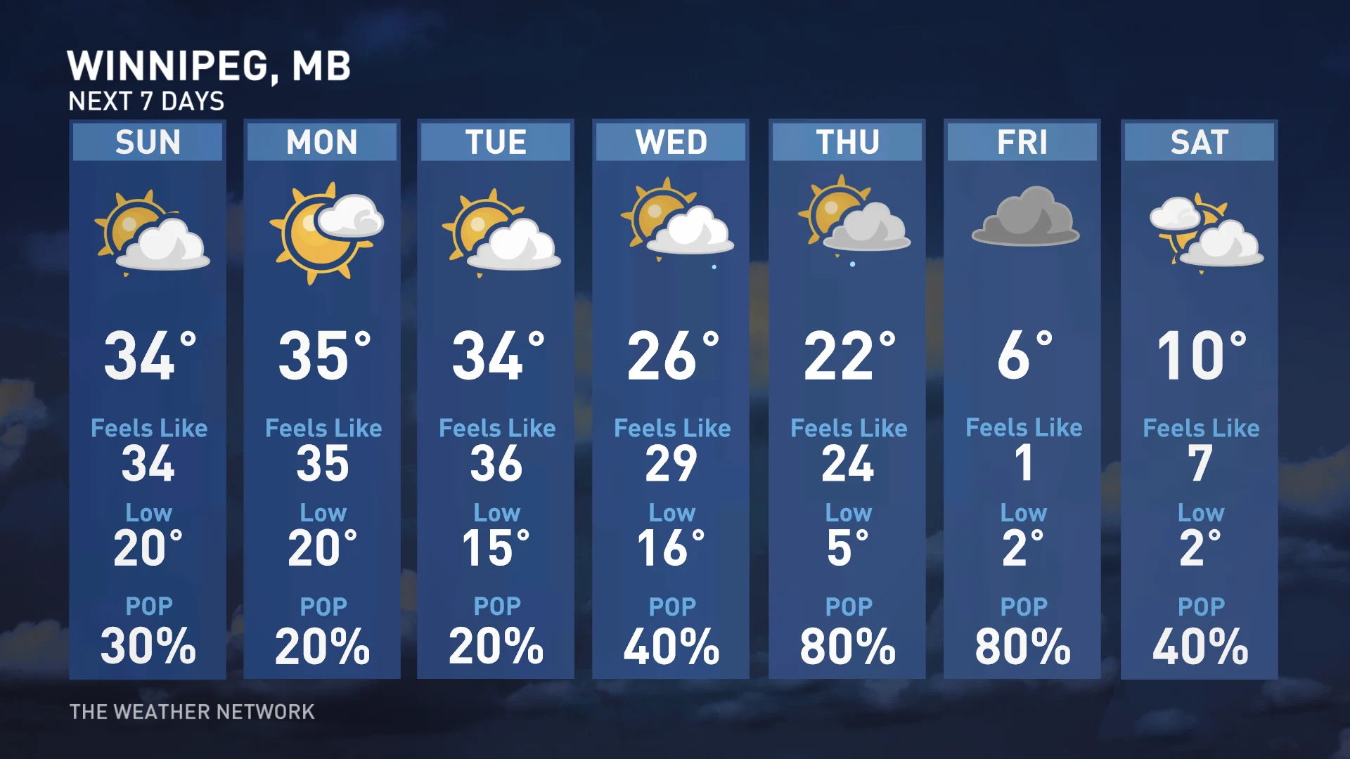
The length of the heat remains uncertain, as the ridge could move faster than expected. If so, it would drop temperatures below 30°C Tuesday and Wednesday for southern Manitoba. Currently, the southeastern parts of the province are the most likely to experience three to four days of 30°C+ heat.
It’s also unlikely to beat Winnipeg’s all-time record for the hottest May temperature, which stands at 37.8°C on May 30, 1934.
Meanwhile, some much-needed rain is coming to the Prairies next week. Some areas will miss out while others will see excessive amounts, but overall, that is very good news for agriculture and for the wildfire danger.
A low will develop over the Dakotas and track into southern Manitoba Wednesday or Thursday with widespread rain, locally heavy, and thunderstorms.
Stay with The Weather Network for more information and updates on your weather across Manitoba.