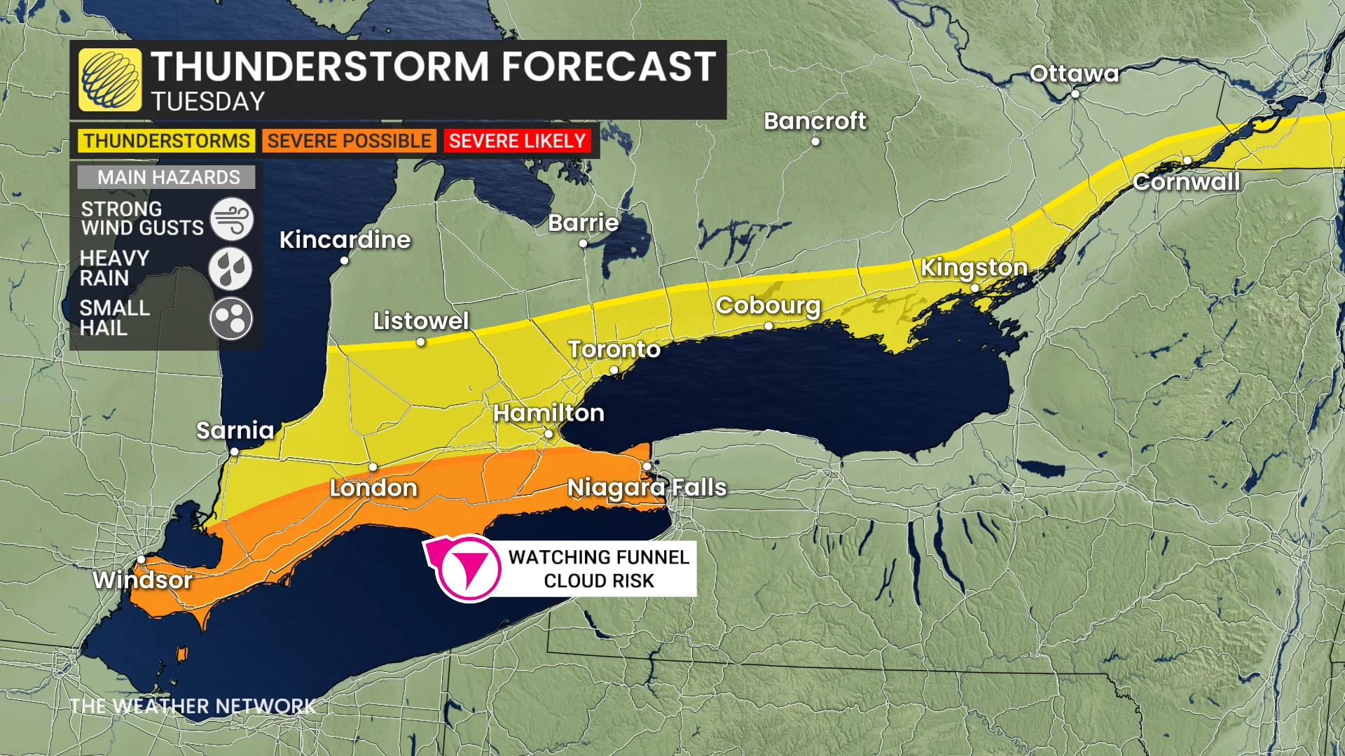
Watching a funnel cloud risk with Tuesday's storms in southern Ontario
Stay alert: Tuesday's thunderstorm threat comes with the risk of funnel clouds in parts of southern Ontario
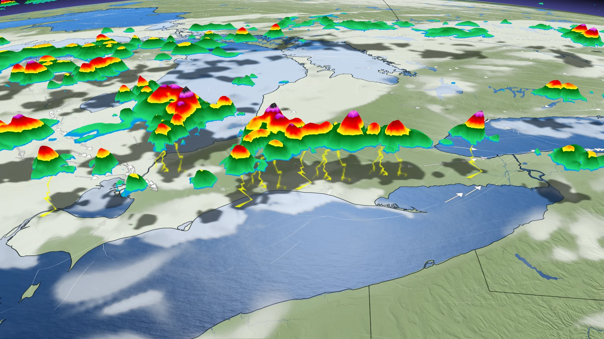
Following a stormy Monday evening in parts of northern Ontario, the risk of severe weather will shift to the southwest, and areas near the Lake Erie shoreline on Tuesday.
This includes a conditional threat of funnel clouds developing, and even a weak landspout tornado for areas in the severe-possible region. However, there is still a considerable amount of uncertainty in the setup for Tuesday.
SEE ALSO: Hair suddenly standing straight up? Take cover immediately
Be sure to monitor local weather alerts and incoming conditions throughout the day.
Tuesday: Stay alert to the chance of funnel clouds with severe thunderstorms
The risk of thunderstorms will shift southward on Tuesday, though significant uncertainty remains around their development.
Lake breezes could trigger severe storms near the Lake Erie shoreline, potentially tracking into the Niagara Peninsula. However, it is unclear whether these weaker triggers will overcome the suppressing heat.
If they do, conditions could support the development of funnel clouds or even a landspout tornado.
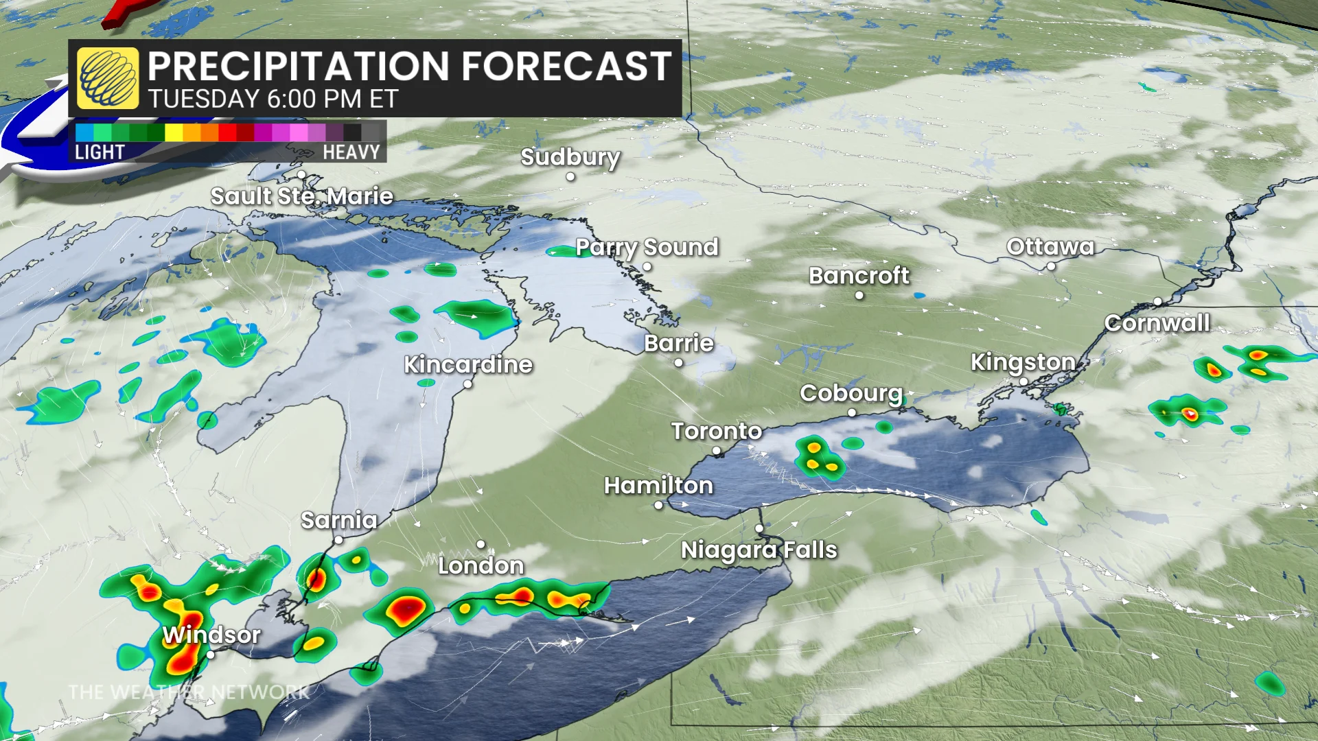
Southern Ontario may experience storms capable of producing heavy rainfall, with localized downpours of 40–80 mm possible.
Repeated storms over the same region could lead to localized flooding, particularly on roadways.
Residents in affected areas should stay alert and monitor local weather updates.
By Wednesday, relief from the extreme heat and humidity is expected, with temperatures in the mid to upper 20s, depending on cloud cover. Conditions will be noticeably more comfortable compared to Tuesday’s heat.
WATCH BELOW: Science behind the lake breeze
RELATED: Storm downs trees, knocks out power in Mattawa, Ont., area
First look at your Canada Day, and early July weather
By the weekend, near-seasonal temperatures are expected, along with reduced humidity. However, there remains a risk of passing showers or thunderstorms during this period.
SEE ALSO: Here's how fireworks harm wildlife, and what you can do instead
Heat and humidity are expected to briefly return on Monday ahead of a strong cold front moving across the region Monday night or early Tuesday (Canada Day). This system is likely to bring a period of rain and thunderstorms. Early July is expected to feature near-seasonal or slightly below-seasonal temperatures, with reduced humidity in the days immediately following the front.
Stay with The Weather Network for more information and updates on your weather across Ontario and Quebec.