'Weather whirlpool' swirls over Eastern Canada thanks to a Greenland ridge
Atlantic Canada remains under an unsettled weather pattern, influenced by a Greenland ridge
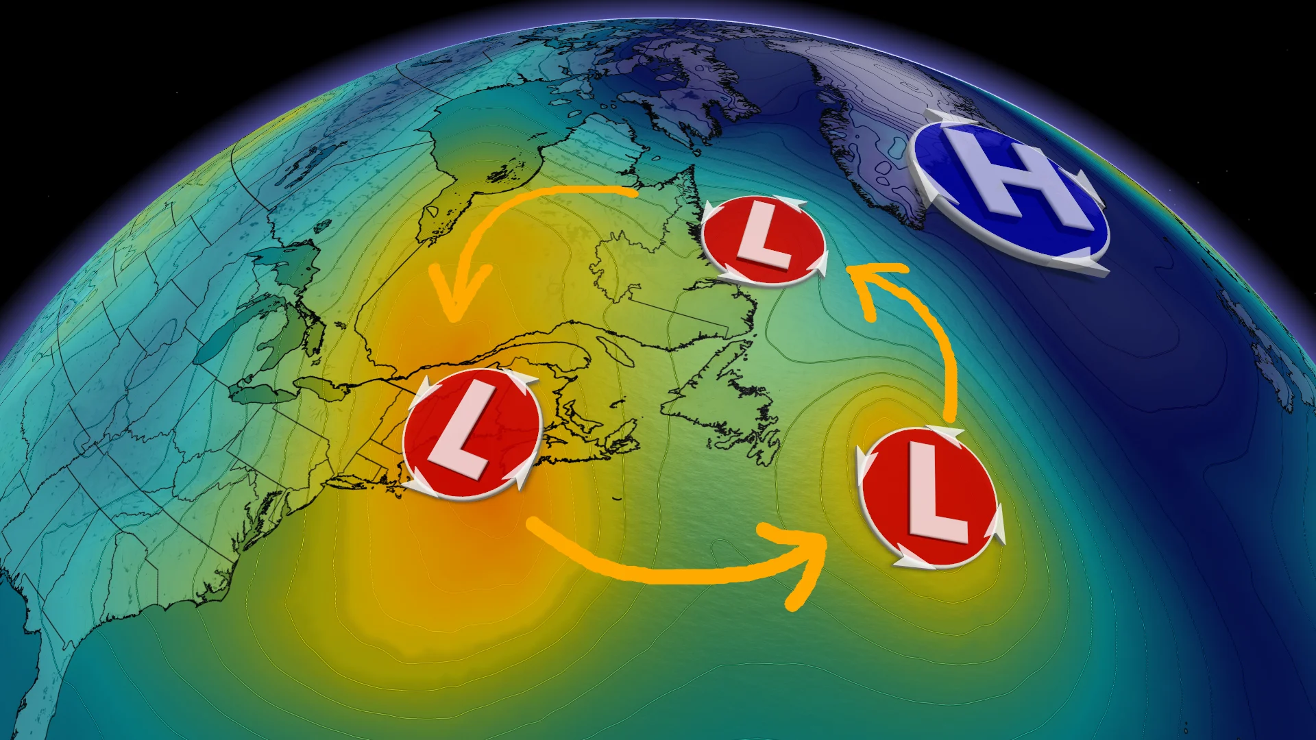
A series of weather systems continues to impact Eastern Canada, driven by a persistent blocking pattern.
Typically, weather systems that leave North America and travel across the Atlantic are no longer a concern. However, a Greenland ridge has created a blockage over Eastern Canada, with a storm parade expected for the next week or so.
DON'T MISS: How Omega blocks and Rex blocks can affect Canada's weather
This ridge, or high pressure system, will disrupt the usual pattern of storms moving from Canada to Europe, halting their typical west-to-east flow.
In meteorological terms, the ridge represents a "rise" in the atmosphere, while the neighbouring trough symbolizes a "dip." The ridge acts like a protective barrier, while the trough forms a low pressure zone where systems tend to settle. Unfortunately, this trough is positioned over Atlantic Canada and could linger for the next week.
SEE ALSO: November fever: Northern warmth defies the typical Arctic chill
Because of the time of year, the lack of significant Arctic air upstream reduces the chances of heavy snowfalls in major cities. Meanwhile, the trough's position will bring some contrasting impacts.

On its leading edge, unseasonably warm air is being funnelled into Labrador and even Nunavut, where temperatures are running 10-15°C above normal.
On the backside of the trough, cooler air is settling, leading to temperatures 2-4°C below seasonal norms across Ontario, Quebec, and the Maritimes.
More rain and wind can be expected across Newfoundland as we head into the weekend, with an unsettled pattern continuing for the next little while.