
Which Canadian spring would you like: 34 degrees or 30+ cm of snow?
Two dramatically different versions of the same season will greet the country this weekend
Spring is a tumultuous season that features the last blasts of winter weather clashing against the steady advance of summertime sultriness.
Sometimes we can see both extremes unfolding in the same weekend.
This weekend will feature 34-degree heat for one major Canadian city, even as folks a few provinces away deal with a full-fledged snowstorm.
Which would you rather endure?
DON’T MISS: La Niña is gone for the summer—but could it return for fall?
Blizzard-like conditions possible for some areas
A low-pressure system moving into Atlantic Canada will bring widespread soggy conditions to the region this weekend. This storm will lift into much colder air as it scoots north, setting up a formidable snowfall event for communities in Labrador.
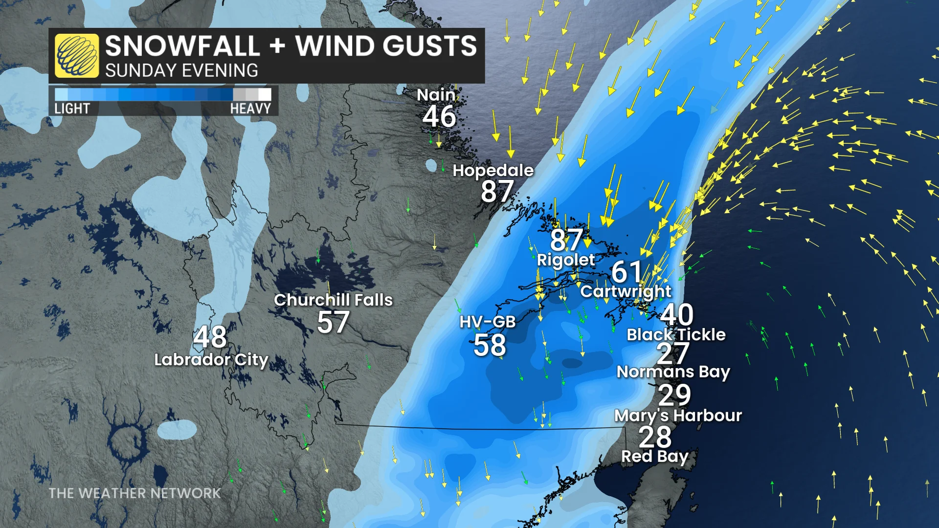
Sunday will be a rough day for much of Labrador as 20-40 cm of snow falls on the region, complete with wind gusts of 80-100 km/h at times throughout the day. This will lead to blizzard-like conditions at times. The snow and wind will linger into the start of Monday.
It’s been five years since the last time we saw more than 20 cm of snow during the month of May in Happy Valley-Goose Bay. If this even produces 20+ cm of snow in the community, it’ll be the latest hefty snowfall there since mid-May 2010.
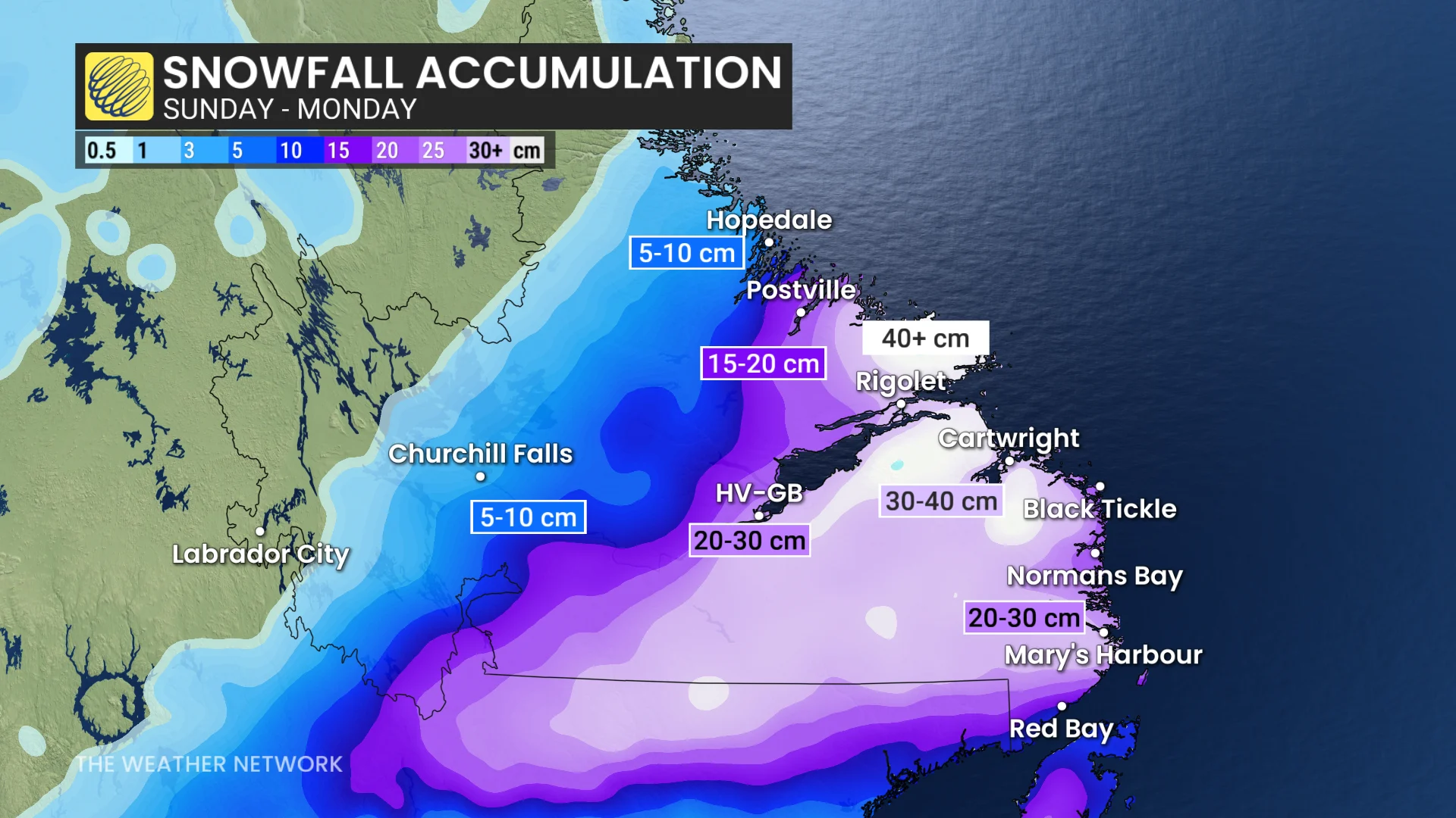
Significant late-season snows aren’t uncommon in this part of the country. Happy Valley-Goose Bay’s latest 20+ cm snowfall occurred on June 28-29, 1980, when the observation station reported 25.1 cm of accumulation.
Early season heat wave for southern Manitoba
That’s one version of spring. Let’s head a few provinces to the west, where folks across southern Manitoba will deal with an early-season heat wave this weekend and into early next week.
A formidable ridge of high pressure building over the Prairies this weekend will linger over Manitoba into the start of next week.
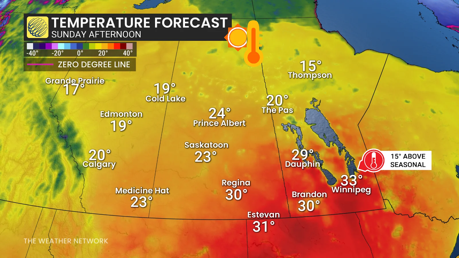
Heat will begin building into the province on Sunday, where Canada’s first 35°C reading of the year could occur close to the international border.
This isn’t just a one-day warmup, either. We could see three or four days in a row of 30+ degree temperatures in southern Manitoba, especially around Winnipeg.
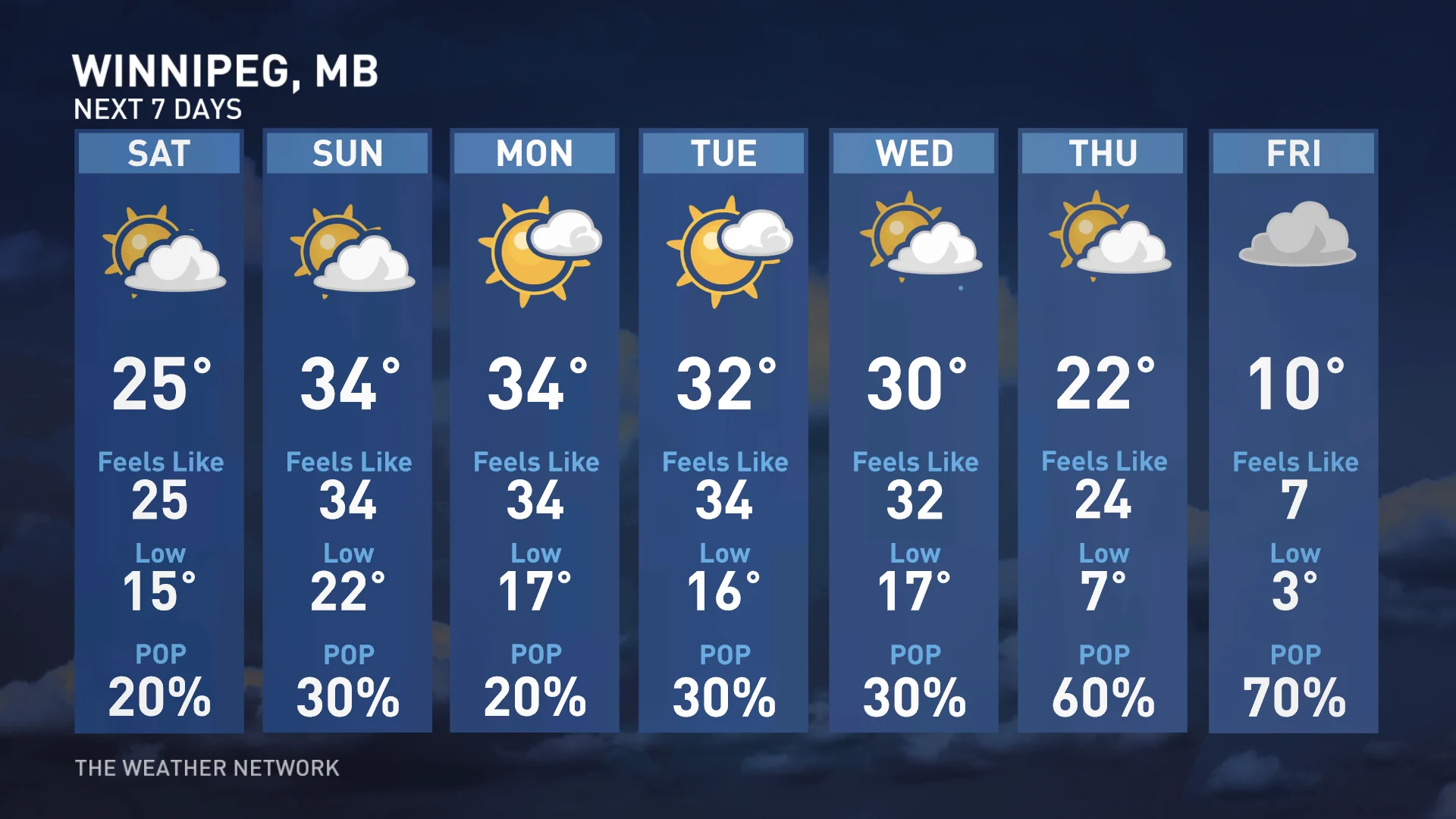
Heat warnings are possible in and around Winnipeg, where daytime high temperatures in the 30s could last from Sunday through Wednesday.
Which version of spring would you rather endure as we approach the middle of May?
Stay with The Weather Network for all the latest on conditions across Canada.
Header image created using graphics and imagery from Canva.