40 cm: Treacherous commute possible as snow squalls continue Monday
Drivers can expect treacherous travel conditions downwind from Lake Huron and Georgian Bay into the Monday morning commute
Cold northwesterly winds sweeping across Ontario set the stage for potent snow squall development through the day Sunday. Snow squall warnings are in effect for some snowbelt communities downwind from Lake Huron and Georgian Bay.
DON’T MISS: Beware the dangers of fall snowstorms across Canada
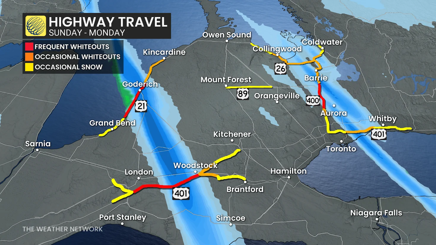
Expect significant travel impacts in those areas, especially near London and Barrie, situated in the two main bands. Road closures are a possibility, so consider changing travel plans into Monday.
Drivers should remain aware of rapidly changing conditions over short distances. Visibility can change from clear to a whiteout when approaching a snow squall.
Snow squalls expected to stay through Monday morning
Cold, northwesterly winds blowing across the relatively warm lakes will provide the classic setup for lake-effect snow squalls to develop over communities downwind from Lake Huron and Georgian Bay.
Stiff wind gusts will help sustain lake-effect squalls through Monday.
Lake Huron squalls will target several counties, but the worst conditions with significant whiteouts are forecast in: Huron, southern Perth, Oxford, eastern Middlesex and Norfolk counties.
Highway 3, Highway 4, Highway 21, and Highway 401 are some of the routes impacted.

The Georgian Bay squall will be impacting communities and population centres downwind, including Toronto.
Greater Toronto Area
City of Toronto
Vaughan → Richmond Hill, Markham
Pickering → Oshawa, southern Durham
Simcoe County-Georgian Bay Corridor
Barrie → Collingwood, Hillsdale
Innisfil → New Tecumseth, Angus
Midland → Coldwater, Orr Lake
Barrie → Midhurst
Newmarket → Georgina, northern York

WATCH: Potent snow squalls rolling across southwestern Ontario
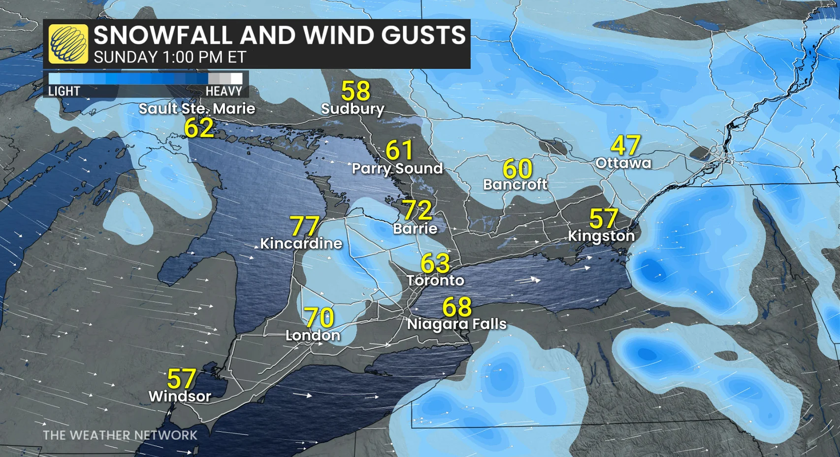
Through the overnight hours Sunday into early Monday, heightened squall activity persists with the Arctic air in place, with the aforementioned dominant squalls. Peak snowfall rates of 3-5 cm an hour and peak wind gusts of 60-70 km/h.
Residents and drivers can expect snow squalls to meander over the region through the overnight hours and lingering into Monday.
Through Tuesday, the band of snow off Lake Huron could produce 20-40+ cm of snow for parts of Huron, Middlesex, Elgin, Perth and Oxford counties. Locally higher totals are possible, especially if the band remains stationary for an extended period of time.
Communities downwind of Georgian Bay will generally see 5-15 cm of snow through Monday, with local amounts of more than 20 cm in areas immediately southeast of the aforementioned body of water.
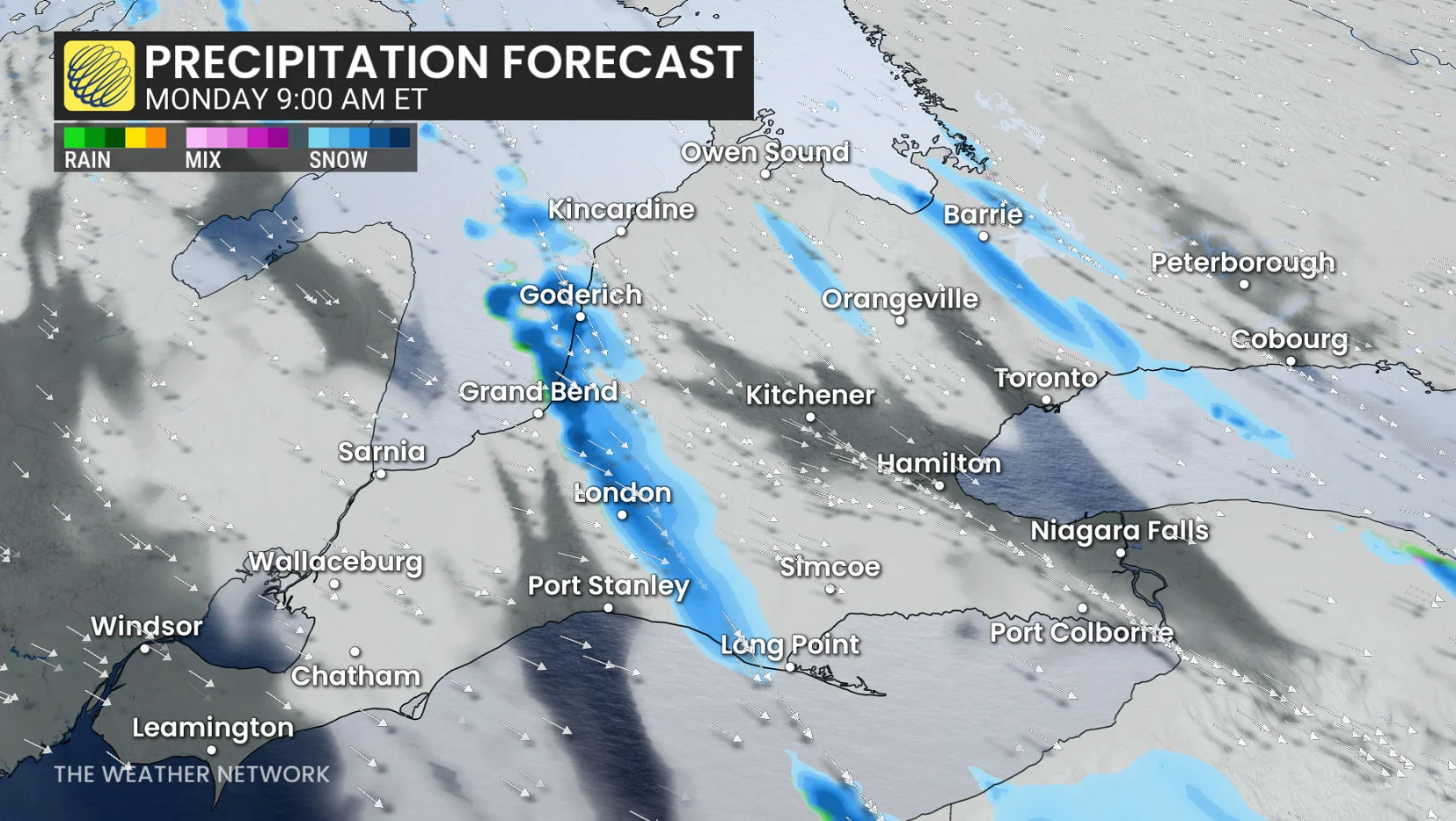
On Monday, gusts will ease slightly but remain supporting squalls that will continue to impact the GTA and regions from Goderich to Long Point off of Lake Huron--potentially creating travel issues.
By Monday afternoon evening, the squalls will begin to ease with warmer air and another wind change.
Expect driving to be difficult at times, and the stiff gusts could further reduce visibility during periods of snowfall.
Stay with The Weather Network for all the latest on conditions across southern Ontario.
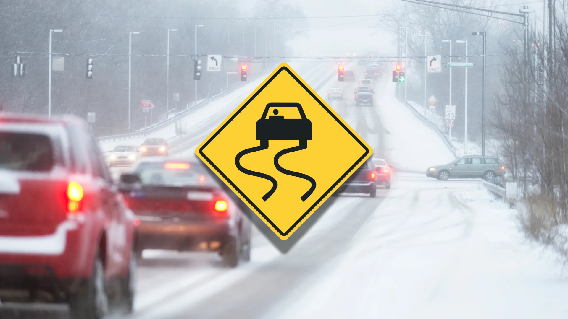
Header image created using graphics and imagery from Canva.