Wintry mess with possible travel impacts in Ontario, Quebec this weekend
A messy mix of rain, snow, and even freezing rain is on the way for parts of Ontario and Quebec this weekend, potentially having some impact on travel and power
An exceptionally strong blocking pattern will lock in a colder pattern in Central Canada much longer than initially expected.
So, that means another chance of wintry weather for Ontario and Quebec this weekend. That includes a growing chance of freezing rain for some areas, too, in addition to rain and snow.
RELATED: Are you ready for 'Snow'vember? Snowfall threat looms over Canada

Anticipate some travel delays or impacts on Saturday night into Sunday morning as the bout of the wintry weather occurs, especially in areas seeing freezing rain and/or snow. Localized power outages and dicey travel are possible where freezing rain occurs.
This weekend:
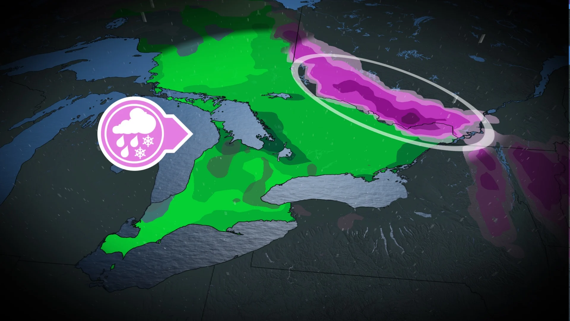
Active weather moving across the northern Prairies will impact Ontario and Quebec this weekend.

Rainfall is expected in southern Ontario Saturday evening, followed by lake-effect rain and snow on Sunday.
DON'T MISS: Winter-proof your home with a heat pump that even works in -30°C
There will be a trickier, more impactful forecast for the Ottawa Valley and Montreal region. Marginal temperatures in those areas may bring a threat for several hours of freezing rain late Saturday into the early hours on Sunday morning.

However, there is some uncertainty in the storm's track: A path farther north increases rain chances while a farther-south trek increases the probability of freezing rain.
There is medium confidence for freezing rain for Ottawa Valley, Gatineau and surrounding regions, and lesser certainty for Montreal due to slightly warmer temperatures.
The good news is forecasters aren't expecting the system to stall, limiting freezing rain accretion to 2-5 mm and duration up to six hours. Risks would increase if the storm slows down, however, so we're watching it closely.
Localized power outages will be possible where freezing rain occurs. The timing of it occurring overnight should help to limit commuting impacts.

Lake-effect rain and snow-showers will develop southeast of Lake Huron and Georgian Bay, change to all snow and then continue through most of Monday. Temperatures will be a few degrees colder than normal.
A couple of significant systems are expected to approach the region later next week and weekend. The storm track is uncertain and that will be critical to whether we can get a stretch of mild weather versus changeable temperatures, with a risk for messy impacts. At this point, a milder and wetter scenario is favoured, especially for southern and western parts of the region.
However, a very wintry pattern is expected to dominate during December with colder-than-normal temperatures. An active pattern is expected to accompany that transition during the final week of November.
Stay tuned to The Weather Network for the latest forecast updates for Ontario and Quebec.