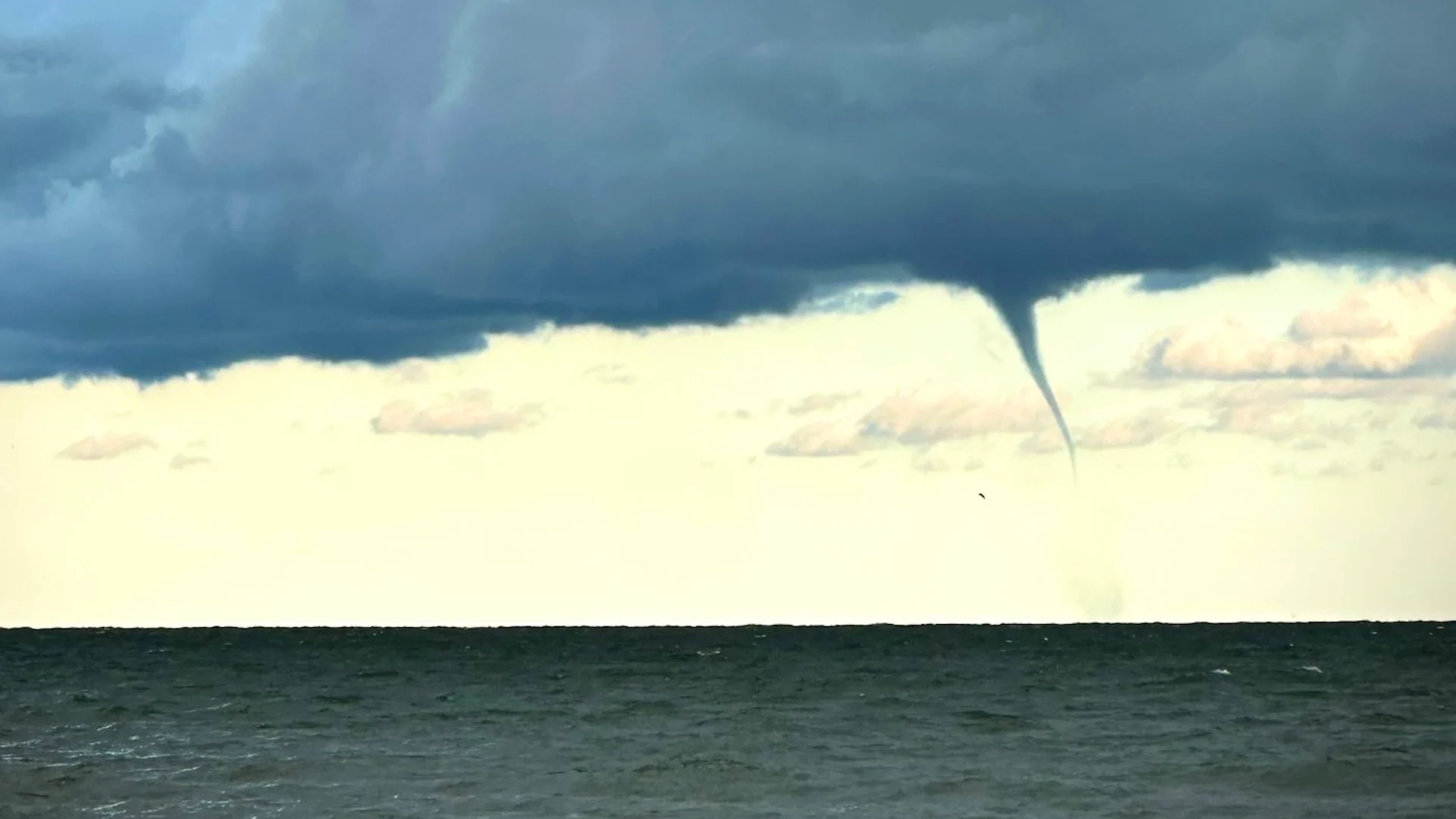
An outbreak of waterspouts dotted the Great Lakes on Sunday
Favourable conditions allowed numerous waterspouts to dance over portions of the Great Lakes this weekend
Spotters reported nearly two-dozen waterspouts over portions of Lake Erie and Lake Ontario on Sunday as favourable conditions swept into the region.
Waterspouts are mostly harmless, but they can pose a hazard to boaters and nearby communities if they happen to spin ashore.
DON’T MISS: Tornado, waterspout, landspout, gustnado: what’s the difference?

A waterspout is a non-tornadic whirlwind that forms beneath a rapidly developing cumulus cloud over water.
The core ingredients needed for waterspout formation include cold air moving over warm lake waters, lower cloud bases, low wind shear, and converging winds at the surface.
Rising air can begin spinning as winds converge near the surface. This spin intensifies as the whirlwind ‘stretches’ out, much like a figure skater pulling in their arms to rotate faster.

MUST SEE: Don’t fall victim to these seven dangerous tornado myths
Sunday’s weather saw a strong contrast between cold air aloft and warm lake waters. Add in cloud bases beneath 1,000 metres and conditions were perfect for numerous waterspouts throughout the region.
Most waterspouts are relatively weak and short-lived, remaining far away from shore. Every once in a while, a waterspout can push inland and cause minor damage right along the shoreline. There were no reports of waterspouts coming ashore on Sunday.
Autumn is peak waterspout season across the Great Lakes as surges of cold air rush over the lingering warmth of the waters below.
Header image courtesy of Jonas Hinderer/Jonash1717 via X.