
B.C. snowmobile club provides wildfire fighters with local knowledge
Merritt Snowmobile Club gives firefighters access to webcams, trail tips
A B.C. snowmobile club is providing firefighters tackling an out-of-control wildfire near the Coquihalla Highway (Highway 5) with invaluable local knowledge.
DON'T MISS: Get the latest wildfire news and safety tips to help you stay safe
The Mine Creek wildfire, burning between Hope and Merritt along the critical highway that connects the Lower Mainland with the B.C. Interior, covered an area of 30 square kilometres as of Sunday morning.
It had jumped the highway on Wednesday amid record-high temperatures in B.C., leading to a two-day closure of the road and evacuation orders and alerts for properties along the Coquihalla.

One of the webcams from the Merritt Snowmobile Club shows heavy equipment being used by the B.C. Wildfire Service. (Merritt Snowmobile Club)
Simon Rizzardo, the club's vice-president, told CBC News that they've given firefighters access to the club's webcams and taken them on tours, pointing out cabins in need of protection and advising them on which trails to use.
"A lot of these structure protection guys are from out of town and they may not know the backcountry like we do, being local," he said.
"We see it summertime and wintertime, so we kind of know all the shortcuts and direct ways to get to our structures," he added. "And yeah, we just want to make sure our cabins get protected."

The Mine Creek wildfire adjacent to the Coquihalla Highway is seen on Sept. 6, 2025. (B.C. Wildfire Service)
Rizzardo said that firefighters may have access to online mapping tools that show them which forest roads to use, but he says local snowmobilers often know which ones are overgrown or in disrepair, adding that the club's webcams have been useful too.
"Capturing some of the the actual footage of the fire rolling across the hills at nighttime definitely helps the fire crews," Rizzardo said.
The snowmobiler said that he wanted to give firefighters the best leg up that he could.
"It's definitely like going into a foreign country," he said. "If you've never been to that area, and you got to go figure it out for yourself where the best burgers are, right? Why not get a local to tell you, 'Hey, this is the best place to go for a burger?'"
Location of Mine Creek wildfire between Hope and Merritt, B.C.
The fire is burning adjacent to the Coquihalla Highway (Highway 5).
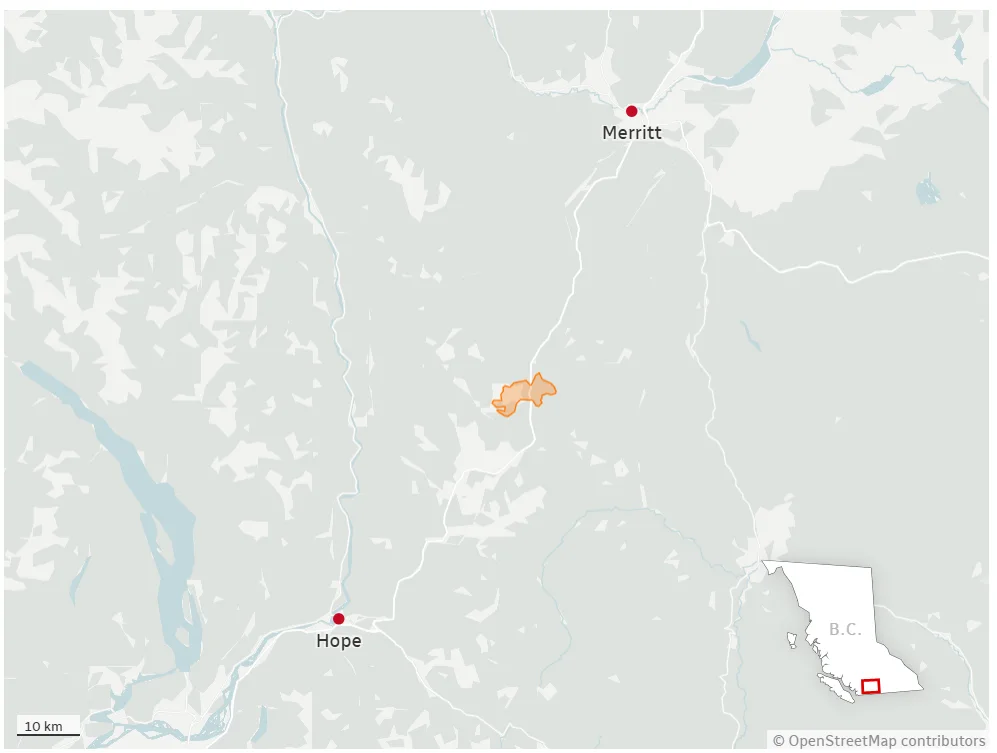
Fire boundaries accurate as of 12:40 p.m. on Sept. 7, 2025. Source: Government of B.C. (Akshay Kulkarni/CBC)
In an online update, the B.C. Wildfire Service said that Sunday was the start of a helpful weather downturn for those tackling the Mine Creek blaze.
It said that lower temperatures and higher humidity were helping decrease fire behaviour — but that forecasted thunderstorms could prove to be a wildcard.

The Mine Creek wildfire is seen on Sept. 1, 2025. (Submitted by Doran Hoge)
"Thunderstorms are a safety consideration for our crews as gusty, erratic winds can result in increased fire behaviour and heavy downpours, which can make highways and back roads wet and slippery," the update read.
A number of severe thunderstorm watches were in effect in B.C. on Sunday afternoon, including for the Okanagan, Nicola, South Thompson and northern Fraser Canyon regions.
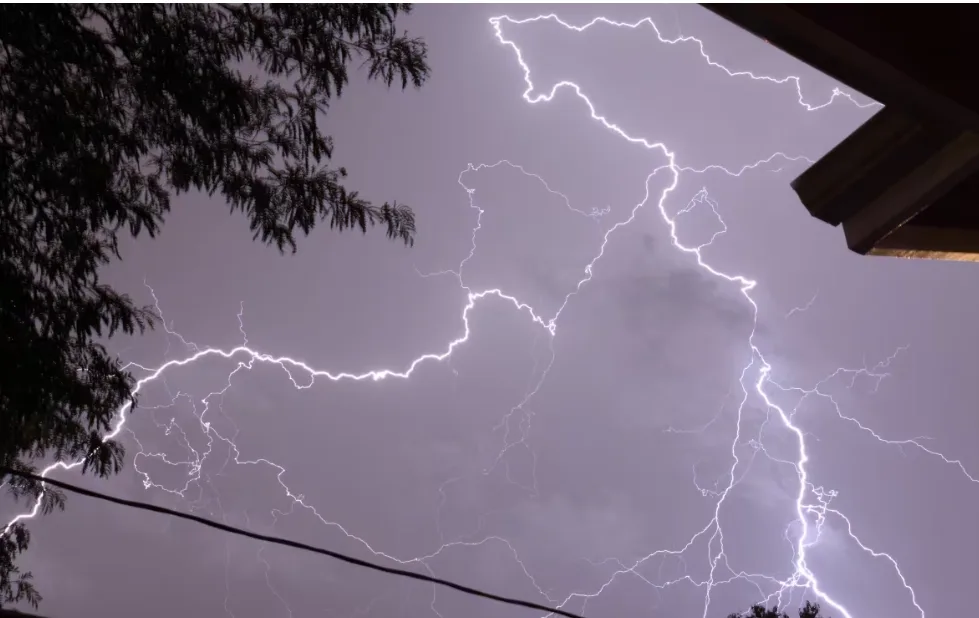
There are some areas under a severe thunderstorm watch in B.C. on Sunday. (Eric Foss/CBC)
Amanda Graves, a B.C. Wildfire Service information officer, said Sunday that crews were seeing variable amounts of rain coming in, and smoke cover was starting to lift in areas across the province.
"That said, aerial operations are continuing to be challenged in some areas where the smoke remains thick, and it's limiting visibility," she said.
"As we move through tonight, the risk of lightning remains in the Southeast Fire Centre, parts of the Kamloops Fire Centre and in the southeast Cariboo Fire Centre."
New evacuation order in Chilcotin area
Meanwhile, multiple fires in the Chilcotin area, near Anahim Lake, have led to hundreds being told to leave their homes in central B.C.
The Beef Trail Creek wildfire covered an area of 106 square kilometres northwest of Anahim Lake, and the Dusty Lake wildfire covered an area of 61 square kilometres southeast of the community, as of 1 p.m. PT on Sunday.
A new evacuation order was issued Sunday morning for residents of 42 structures southeast of the Dusty Lake blaze, due to the nearby Smokey Lake wildfire.
Location of major wildfires in B.C.'s Chilcotin region on Sept. 7, 2025

Fire boundaries accurate as of 12:40 p.m. PT on Sept. 7. Source: Government of B.C. (Akshay Kulkarni/CBC)
That fire covers an area of 57 square kilometres, and firefighters say they're seeing aggressive fire behaviour on Sunday, with flames occasionally burning to the tops of trees.
A related evacuation alert covers 36 land parcels, as well as the West Chilcotin Health Centre in Tatla Lake, B.C.
An evacuation order means residents should leave immediately, while an evacuation alert means residents should prepare to leave at a moment's notice.
WATCH BELOW: Vancouver residents asked to register fireplaces or risk a fine
This article, written by Akshay Kulkarni, was originally published by CBC News. With files from Jenifer Norwell
Thumbnail image courtesy: Submitted by Simon Rizzardo via CBC News