
Believe it or not, 2025’s hurricane season is ahead of the curve

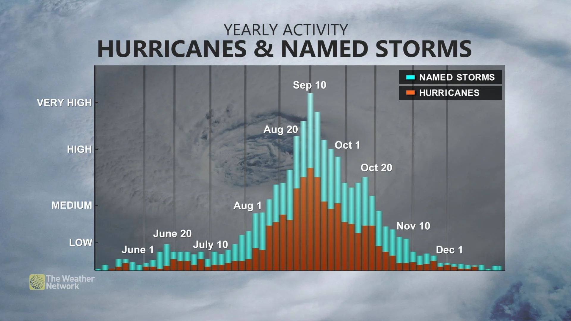
The peak of Atlantic hurricane season doesn’t arrive until the second week of September
This year’s Atlantic hurricane season may seem like it’s off to a sluggish start compared to the blockbuster seasons we’ve seen in recent years.
But this year’s tropical activity is actually progressing a few steps ahead of a ‘typical’ hurricane season by this point in the year.
DON’T MISS: Hurricane forecasts are better today than ever before—here’s how
Forecasters widely expect an above-average Atlantic hurricane season as 2025 wears on.
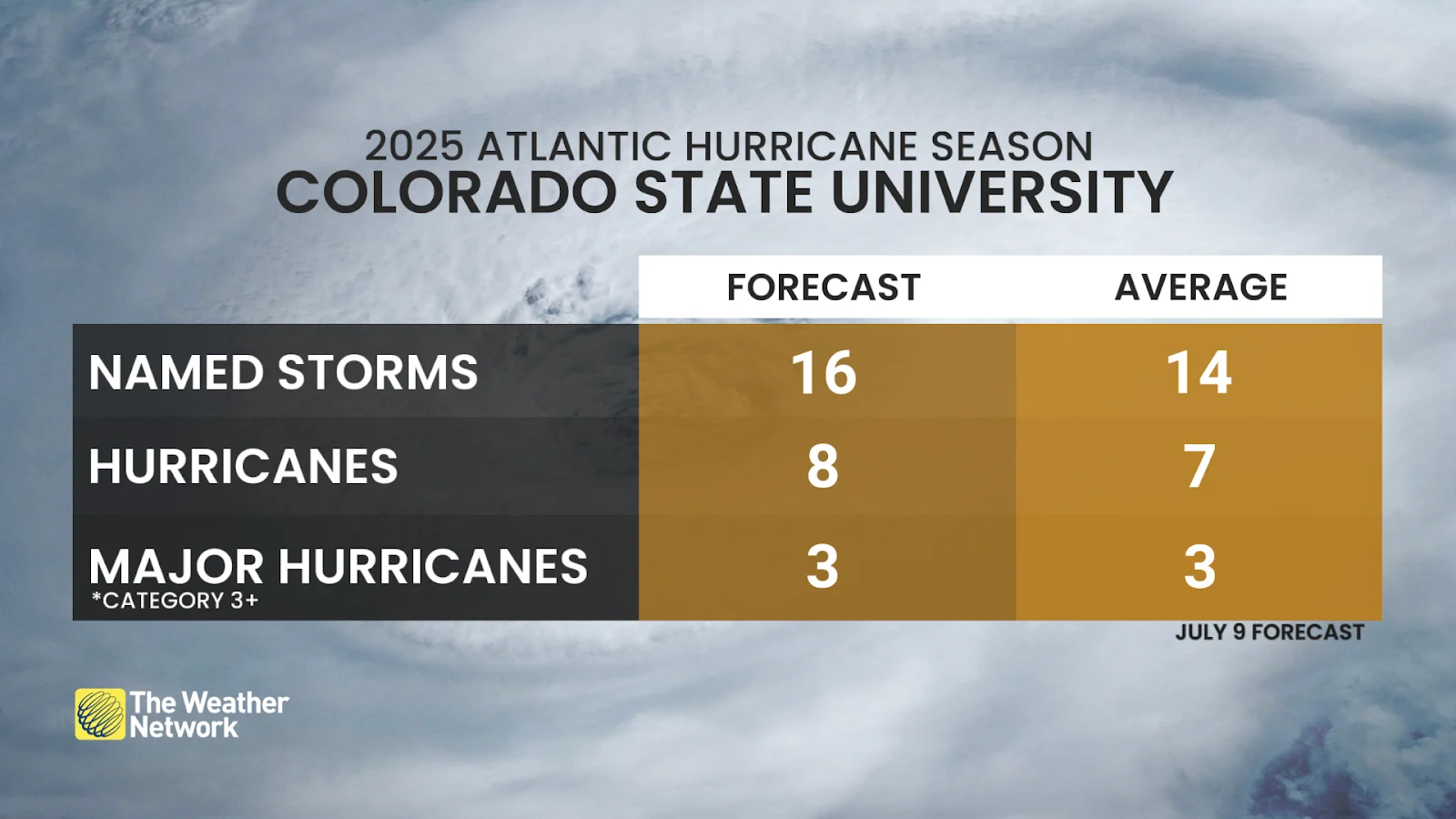
Colorado State University’s updated outlook earlier this month called for 16 named tropical storms, 8 hurricanes, and 3 major hurricanes.
An average season produces 14 named tropical storms, 7 of which become hurricanes, and 3 of those hurricanes intensifying to major Category 3 status or stronger.
We’ve seen three named storms so far this year. Tropical Storm Andrea formed in the open Atlantic on June 24. Tropical Storm Barry formed four days later and struck the coast of Mexico, eventually contributing to the tragic floods in Texas. Tropical Storm Chantal developed on July 4 and made landfall in South Carolina.

This is the slowest start to the hurricane season since 2019, a year which saw its third named storm form in the middle of July.
But we witnessed unusually robust tropical activity between 2020 and 2024—and despite the relatively slow start, the three storms we’ve seen so far in 2025 still put this hurricane season ahead of the curve compared to average.
According to data collected by the U.S. National Hurricane Center (NHC) between 1991 and 2020, the basin’s first named storm typically developed on June 20, followed by the second named storm on July 17, with the third named storm usually arriving on August 3.
MUST SEE: Hurricane remnants can bring dangerous weather deep into Canada
The most favourable conditions for Atlantic hurricane activity—including warm ocean waters and tropical waves moving off the African coast—typically build through the late summer into early fall, peaking around the second week of September.
Remember that it only takes one storm making landfall to make it a bad season. Folks across Eastern Canada should prepare for hurricanes well before any storms have the opportunity to form.
Ensure you have emergency plans and supplies in place in case a storm threatens your location. The wind, rain, and tornadoes from landfalling storms can even affect Ontario and Quebec.
Header image of Tropical Storm Chantal courtesy of NASA Worldview.