CN train derails in B.C., power out as atmospheric river hammers the coast
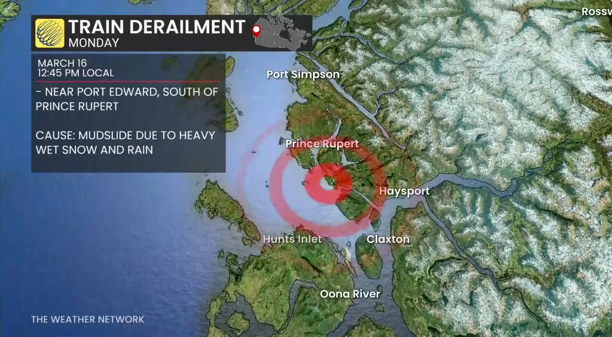
A CN Rail train carrying empty grain cars has derailed after a mudslide in northwest B.C., as the region is hammered by heavy, wet snow and rain leading to upgraded weather alerts from Environment and Climate Change Canada.
CN Rail says the derailment happened about 12:45 p.m. PT near Port Edward, south of Prince Rupert.
"The crew exited the locomotive safely and are being attended to by local first responders," an email to CBC News says.

"There are no dangerous commodities, leaks or exposures and no danger to the public as a result of the derailment."
The Lax Kw'alaams Band says it happened about "two track miles" to the east of the North Pacific Cannery, a national historic site, along Skeena Drive.
A post from the neighbouring Cassiar Cannery on Facebook says there is significant muddy runoff in the area.
"We are fine," the post says. "Please do not drive out here to check it out."
In a post made earlier in the day, Cassiar Cannery described an "epic winter storm session," in the region.
"We have over two feet and today is absolutely pouring before it cools off just enough to give us another big dump," the post said, calling it "epically soupy and slushy."
The Central Coast Regional District issued an evacuation alert around 4:30 p.m. Monday for Martin Valley, around 36 kilometres northeast of Bella Bella, due to flooding and potential landslide risk from Mount Caro Marion.
It warned people in households between Highland Drive and Garden Drive to be ready to leave on short notice.
Multiple power outages, orange warning
Environment Canada has upgraded its existing weather warnings for the Central Coast to an orange warning under its new colour-coded warning system.

Example of how the new colour-coded alerts are issued. (ECCC/The Weather Network)
Orange indicates "severe weather is likely to cause significant damage, disruption or health impacts" which are "widespread and/or may last a few days," the agency says, calling them "uncommon."
Up to 150 millimetres of precipitation is expected for North Vancouver Island and coastal sections of the Central Coast in valley communities, Environment Canada warns, with up to 250 mm over the mountains.
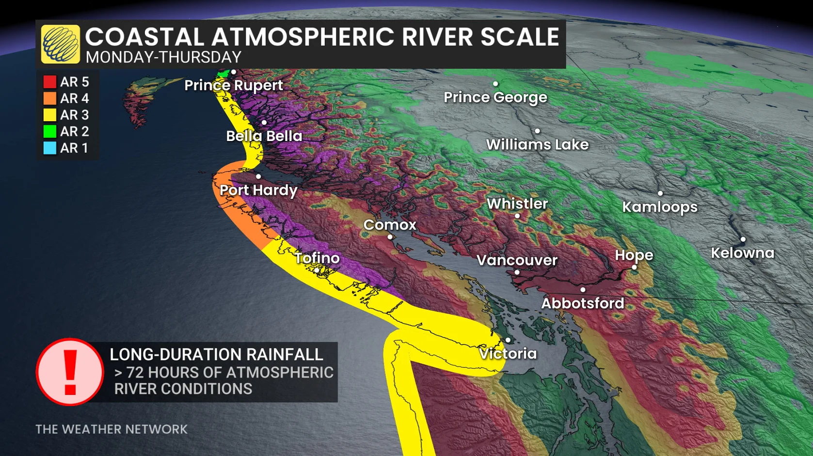
Brian Proctor, a meteorologist with Environment Canada, called those amounts a one-in-40-year event.
"It's a very significant amount of precipitation and very impactful," he said.
As of Monday afternoon, the north and central coasts were dealing with multiple power outages, including more than 600 customers without power due to a substation fault in Bella Bella.
Avalanche Canada says the heavy rain also brings an increased avalanche threat, marking the danger rating as high for large swaths of Vancouver Island, the southern and central coastal regions and along the Rockies.
"Of all the regions about to get walloped by this storm, the central Columbias is our top contender for weak layers producing large, destructive avalanches," Avalanche Canada says on its site, suggesting people "steer clear" of avalanche terrain.
B.C.'s River Forecast Centre upgraded high streamflow advisories to flood watches on Sunday for the northern and western portions of Vancouver Island, as well as for the Central Coast.
"Current forecasts indicate that multiple pulses of precipitation may impact the region through early to mid-week," the flood watch advisory for the Central Coast says.
WATCH: Heavy rainfall and high avalanche danger for British Columbia
This article was originally published for CBC News. Contains files from Radio West and The Canadian Press.