Dramatic spring pattern split spawns fires and floods

A short drive separates severe drought and widespread flooding this spring
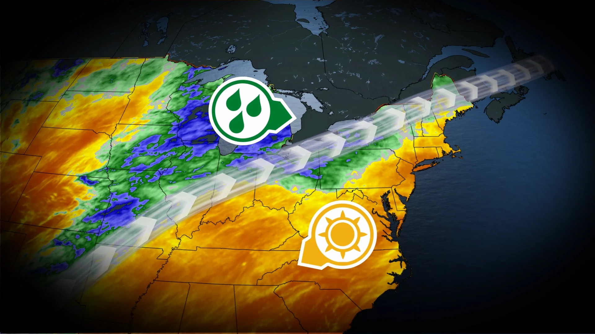
Sharp contrasts define this spring’s weather across North America as exceptional drought grows for some areas while persistent deluges drench others.
The worsening drought across the southeastern U.S. is directly linked to the flooding rains we’ve seen over Ontario. This pattern has also contributed to the unusually dry conditions growing across parts of the Prairie provinces.
DON’T MISS: El Niño may split Canada’s summer in two
Extreme heat and drought to the south
A major driver of this spring’s pattern is the relentless heat that roasted portions of the United States this spring. The western half of the country saw record-shattering temperatures soar as high as 44.4°C before the ridge migrated east.

The southeastern U.S. is enduring its worst drought so far this century, with 94.11 per cent of the region experiencing at least severe drought conditions according to the United States Drought Monitor.
This year’s rainfall deficit in Charlotte, North Carolina, is approaching 200 mm. Savannah, Georgia, has only seen about 27 per cent of its normal rainfall so far in 2026.
Crews are battling numerous fires throughout the southeast as a result of the growing drought. Lingering vegetation damage from Hurricane Helene in September 2024 has exacerbated the fire risk in the hardest-hit areas from Florida to western North Carolina.
Ontario drying out from spells of drenching rains
Things couldn’t be more different just a bit farther to the north. Repetitive storm systems following an active storm track around that ridge from Texas to Ontario have brought extensive rains to the region.

Numerous communities in southern and central Ontario have recorded or approached their wettest start to spring on record, recording 100 to 200 per cent of normal precipitation over the past 30 days alone.
Toronto-Pearson Airport reported 188 mm of rain between Mar. 1 and Apr. 21. Barrie has seen more rain in the past few weeks than it typically picks up during September, its wettest month of the year.
Prairies in a precarious position heading into fire season
An active storm track parked firmly over the Great Lakes often left portions of the Prairies high and dry.
While near- to above-normal precipitation amounts have fallen across much of Alberta and parts of Saskatchewan over the past three months, some areas are enduring a significant precipitation deficit.

RELATED: Prepare for an active wildfire season in British Columbia
We’ve seen less than 85 per cent of our normal precipitation in the past 90 days across the southwestern Prairies and throughout a wide portion of southern Manitoba. A significant precipitation deficit is also ongoing across much of the B.C. Interior.

This extended dry spell isn’t good news heading into fire season, which begins on May 1. Warmer temperatures will combine with lower-than-normal soil moisture to enhance the risk for wildfires in the areas most affected by the recent lack of precipitation.
Conditions look favourable for an active wildfire season across British Columbia, as well, with the emerging El Niño pattern we’ll face in the weeks and months ahead. Years with a similar setup have seen widespread fire activity.