From alpine snow to thunderstorms: B.C.'s wild Victoria Day weekend
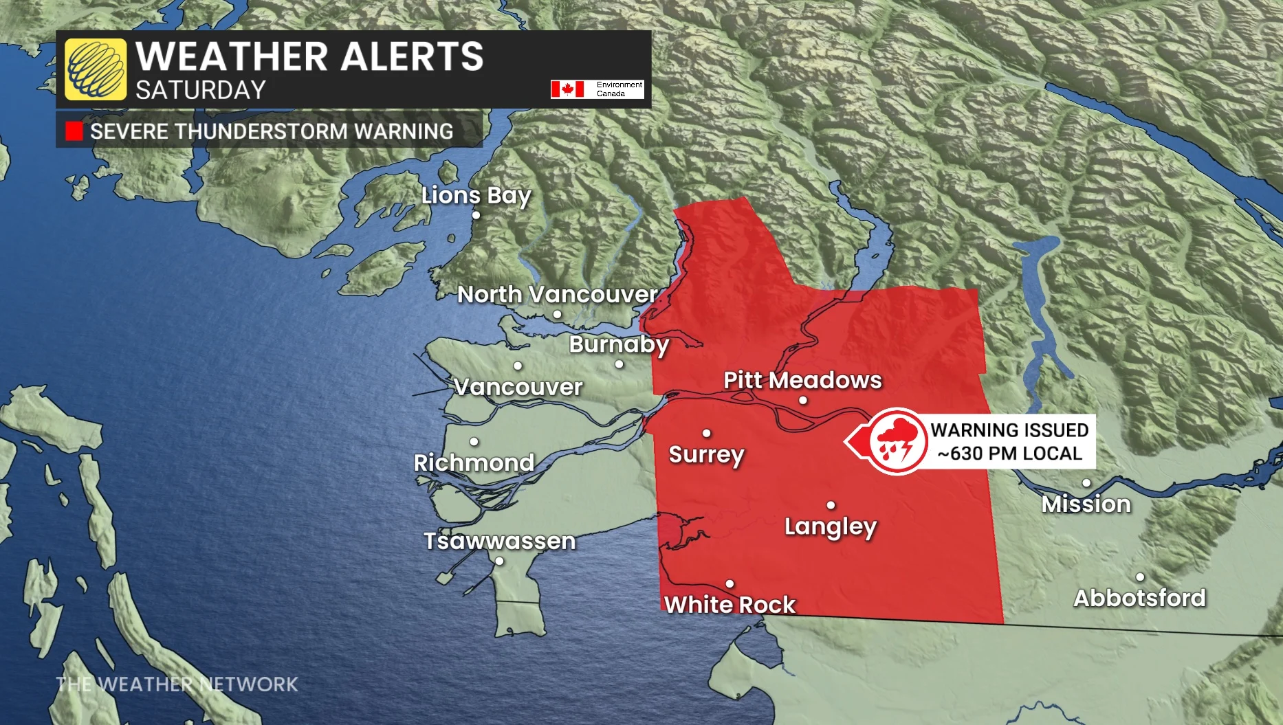
An eventful long weekend took place across British Columbia--one that featured a rare severe thunderstorm warning across the eastern sections of the Lower Mainland, with a funnel cloud sighting, along with heavy, alpine snow
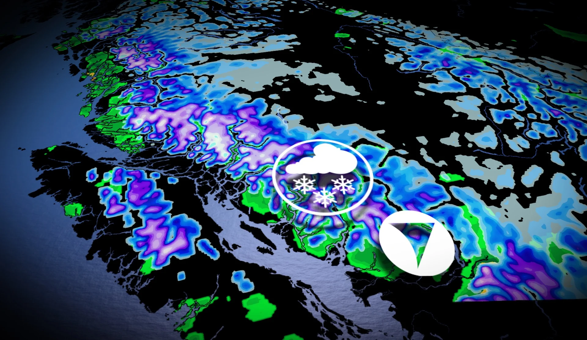
This weekend has been anything but lacklustre in B.C., weather-wise anyway, with parts of the province seeing severe thunderstorms while other areas dealt with a bout of heavy snowfall.
While B.C. is no stranger to spring thunderstorms, it's where the warning popped up that made it an unusual occurrence at this time of the year.
DON’T MISS: The pyrotechnic science behind Victoria Day firework displays
The storms popped up in the eastern Lower Mainland on Saturday, prompting a severe thunderstorm warning around 6:30 p.m. local time, with a funnel cloud spotted near Cloverdale, southeast of Surrey, according to the warning and reports that surfaced on social media.
Despite the accounts, nothing further developed from the sighting.
The infrequent nature of severe thunderstorm warnings caught the attention of at least one person on X.
Meanwhile, most of the local mountains and numerous, high-elevation travel routes--including Highway 3, Highway 97C and the Coquihalla--in the province recorded snowfall.

Whistler peak weather station, as of Monday morning, recorded a temperature of -5°C, unusually chilly for late May. The freezing level was near 1500 metres with widespread, accumulating snowfall ongoing this holiday Monday.
The colder-than-normal air originated from thousands of kilometres away from the Bering Sea, then moved across the province this weekend.
So, what caused such unsettled weather and the funnel cloud?
Cooler air associated with an upper-level trough was situated across the province, and with some instability in the environment, some stronger updrafts were able to develop––even without a large source of instability.
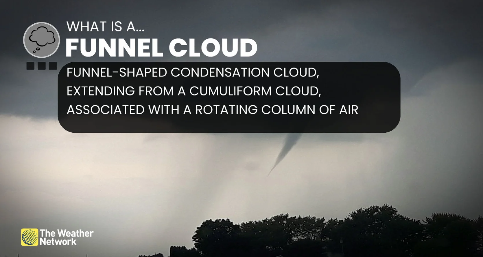
The funnel cloud was likely a non-supercell funnel, also known as a cold-air funnel, triggered by local convergence.
Below is just a selection of the storm and snow visuals that are making the rounds on social media.