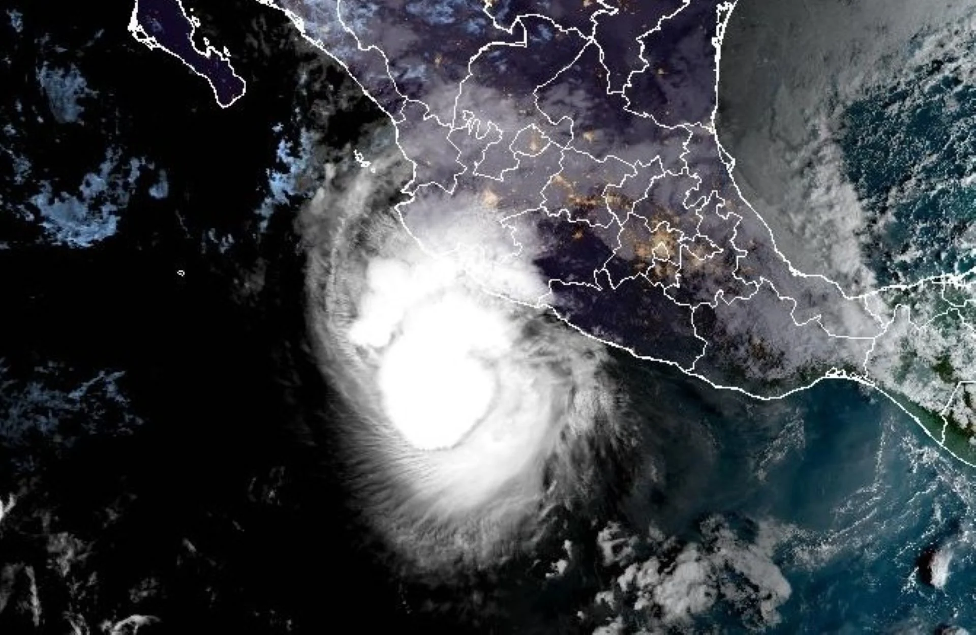
Hurricane Trudy will intensify as Mexico coast braces for flooding rains, winds

Hurricane Trudy loses organization as it tracks closer to the Pacific coast of Mexico. However, Puerto Vallarta remains the main population centre in its path.
Although it's now a Category 1 hurricane off Mexico's Pacific coast, Trudy is expected to climb back to a Category 2 soon as communities prepare for its extreme rainfall and threats of flooding and mudslides.
Trudy is the 10th hurricane to form in the Eastern Pacific this year--the first time since 2018 the basin has seen that feat, indicating an unusually active season.
Hurricane and tropical storm warnings are in effect for parts of the Mexican coast. residents should monitor local forecasts and follow emergency officials' instructions.
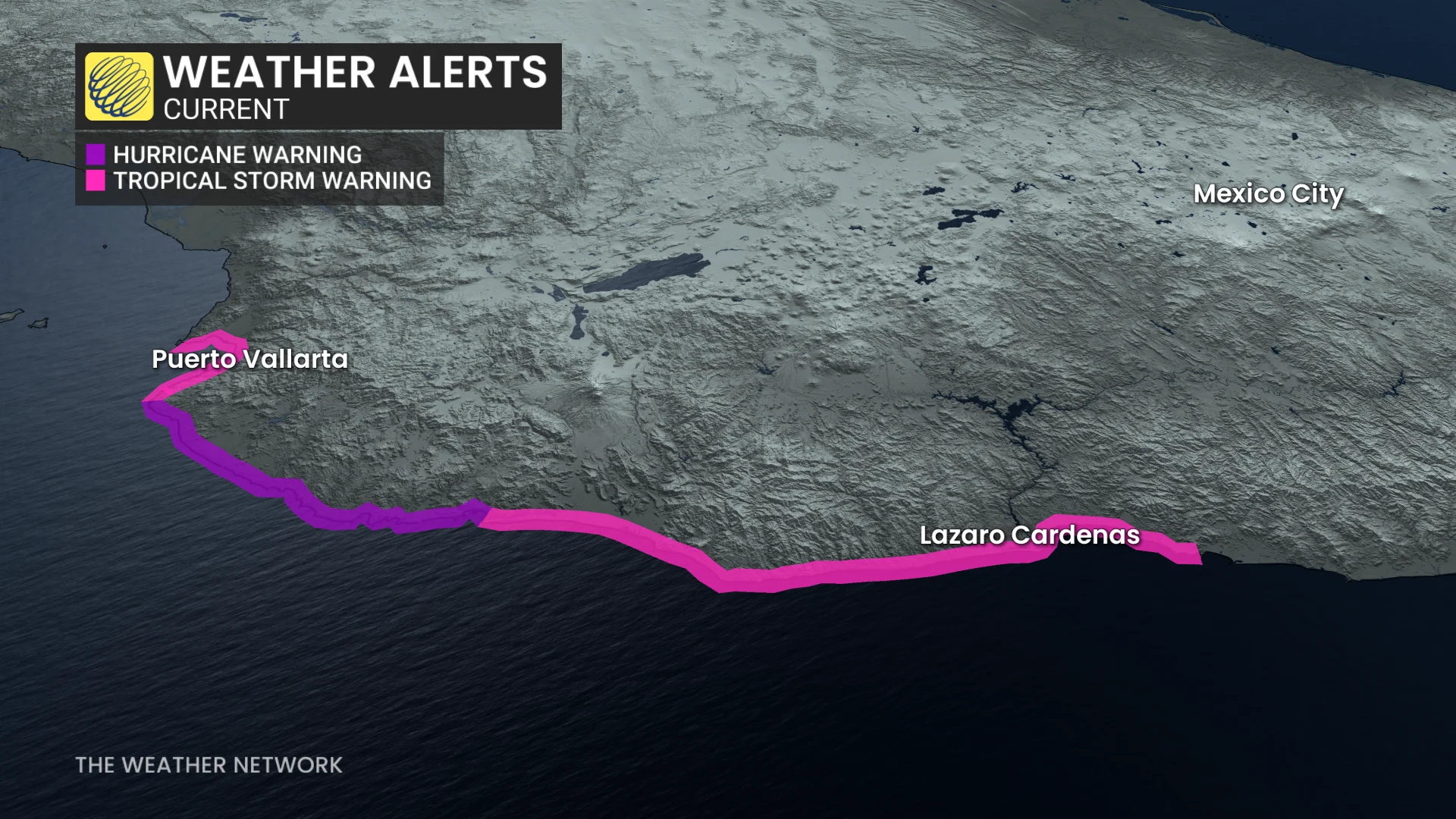
Trudy could strengthen before weakening near shore
Trudy is currently offshore, situated a few hundred kilometres south-southeast of Manzanillo, Mexico.
On the forecast track, the centre of Trudy will approach the coast of southwestern and west-central Mexico on Saturday, and pass near the coast tonight into Sunday.
Maximum, sustained winds are near 150 km/h with higher gusts. Some strengthening remains possible today, putting the hurricane back to a Category 2 storm, followed by weakening beginning by Sunday.
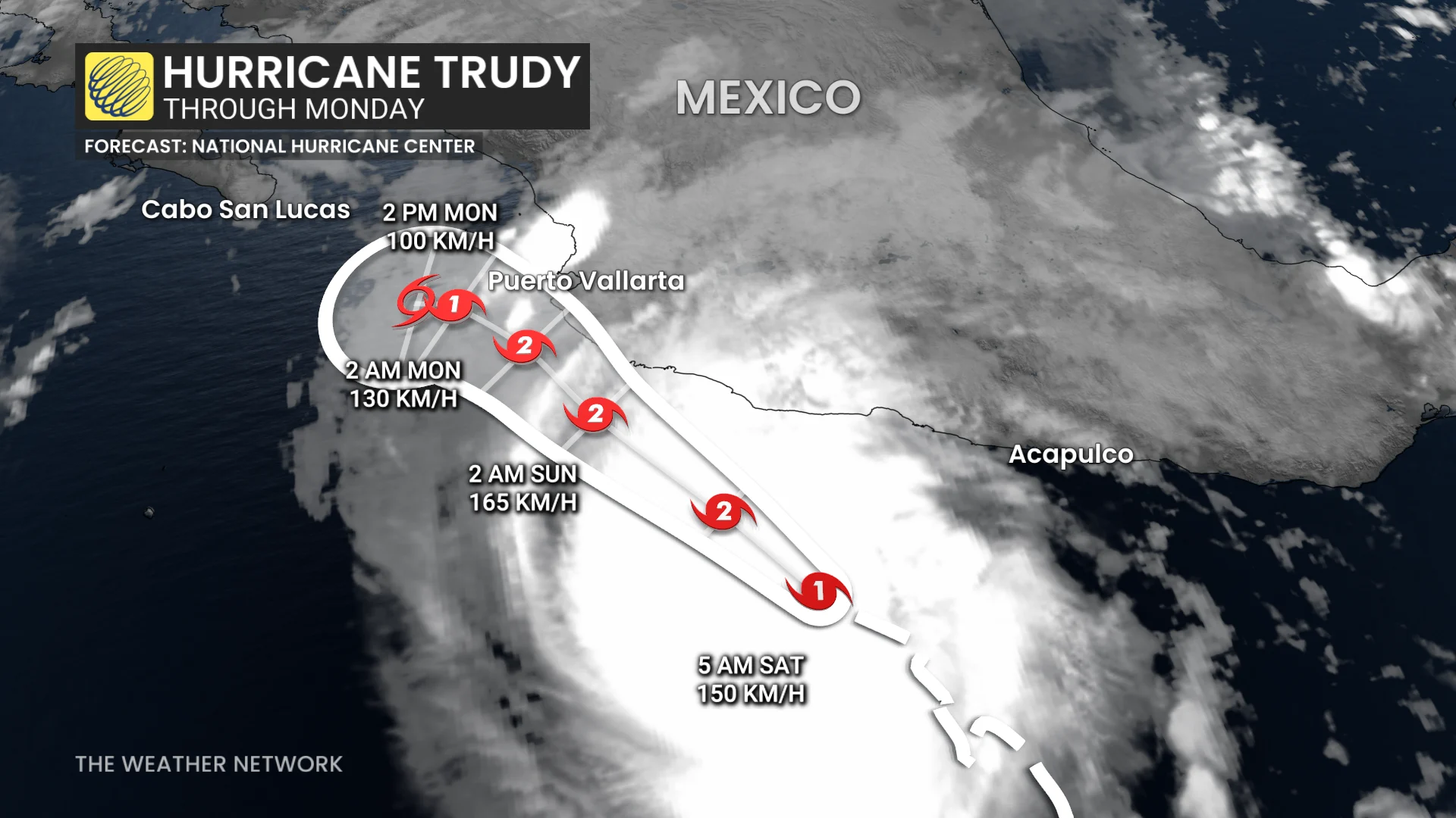
Trudy's longer-range movement could be similar to Hurricane Simon, which stalled offshore near the Baja California peninsula.
Flooding and mudslides possible this weekend
Damaging winds, storm surge, and heavy rainfall remain the most serious threats, particularly along the coast. Coastal flooding from storm surge is possible in areas of onshore winds. Near the coast, the surge will be accompanied by large and destructive waves.
Like-threatening flooding and mudslides are possible from Acapulco to Puerto Vallarta.
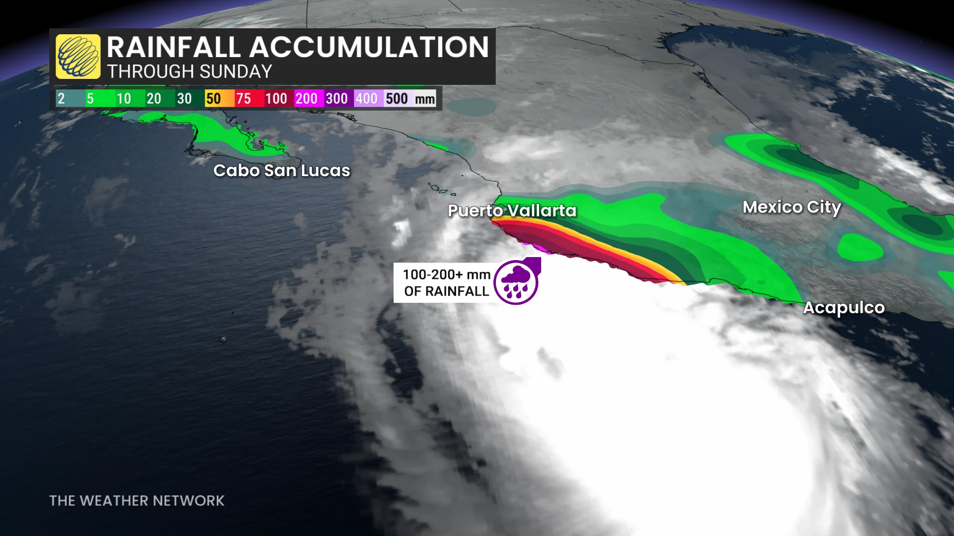
The two major travel destination cities won’t see the worst of the rain but 300-400 mm is possible between the two where hurricane and tropical Storm warnings are in place.
"This rainfall may produce life-threatening flooding and mudslides, especially in areas along steep terrain," the U.S. National Hurricane Center (NHC) warns.
Thumbnail courtesy of NOAA.