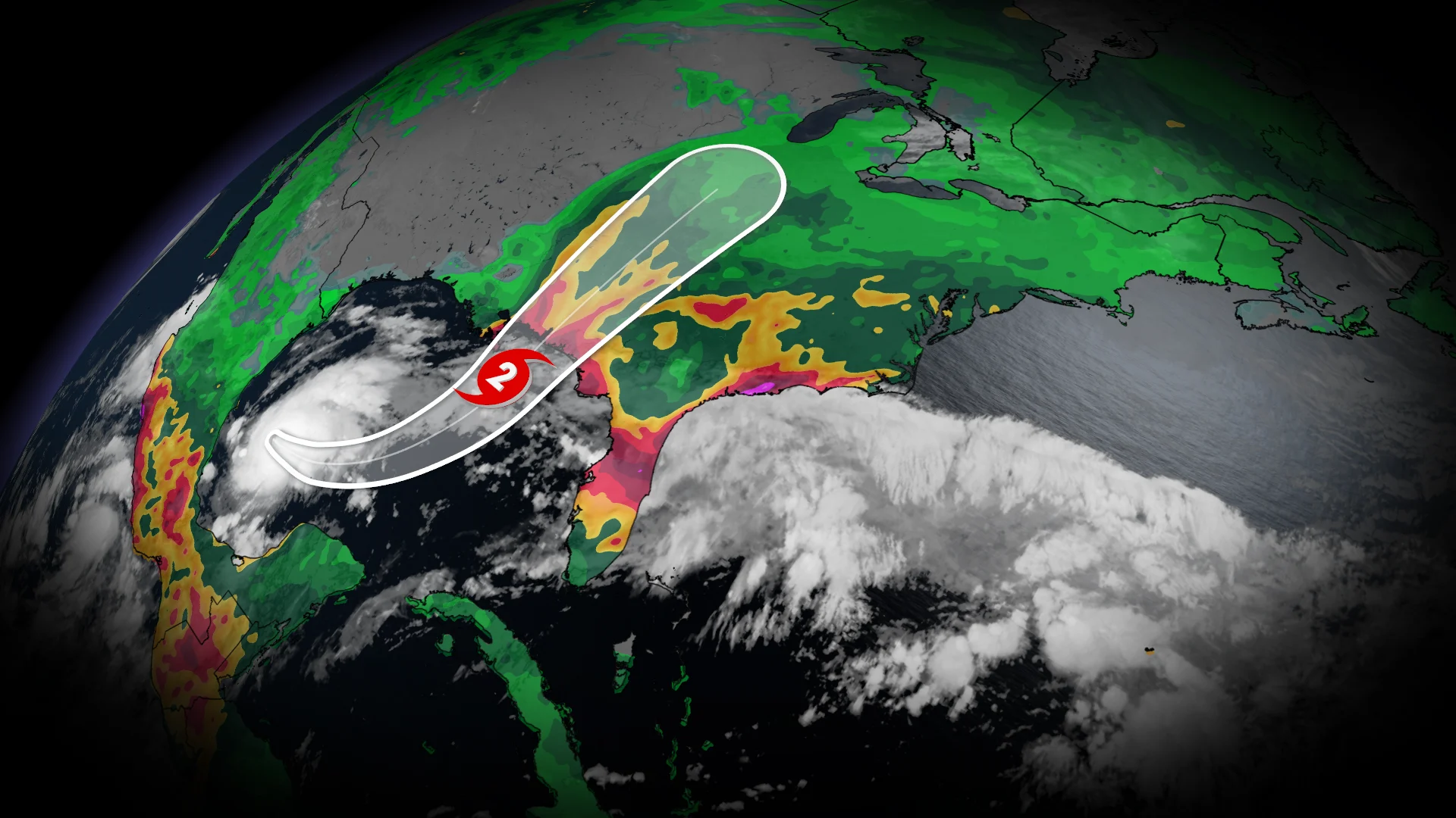
Isaias could become Atlantic’s first hurricane, potential Canadian impacts

Isaias has arrived in the Gulf of Mexico, and is forecast to become the Atlantic's first hurricane of the season--putting interests in the Yucatan Peninsula and the northern U.S. Gulf Coast on alert
The lack of hurricanes in the Atlantic Ocean this season can at least be partly blamed on a "super" El Niño in progress.
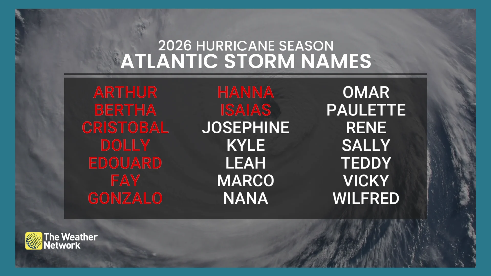
However, Tropical Storm Isaias has arrived and is expected to intensify further. It is forecast to reach hurricane status to become the Atlantic basin's first of the season.
Residents in the Yucatán Peninsula and along the northern U.S. Gulf Coast are advised to closely monitor this system's development.
Isaias comes to life, poses threat to land
By early Wednesday morning, Tropical Storm Isaias came to life in the Gulf of Mexico.
The storm is expected to track slowly eastward or east-northeastward during during the next couple of days while it moves in the flow near the base of a deep-layer trough.
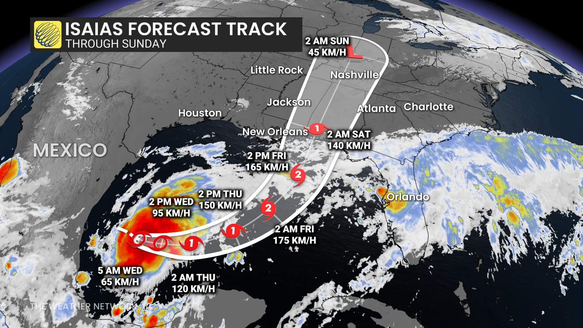
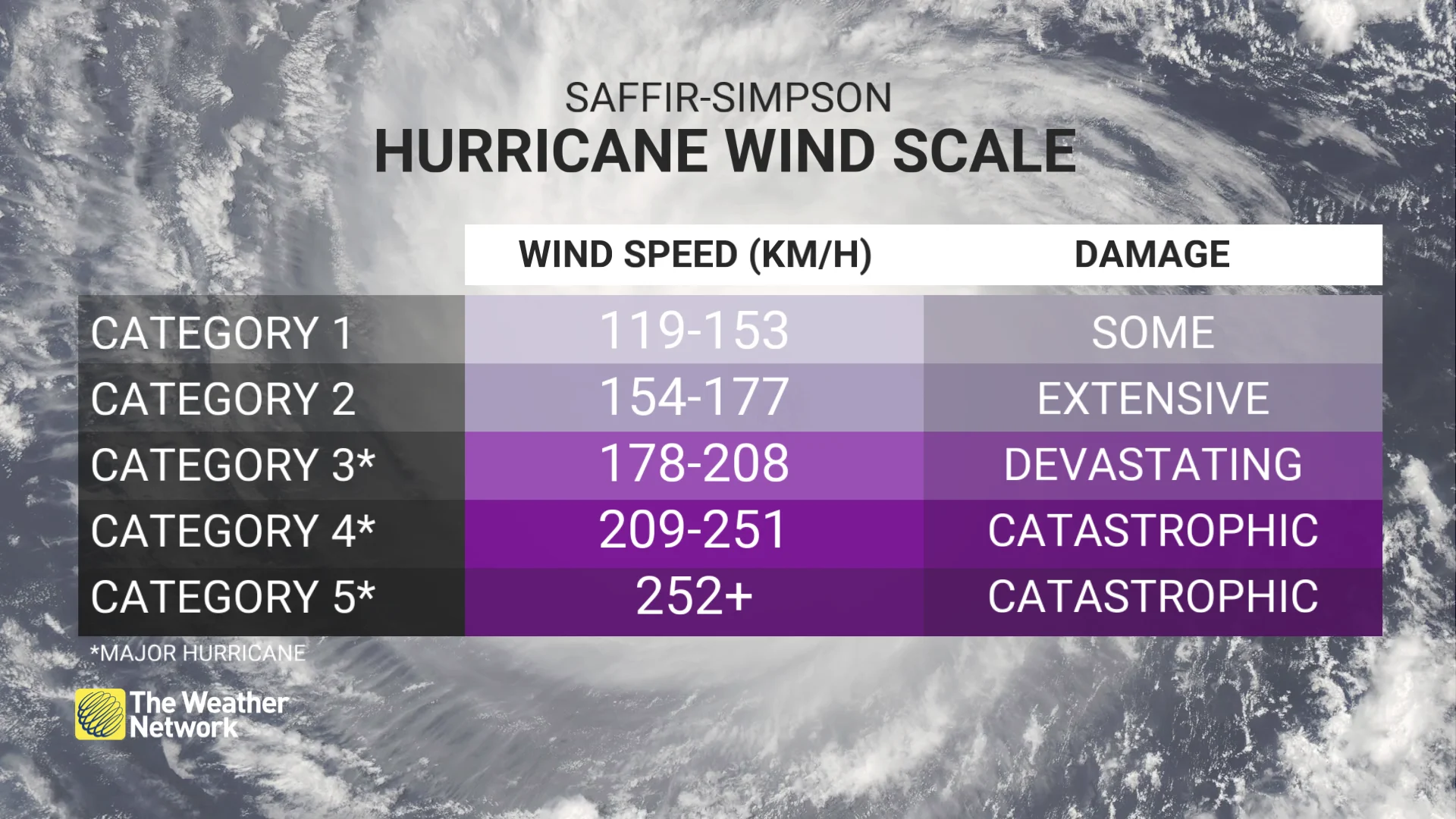
The storm is forecast to strengthen steadily and is expected to become the Atlantic’s first hurricane of the season by Thursday. This would mark the latest first hurricane development in the Atlantic basin since 1966.
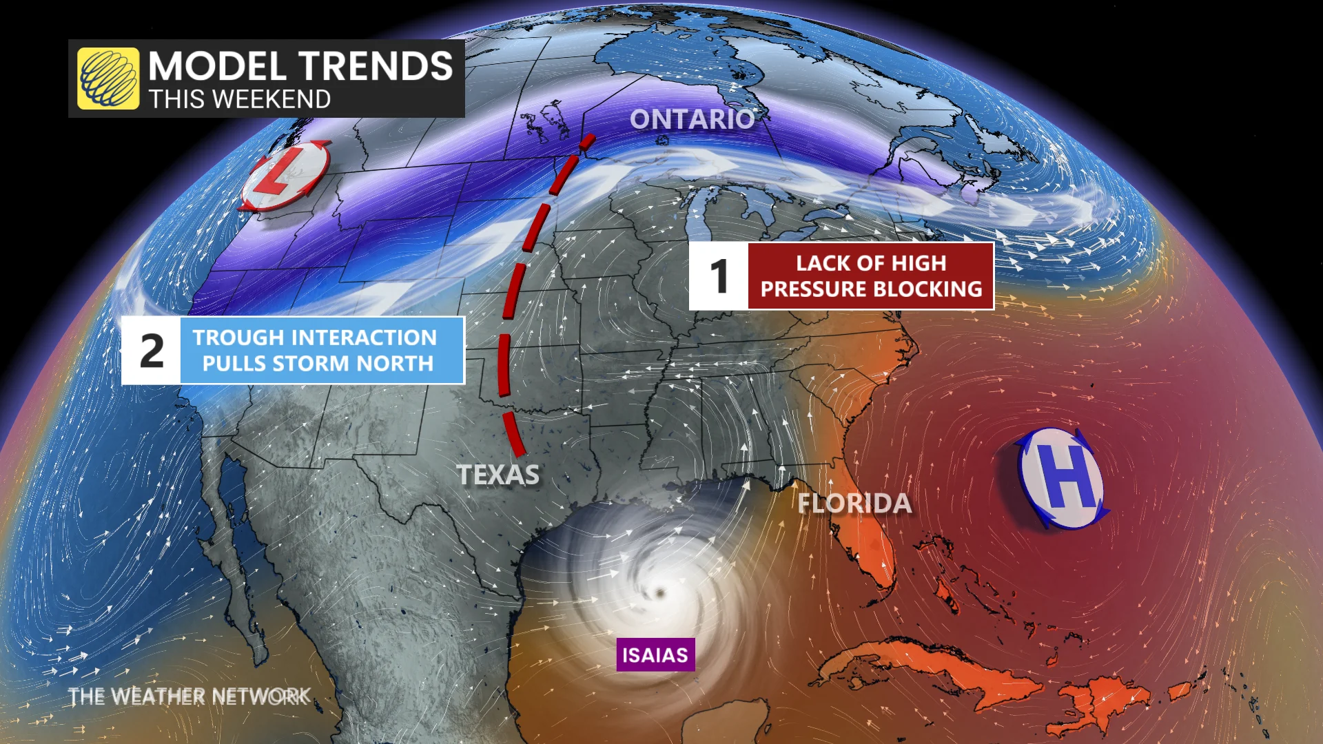
By Friday, a sharp turn to the northeast is expected when a trough forms over Texas and a ridge strengthens over it.
There is an increasing risk of dangerous wind and storm surge impacts along portions of the northern Gulf Coast. The system will bring areas of heavy rainfall to the central U.S. Gulf Coast on Friday.
The environmental conditions and model guidance are showing strengthening and reaching its peak before reaching land. It is still expected to be a dangerous hurricane when it makes landfall near Mississippi and Florida’s Panhandle.
It is expected to produce rainfall amounts of 50-100 mm through Thursday across coastal portions of the Bay of Campeche, with isolated, higher amounts possible in the states of Campeche and western Yucatan.
From Friday through the weekend, the system is expected to produce rainfall amounts of 75-150 mm, with localized totals up to 250 mm, across the central U.S. Gulf Coast extending from southeastern Louisiana to the Florida Panhandle.
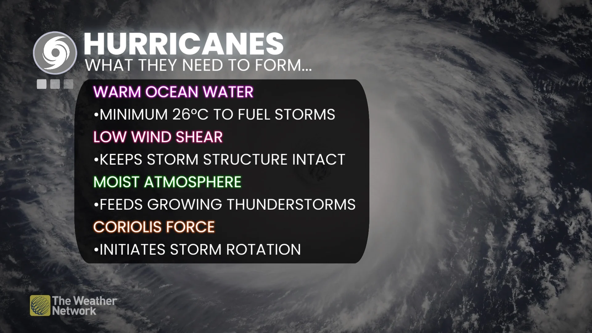
Flash and urban flooding, along with isolated river flooding, will be possible.
Canadian impacts? Southern Ontario's weekend to be watched
Ontario's Thanksgiving weekend is currently expected to start off dry and mild, but the remnants of Isaias could bring rain for parts of the region by Sunday.
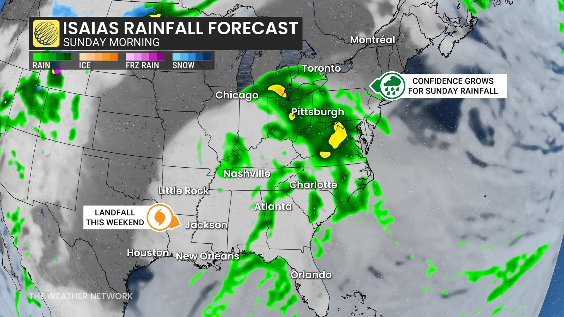
Without a strong, high-pressure system in place, there is little to block the storm's progression northward. Current forecasts suggest the remnants of Isaias could track towards the Great Lakes early on Sunday morning.
This brings a growing chance of rain bands clipping southern Ontario between Sunday and Monday.
However, the extent of rainfall and its precise timing will depend on how far north the system tracks and when it shifts eastward.
Uncertainty remains high regarding the storm's exact path.
Stay tuned to The Weather Network for more details.
'Super' El Niño contributes to lack of hurricanes
With forecasters now confirming a "super" El Niño in place, the phenomenon is driving the Pacific and Atlantic basins'respective hurricane seasons this year. These warmer-than-normal waters are having a profound effect on the atmosphere across the region.
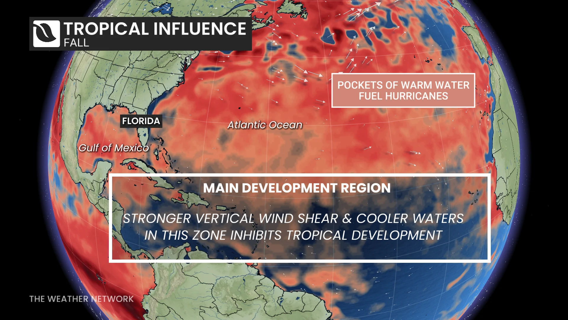
Tropical systems are thriving in the rising air and calm environmental winds throughout the northeastern Pacific. Meanwhile, this same pattern has increased the amount of disruptive wind shear blowing east over the Atlantic basin, shredding apart potential disturbances before they can develop any further.
With files Dennis Mersereau, a digital journalist and weather specialist at The Weather Network, and Nathan Howes, a digital reporter at The Weather Network.