
The historic October snowstorm that brought 30 cm to Ontario

Some areas saw more than 50 cm of snow weeks before Halloween
An unusually early band of lake-effect snow caused millions of dollars in damages when it blew off Lake Erie during the middle of October 2006.
Dubbed the “October Surprise” by residents affected by the storm, the potent squall produced snowfall rates as high as 10 cm per hour in the hardest-hit areas.
DON’T MISS: Snow and ice are heavy hazards that can damage trees, roofs
Lake-effect snow season typically runs from late autumn into the winter months. But conditions occasionally align to bring hefty totals early in the season.
One of those early-season setups developed during the second week of October 2006. A strong low-pressure system over the Upper Midwest and northern Ontario sent a potent cold front sliding east across the Great Lakes.
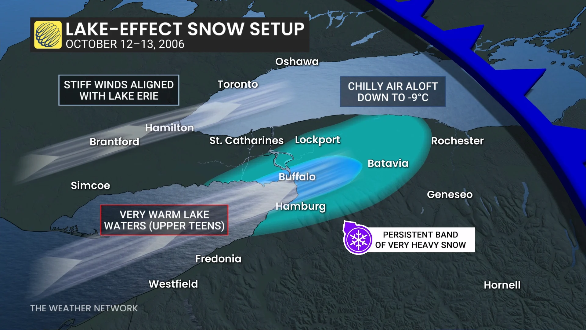
Water temperatures on Lake Erie ran several degrees warmer than normal for this point in the year, with surface readings hovering in the middle to upper teens. Meanwhile, the storm system ushered in unusually cold air aloft.
The sharp contrast between warm waters and cold air triggered convection over Lake Erie. Strong, persistent winds oriented perfectly down the length of the lake organized that convection into one long squall.
A rain-snow mix began downwind from the lake during the mid-afternoon hours on Oct. 12. Falling temperatures forced the precipitation to change over to snow by the evening commute.
This heavy, wet snow added significant weight to tree limbs and power lines, causing widespread damage and power outages throughout the Niagara Peninsula and western New York.
Snowfall rates increased as temperatures continued to drop through the overnight hours, allowing a transition to fluffy snow that accumulated at a much quicker rate. The lake-effect squall eventually fizzled out the following day.
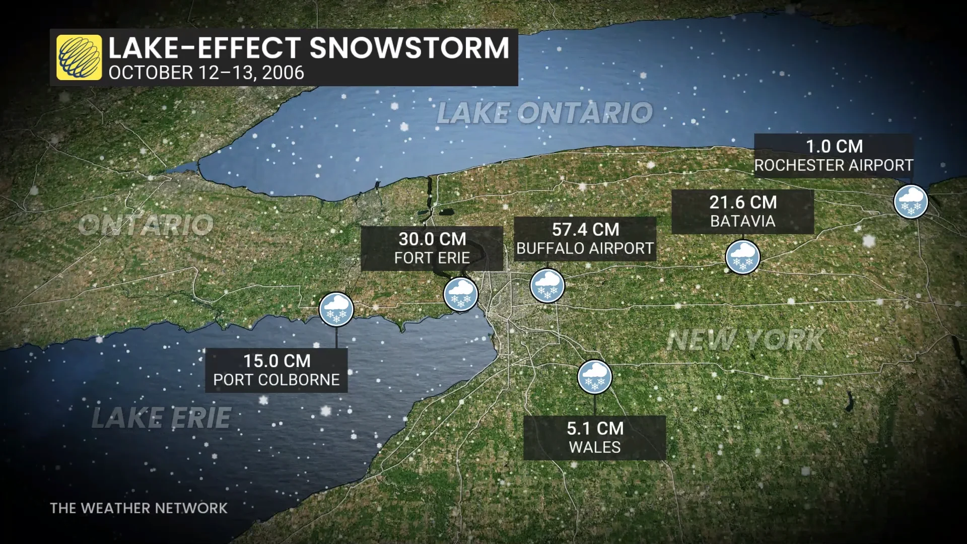
The squall left behind a sharp gradient in snowfall totals. The U.S. National Weather Service office east of Buffalo reported the highest amount with 57.4 cm on the board. 30 cm fell in Fort Erie, while Port Colborne reported 15 cm of snow from the event. St. Catharines, just a short drive away, reported only a trace of accumulation.