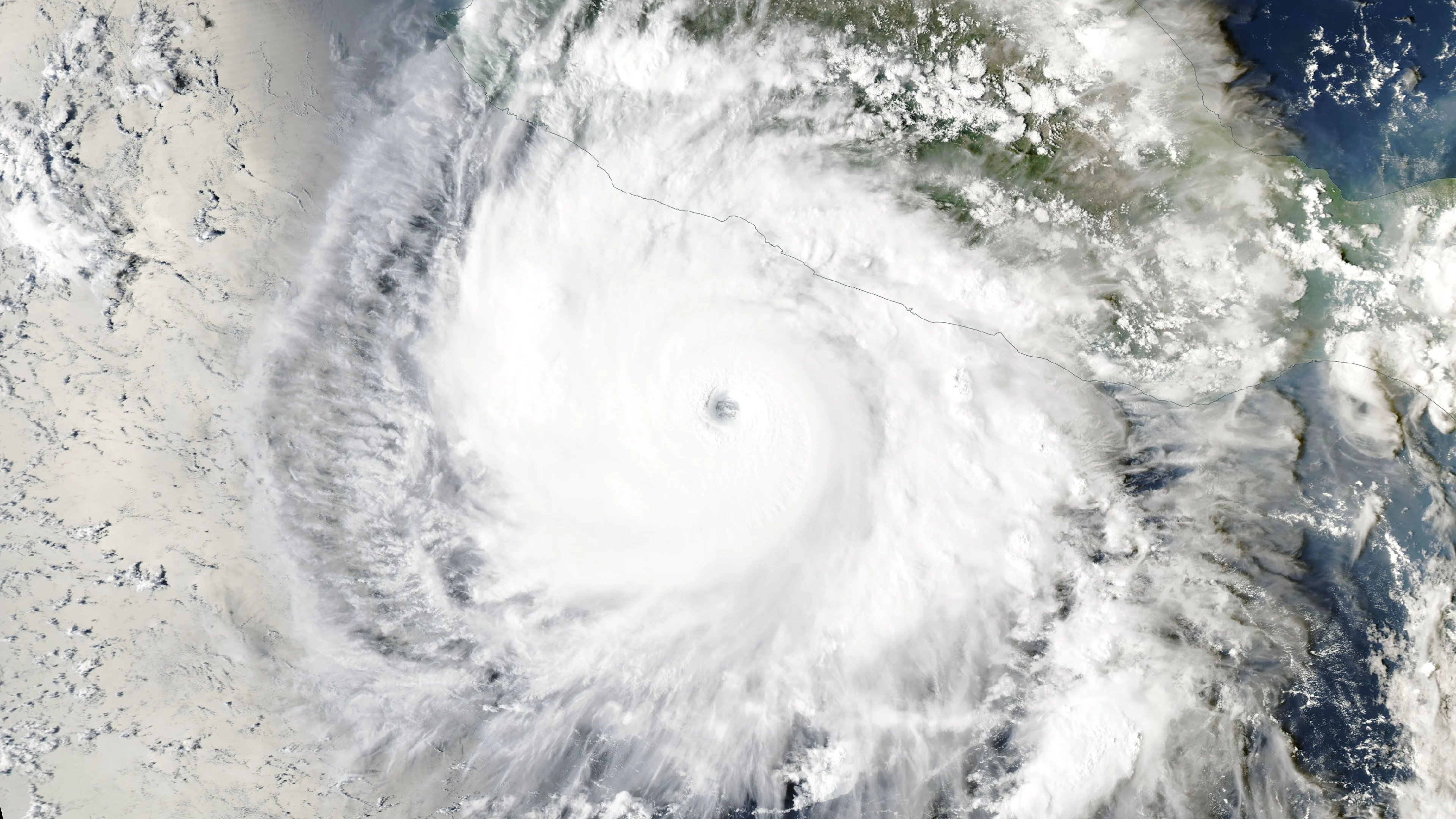
Polo cements status as Pacific’s second-most intense hurricane

The storm has reached Category 5 intensity several times throughout its lifespan
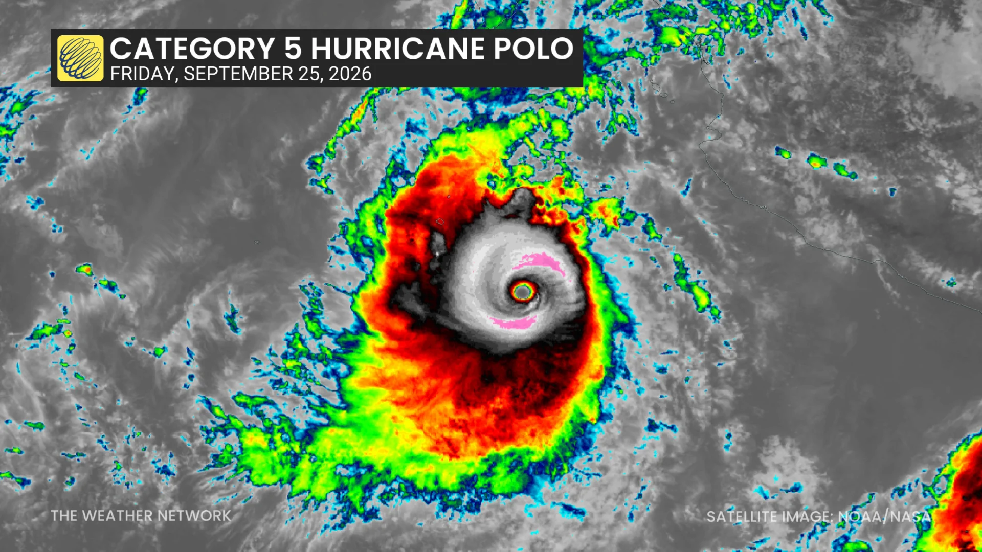
Hurricane Polo will live in the records as one of the most intense hurricanes ever observed in the eastern Pacific basin.
A near-historic El Niño fuelled the perfect setup for the hurricane to approach the upper limit of how strong a tropical cyclone can grow.
DON’T MISS: What’s the difference between hurricanes, typhoons, and cyclones?
A monstrous eastern Pacific hurricane
Polo formed off Mexico’s west coast amid an extremely active hurricane season in the eastern half of the Pacific Ocean.
Very warm water temperatures, relatively calm wind shear, deep atmospheric moisture, and conditions favourable for rising air allowed one disturbance after another to develop throughout the region through the summer and early autumn.
The system rapidly intensified from a tropical depression to a scale-topping Category 5 hurricane in about 40 hours, marking one of the fastest rates of strengthening ever observed in this part of the world.
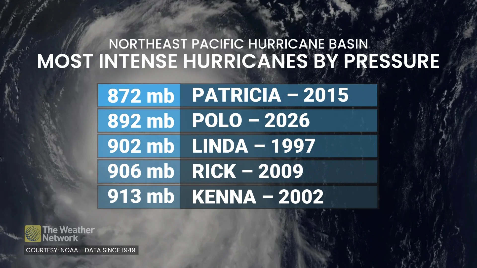
Hurricane Hunters found that the storm reached peak intensity on Tuesday, Sept. 22, with maximum sustained winds of 285 km/h and a minimum central pressure of 892 mb. For context, standard atmospheric pressure at sea level is 1013 mb.
Only one hurricane in the eastern Pacific has generated a lower air pressure. Hurricane Patricia bottomed-out at 872 mb in October 2015 when it became the most powerful tropical cyclone ever observed with maximum winds of about 345 km/h.
Category 5 storms are rare
It’s exceptionally rare for a hurricane to reach Category 5 intensity, with only about 8 per cent of all hurricane-strength storms around the world achieving this feat since reliable records began in the mid-1900s.
Such a formidable hurricane requires near-perfect conditions and a solid internal structure to reach that kind of strength. Most storms that produce scale-topping winds can only maintain that intensity for a day or so before stumbling and losing steam.
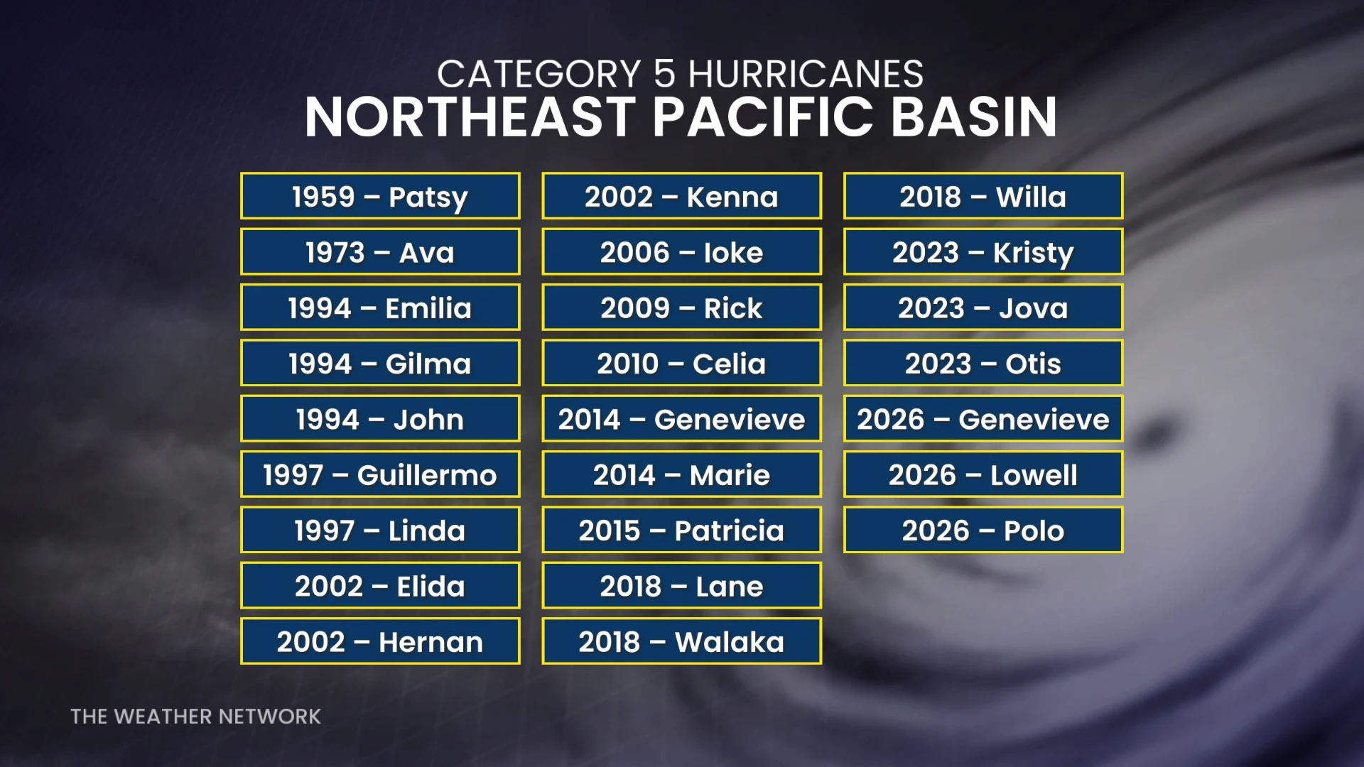
Hurricane Polo is the 25th Category 5 storm observed in the eastern half of the Pacific since 1949, and it’s the third such storm this year behind Genevieve and Lowell. Several other seasons, including 2002 and 2018, have produced three Category 5 storms.
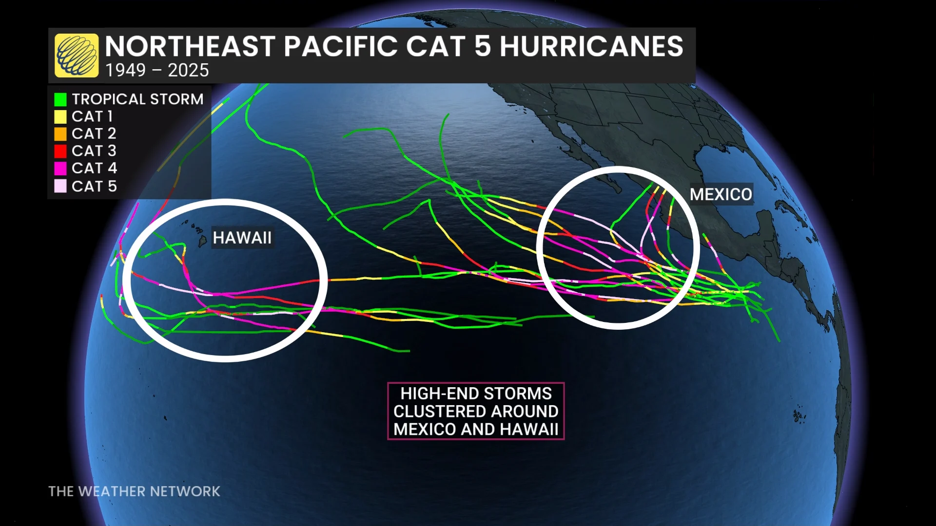
Most of the region’s high-end storms hit their peak intensity off the western coast of Mexico and south of Hawaii, areas where conditions are most favourable for strengthening. These storms typically remain out to sea due to prevailing winds.
Only one storm on record in the eastern Pacific has made landfall as a Category 5 hurricane.
Hurricane Otis directly struck the popular resort town of Acapulco, Mexico, on Oct. 25, 2023, with maximum sustained winds of 260 km/h. Ferocious winds and a major storm surge caused widespread structural and infrastructure damage. Otis reportedly caused nearly 100 fatalities and tens of billions of dollars in damages.