Severe thunderstorm threat as hot, muggy air hits southern Ontario
Severe thunderstorms expected Wednesday in southern and central Ontario as the heat and humidity builds
Increasing instability and an approaching cold front will heighten the potential for severe weather across parts of central and southern Ontario through Wednesday.
In addition to the storm risk, the region faces elevated heat, with some major cities potentially reaching their first 30°C reading of the year.
DON'T MISS: The Weather Network's exclusive summer 2025 forecast
Wildfire smoke remains a factor as well, which will continue to make for some hazy skies and red sunsets and sunrises. Wildfire smoke often limits storm development, and upper-level smoke is expected to persist through Wednesday.
Be sure to keep an eye on local weather alerts for your area before heading out, and be prepared to adjust any outdoor plans as conditions change.
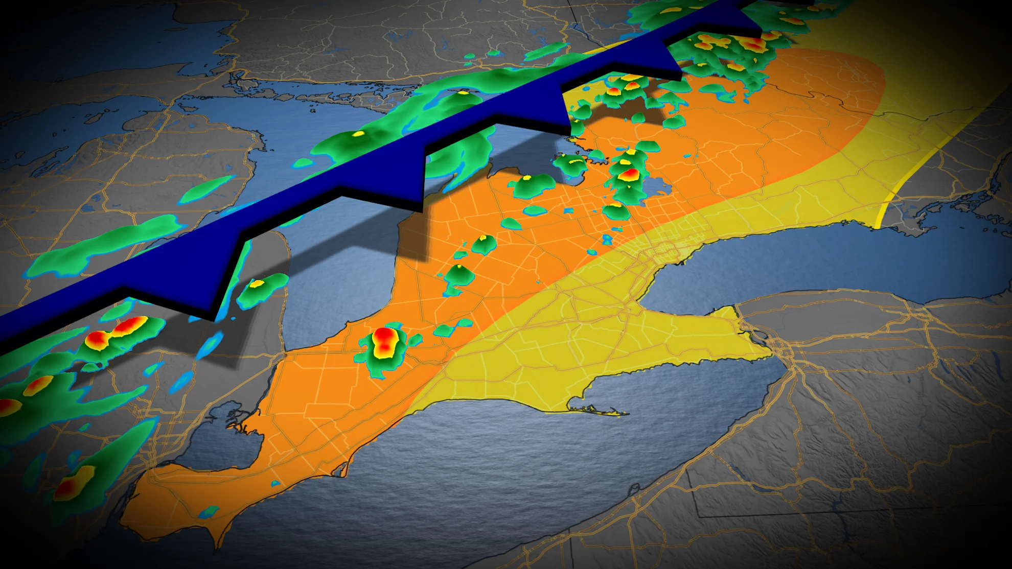
Severe thunderstorm threat builds across southern Ontario
The risk for rain showers and thunderstorms will shift south into central and southern Ontario Wednesday, fuelled by a hot and muggy air mass.
Afternoon highs are expected in the high 20s, with some areas likely reaching 30°C. The heat will increase atmospheric instability, pulling additional energy into the region and raising the chances for severe storms to develop.
Some storms may bring wind gusts of 80–100 km/h, and the potential for quarter-sized hail.
WATCH: Closely tracking the storm risk for Wednesday
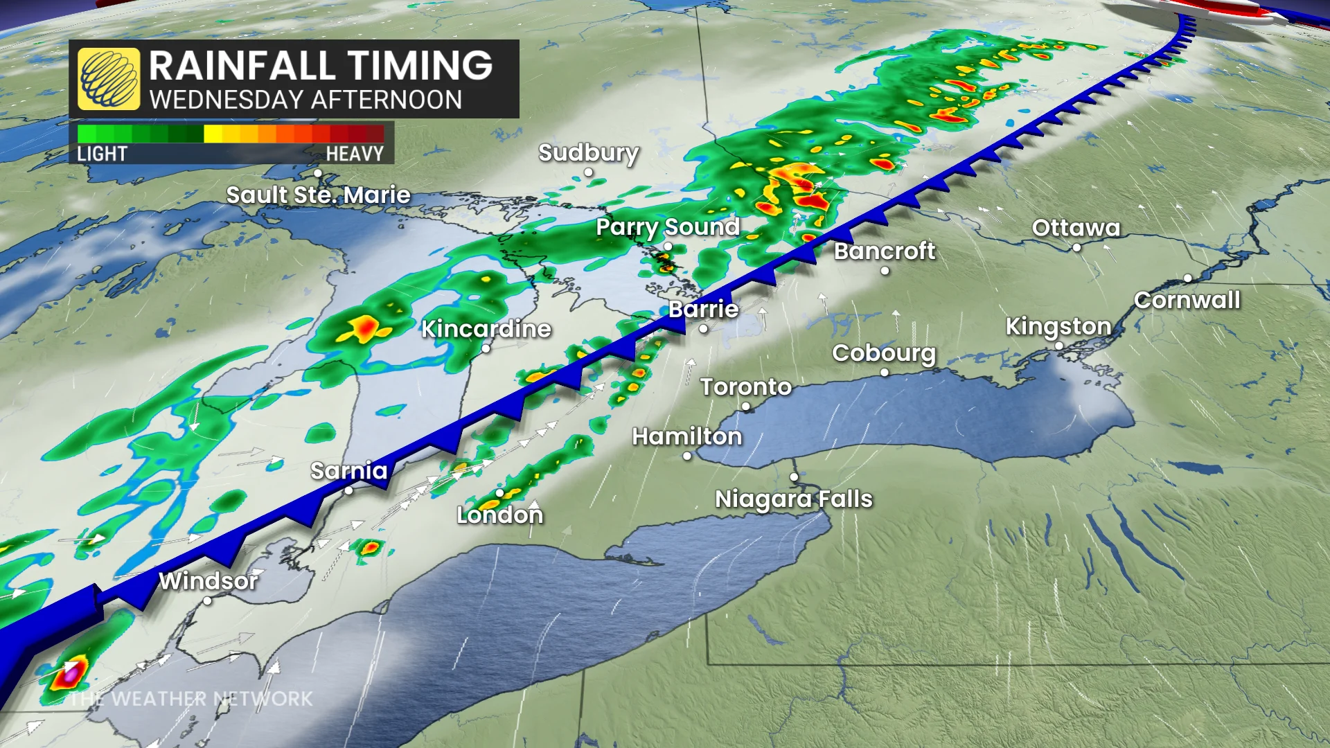
While much of the day will remain dry along the 401 corridor, storms are possible later in the evening. Severe thunderstorms are most likely between 4 p.m. and 7 p.m., particularly in areas from Sarnia to Barrie.
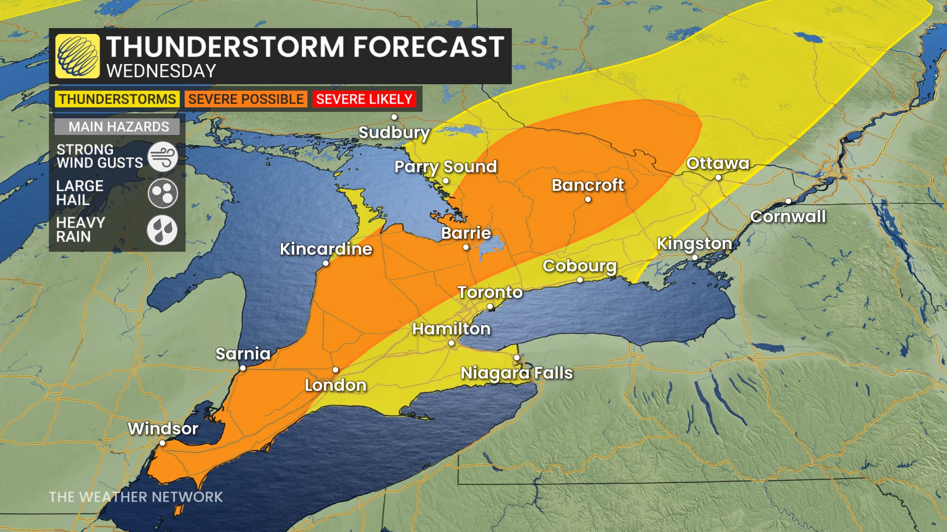
Uncertainty remains regarding how far south the severe weather will extend.
DON'T MISS: The Weather Network's wildfire hub
Some areas could experience back-to-back storms, increasing the risk of localized flooding. Residents in the affected regions should monitor forecasts for updates.
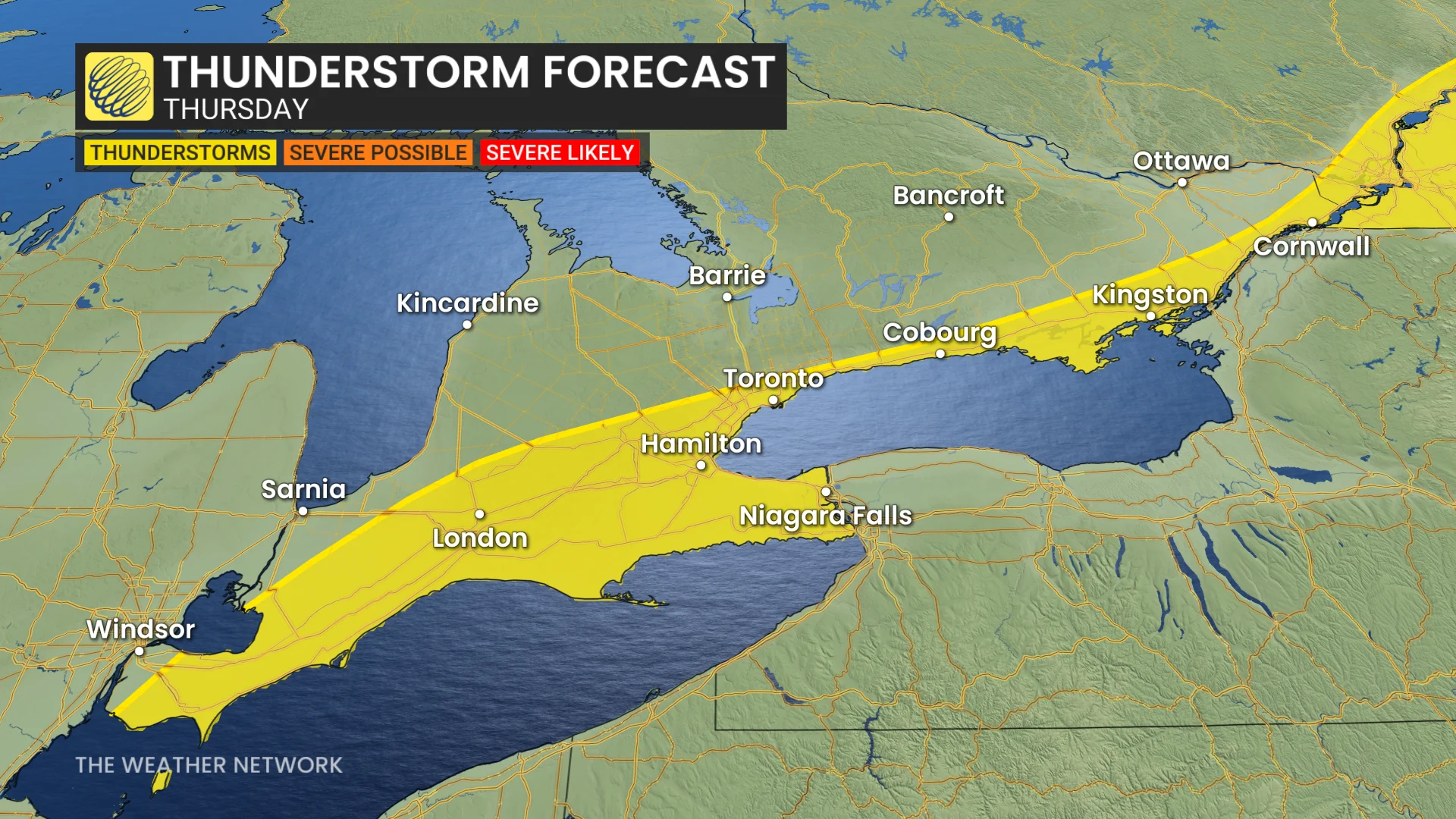
Thunderstorm threat lingers into Thursday
Showers and thunderstorms are possible during the first half of the day for regions along and south of the 401 corridor.
June will feature a quick transition to much warmer, early-summer weather with above-normal temperatures expected to dominate across Ontario. However, we do not expect an excessively hot pattern. Temperatures will still be changeable with showers and thunderstorms at times.
WATCH: Wildfires this year could put the brakes on stormy weather
Continue to follow The Weather Network for the latest weather updates across Ontario.