Texas storms triggered a ‘large and deadly flood wave’

At least 43 people died, and many more remain missing, after historic flooding in portions of central Texas
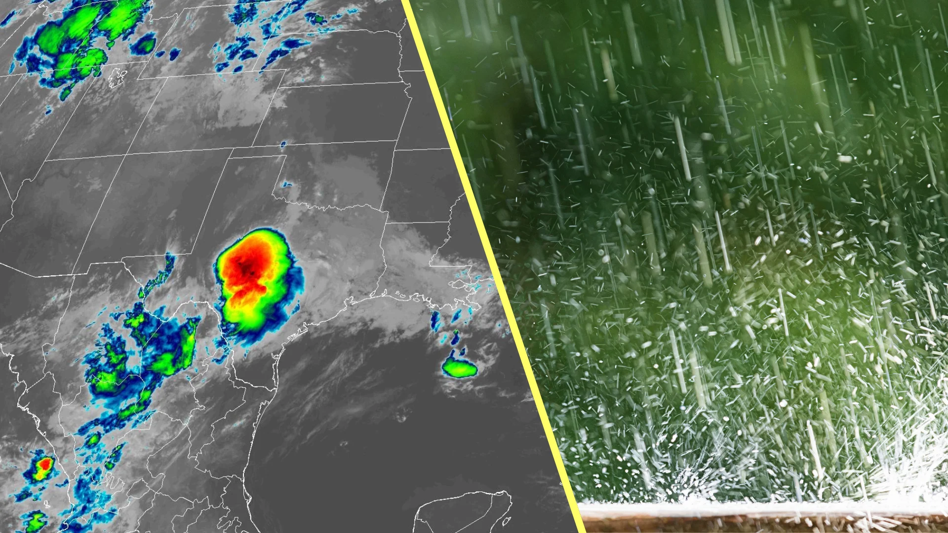
Thunderstorms that stalled over central Texas early Friday morning unleashed catastrophic flooding along the Guadalupe River.
Waters rose nearly 10 metres in just minutes as downpours fell on the arid landscape, killing at least 27 people and leaving many more reported missing—including both children and adults who were camping at the time.
Here’s a look at how the atmosphere produced an unfathomable deluge in such a short period of time.
RELATED: Death toll from Texas floods reaches 43; many still missing
Stationary thunderstorms lead to tragic flash flooding
The atmosphere over central Texas was primed for flash flooding by the end of the week.
Remnants of Tropical Storm Barry helped push excess moisture over the region. Favourable winds and hilly terrain boosted the development of thunderstorms west of San Antonio and Austin during the overnight hours Thursday into the early morning on Friday.
Thunderstorms kept redeveloping over the same areas for hours at a time. 25 to 50 mm of rain fell across the region in short order—with downpours continuing at a rate of 50 to 75 mm per hour.
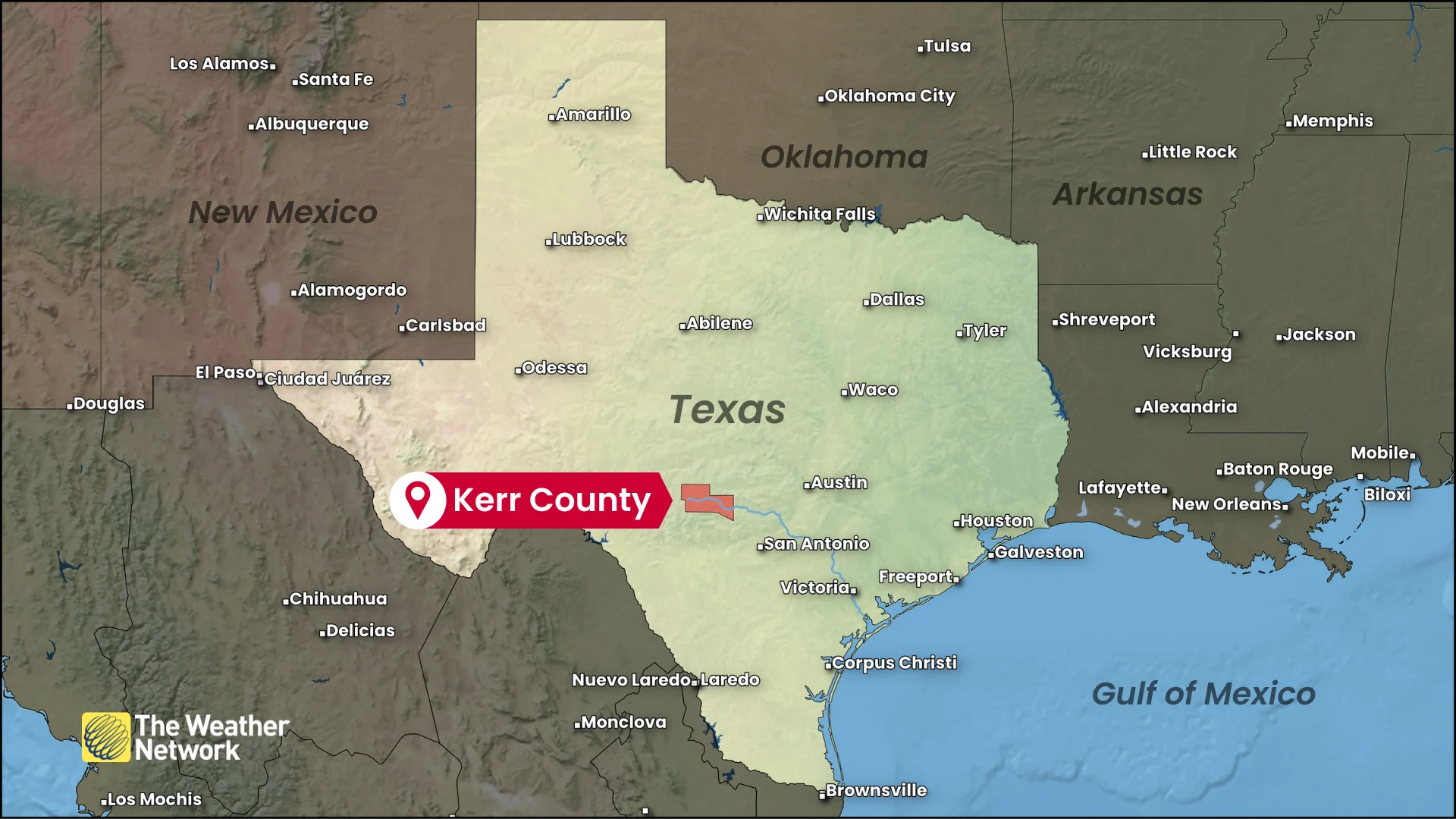
The rain kept coming at an astonishing rate. One rain gauge west of Kerrville, Texas, measured 302 mm of rain between Thursday and Saturday—most of which fell over the course of several hours early on Friday.
River gauges rose at incredible rates
Meteorologists with the U.S. National Weather Service (NWS) issued the first flash flood warning for Kerr County, Texas at 1:14 a.m. local time.
Just after 4:00 a.m. local time on Friday, forecasters upgraded the flash flood warning to a flash flood emergency—enhanced wording used to convey the severity of the situation to those in harm’s way.
River gauges in the region began to show a tremendous increase in water depth and flow rates as the excess runoff gushed across the dry, arid landscape.
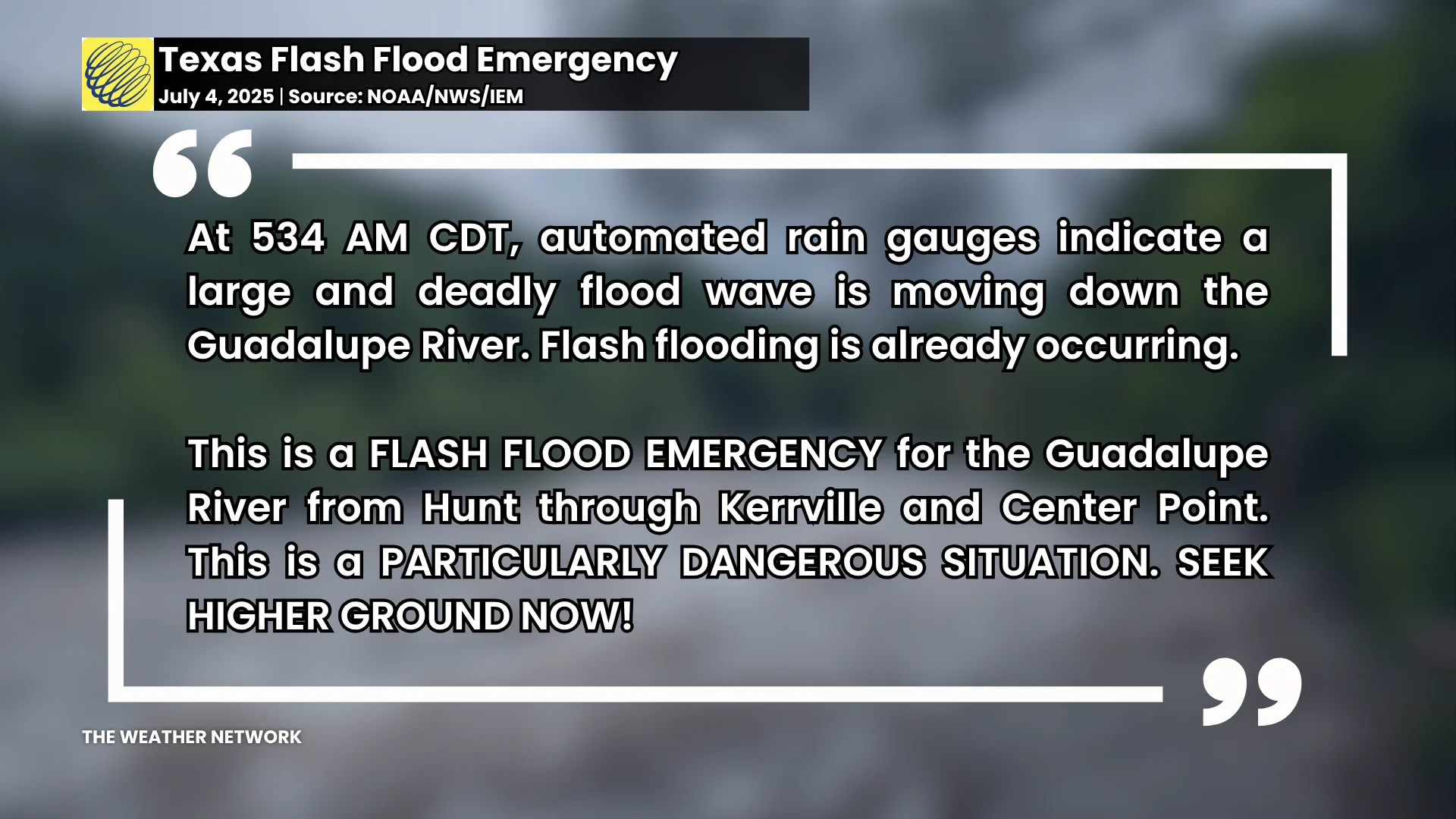
Meteorologists could see this influx of water in the river observations, prompting them to issue a dire message in another update around 5:30 a.m. on Friday:
“Automated rain gauges indicate a large and deadly flood wave is moving down the Guadalupe River. Flash flooding is already occurring.”
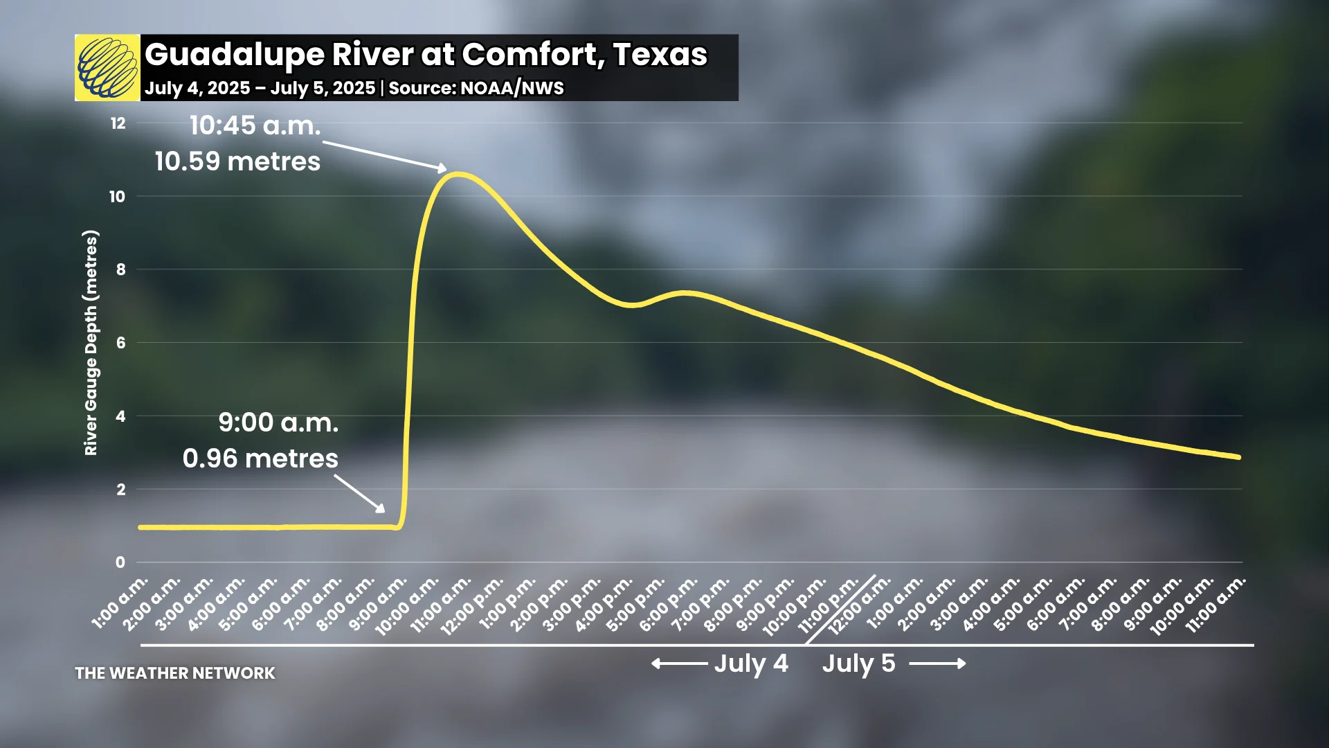
A gauge on the Guadalupe River in the town of Comfort rose from 0.96 metres at 9:00 a.m. to a whopping 9.84 metres by 10:00 a.m., further climbing to a peak of 10.59 metres around 11:00 a.m. before the floodwaters slowly receded through the day on Friday.
Additional flooding continued to the east of the hard-hit region on Saturday as a similar atmospheric setup allowed stationary thunderstorms to pour copious amounts of rain through the day.
Header image created using graphics and imagery from Canva.